


BARBONDALE ROUND 5 APRIL 2014
The Barbondale Round Saturday 5th APRIL 2014
Set in pleasant rural scenery and close to, but away from the hustle and bustle of the Lake District and the busier Dales, Barbon is situated in the Lune valley, some 3 miles north of the historic town of Kirkby Lonsdale and close to the point where Barbon Beck joins the River Lune. There are now few signs of the Roman Road just to the west or of the railway line that once passed through the village, making it once a thriving little community. Now a sleepy place with it’s 17th. century coaching inn and attractive church it is a perfect starting point for your walk.
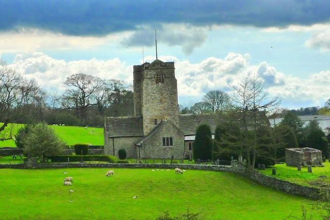
Barbon Church
The route takes you almost immediately into Barbon Park, whose tranquillity is rudely transformed, once or twice a year, as motor sport enthusiasts test their driving skills, up the drive to Barbon Manor, in the Barbon Hill Climb.
Built in 1862 Barbon Manor is of the French Renaissance style and was used as a shooting lodge for Sir James Kay-Shuttleworth, famous for having set up the first teacher’s training college in Britain and as a social reforming doctor who had treated cholera in Manchester.
You soon leave the open parkland behind and a well constructed path now enters woodland which, around the date of the event, is very often carpeted with bluebells. Once clear of the trees a very different aspect of Barbondale unfolds as you enter an upland landscape and cross Barbon Beck. After a short section of quiet road, a bridle path takes you up to Bullpot Farm. No longer used for agricultural purposes, Bullpot Farm is now the hub of Red Rose Caving and Potholing Club and is well situated for the Ease Gill cave system, the longest in Great Britain. More to the point, this is your first checkpoint and a chance to have a drink and a quick bite to eat
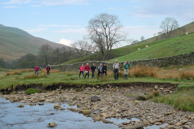
Barbon Beck
Above the checkpoint and a short length of track, a faint rising path ascends the ridge to Great Coum. As you climb, over the valley to your right is Gragareth and the highest point in the present day Lancashire. While to your left you are looking over Barbondale to Calf Top and the splendid ridge you will be passing along later in the day. Standing at 687 metres above sea level, Great Coum is your high point of the day and if you are one who likes to ‘bag’ hills you now have another Marilyn, a Hewitt and a Nuttall to add to your lists.
You must not let the fine views down into Dentdale and across to the Howgills, distract you too much, as the descent from here is quite steep and rough in places, before levelling out on a track leading to what is shown on the map as ‘Green Lane’. Known locally as the Old Occupation Road or ‘Occy Road’ this lane was an old drove road and rebuilt in 1859 at the time of the Enclosures Act. It is at it’s junction with Barbondale Road where previously the short route headed left back down the valley to the finish. As from 2014, however, both the long and the now more demanding short routes turn right towards Dentdale. First though you must visit the checkpoint where you can refresh yourselves with an assortment of drinks and snacks.
A little over half a mile beyond the checkpoint, where the path ahead steepens, the routes divide. The short route takes a new line up hill to Combe Top and along to Weather Ling Hill. This is where it crosses a stile to re-join the long route, which it then follows, over Calf Top to the finish.
Meanwhile the long route stays with the path and heads towards Combe House and the grade 2 listed building at Tofts, making its way down hill to join the quiet country lane on the south side of the River Dee and a section of the Dales Way. Another drink awaits you at Rash Bridge, which in itself is another grade 2 listed ‘building. In 1587 a corn mill was built close by, only to be torn down in 1590 by jealous rivals in trade and was thought to be the inspiration behind the folk song ‘The Jolly Miller of Dee’.
The next checkpoint is on the west side of Middleton Fell, just below Fellside. Here you can take on refreshments before engaging a slightly lower gear for the long, but gradual ascent, onto the ridge above. It is on this very fine ridge where your route joins company again with the short route and together they continue up and along the ridge to Calf Top.
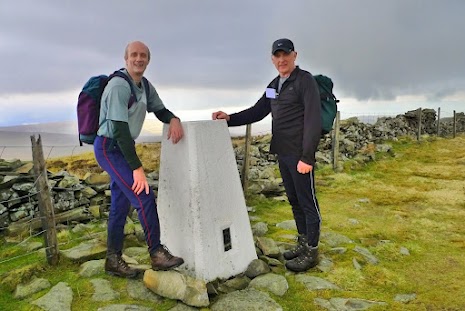
Calf Top
Being independent of its neighbouring fells, the high point of 609 metres at Calf Top is an outstanding viewpoint with Lake District, Howgills and Bowland Fells all visible on a clear day. What’s more hill baggers it’s another shapely Marilyn to add to your list! With most of the hard work now over, apart from a short steep rise onto Castle Knotts, the descent back to the finish, with fine views down the Lune Valley, even for those with weary legs, is pure pleasure.
It’s not surprising people come back to do this event year after year.
Photos courtesy of Brian Fisher.
CLICK FOR: ENTRY FORM:
Long Route - 24 miles Short Route – 14.5.5 miles
ROUTE DESCRIPTION - LONG CLICK HERE ROUTE DESCRIPTION: EITHER
NEW Short ROUTE: CLICK HERE
ORIGINAL Short ROUTE: CLICK HERE


