


Lancashire Way Central Loop
 Day 1 of the second part of the Lancashire Way – the Central Loop – 6th September 2018
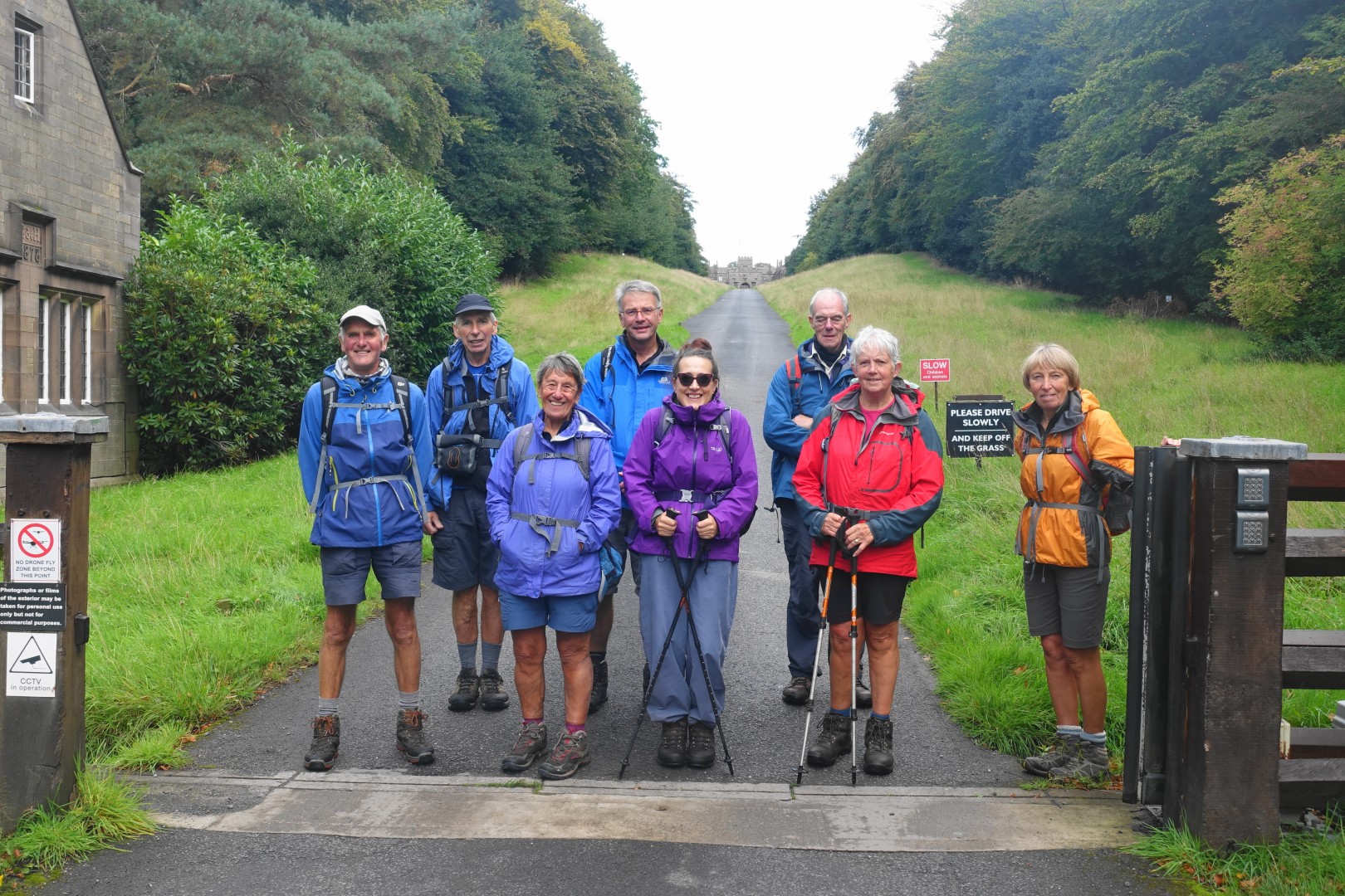
We met and began the day at Preston Railway station, which we are all now quite familiar with as this was also the start and finish of the Southern Loop, which we walked earlier in the year. The point of starting at the station is that it is easily accessible from wherever although I don’t think one of us arrived by train!
So again, through Winkley Square and down the Avenham Walk to the replica tramway to meet Gareth and Doreen, and then this time, rather heading west along the Ribble and then south in to Southern Lancashire, we turned east and began by following the Ribble upstream and then out of its flood plain through Walton-le Dale. Most of the route is initially along the main road but just after crossing the M6, the walk becomes much quieter and rural. Down to the River Darwen, which we follow on and off for much of the first half of the day, and then along to Roach Bridge with its old mill and weir. The river here was in full flow, which gave Brian a good photo opportunity – I am not sure if it appeared on the television weather watchers that night? The river level reflected the black and cloudy skies – it was one of those mornings, when the cagoule was constantly being taken off and then put back on.
On to Samlesbury Bottoms and another stretch of the Darwen, which was familiar to several from Bottom’s Up fame. From here we headed towards Hoghton Towers, but the weather seemed to be deteriorating and Darwen Tower on the horizon was about to be engulfed by cloud. We took the opportunity of sheltering in the woods for lunch. And when we had finished, the day had miraculously changed, the rain had stopped, blue sky had appeared, and the sun came through from time to time.
The route then has a couple of lengthy diversions in order to take in the best of this part of Lancashire. The first of these crosses the drive to Houghton Towers, down to Riley Green and then around the back of the rock on which the Towers stand via the impressive gorge through which the River Darwen flows. A kingfisher and members of the River Trust, tagging fish to monitor the success of the new fish ladder, added extra interest.
From Houghton Bottoms, the route takes its second diversion to Pleasington, Witton Park and Billinge Hill before returning back to Alum Scar via Wainwright’s view point. This part of the day was probably the best, with an almost 360 degree panoramic view (Blackpool Tower, Black Combe, Pendle Hill, Darwen Tower and Winter Hill) and the sun was still shining. Down through the woods and then across fields near Woodfold Hall to Stanley House and Blackburn Old Road. At this point we should have finished the day by walking up into the village of Mellor but the next bus was due shortly and we probably would not have made it back in time so all but Barry, who was being picked up at the Millstone Inn, missed this last short section.
Length of walk – approx. 8 hours – 19.5 miles. Ascent 2,228 ft.
Photo's can be seen 'here'
For more details see Stages 17 and 18 on www.lancashireway.com
Day 2 of the second part of the Lancashire Way – the Central Loop – 13th September 2018
The day began in darkness, partly because of the early start time of 7.30am, but also the many ominous and thick black clouds in the sky. The early start time was dictated by the need to catch a bus at 15.14 from Barley for our return to the start.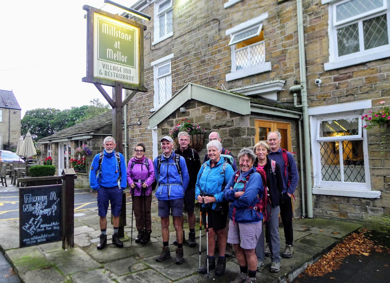
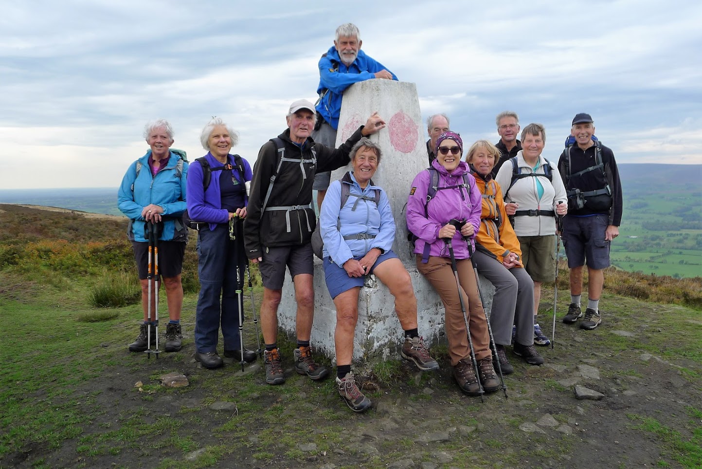
So, we began the day at the T junction in Mellor next to the Millstone Inn with the first stop being Mellor Moor and its viewpoint and trig point. You could see why it was apparently once the site of a Roman look out point with great views all around, even in the mist and rain which now accompanied us on the exposed hill top. However, in spite of the heavy cloud, we had a good view of our route along the various sandstone ridges towards Pendle Hill to the north.
From Mellor Moor back to the road and then over Ramsgreave stopping at the point at which a major Roman Road from Manchester to Ribchester crosses. Then down into Wilpshire and up the other side of the valley to Dean Clough Reservoir. Finally, the day seemed to be improving and Pendle Hill was getting closer. We then took the steep road down into Whalley losing the height that we had gained - a shame as the next few miles involved a constant climb firstly up to the Nick of Pendle and then around the back of the Deerstones to the highest point of the day on Spence Moor at 460m.
Lunch was had at the Nick with good views all around and the sun was now out, although as always there was a strong cool wind. The last part of the day involves the descent down firstly into Newchurch, with its witches, and then to our destination of Barley. Throughout we could see the mass of Pendle Hill to our left – but that was not for today as we will only be climbing to the top in a fortnights time. And we had made good progress as the time was only 14.30 so we had time to spare for drinks at the café on the car park.
And if we thought our journey had ended there we were wrong as the two buses back to Mellor were in themselves a tour of Lancashire and a bumpy one too!
Length of walk – approx. 7 hours – 16 miles. Ascent 2,321 ft.
Photo's can be seen 'here'
For more details see Stages 19 and 20 on www.lancashireway.com
Day 3 of the second part of the Lancashire Way – the Central Loop – 27th September 2018
The day began at the public car park in Slaidburn at 9am. We had a coach to catch to the start of the walk in Barley – unfortunately we were a little late with lots of traffic in Clitheroe so the journey over Waddington Fell required more speed than I think my passengers liked – apologies! Well at least the coach driver treated us to a much more leisurely journey back to Clitheroe and then on to Barley and also a preview of some of the walk back that day to Slaidburn.
A late start to walking of just before 10am promised a late finish with around 7.5 hours of walking in store for us, beginning with the climb to the summit of Pendle Hill (the highest point on the Central Loop at 557m) via the Ogden Reservoirs. Good progress was made and we had a rest and drinks break at the top in the lea of the hill to gain shelter from a brisk wind. But what a view! The cloud had cleared and the sky was almost a clear blue – you could see for miles including Ingleborough and Pen-y-Ghent across the border in that other county, which cannot be named.
The descent off Pendle was punctuated by a brief geology lesson to explain the geology of the Ribble Valley, which stretched out before us, and the geological time sequence of the Carboniferous Period, which explains much of the topography of Lancashire. Hopefully some of it made sense?
An early lunch, by the stream, in the beautiful and unspoilt village of Downham was followed by an easy walk across to Sawley and the remains of the abbey and the River Ribble itself. Then a road section, with Pendle ever present to our left across the valley, to Grindleton. This village is not as popular as nearby Waddington – but if you visit, do look up the Heritage Trail, and you will discover a rich history behind many of the interesting and attractive buildings.
On then on with our second ascent of the day to Grindleton Fell and Easington Fell and, in the hour or so it took us to reach the top, the sun had disappeared and the day was now grey with cloud and rain was in the air. Such a contrast to earlier in the day and a disappointing end to what had so far been a great day. So, we descended down the other side into the Hodder valley with a detour to another typical and pretty Lancashire village - Newton in Bowland. But it was now quite late, so we missed out the village and followed the River Hodder for the 1.5 miles directly back into Slaidburn.
It was exactly 6pm – so a fairly hard days walk in terms of both time and ascent. But be warned, next week, when we cross the southern Bowland Fells, is longer again at 21 miles and over 3,000ft of scent. Hopefully the sun will shine for the full day as otherwise these fells can be a desolate and forbidding place to be!
Length of walk – approx. 8 hours – 18 miles. Ascent 2,741 ft.
Photos can be seen ‘here’
For more details see Stages 21, 22 and 23 on www.lancashireway.com
 Day 4 of the second part of the Lancashire Way – the Central Loop – 4th October 2018
My last report began with the words “Hopefully the sun will shine … as otherwise these fells can be a desolate and forbidding place to be!” Well those words proved portentous as the day was grey, the weather forecast poor and thick cloud clothed the tops of the Bowland Fells, which lay ahead of us! It really did not help my anxiety for the day – a schedules 21 miles and over 3,000ft of ascent with the nights drawing in. Would we make it?
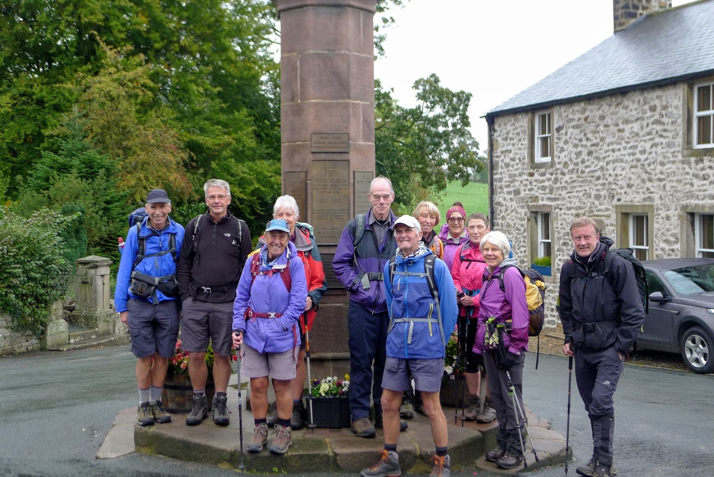
But before we began, we took a group photo in front of the War Memorial in the centre of Slaidburn. It has to be one of the best – a foot soldier in bronze with head bowed in remembrance of those who had fallen in the Great War. Their names stand proud on plaques below the soldier – surnames often repeated – true brothers in arms.
And so on with the walk across rich farm land to Croasdale House and then the boggy and little used path to the Hornby/Salter Road on Croasdale Fell. It was raining heavily by now and the wind cold as we trudged to the top – the old boundary between Lancashire and Yorkshire – but all in Lancashire now! A brief rest and then the descent down to Whitendale and thankfully below the cloud cover and out of the rain. And whilst the skies were still grey, the hillside were a delightful mix of browns oranges and yellows – much appreciated by Brian and his camera.
A late lunch and then the final push on to Dunsop Bridge and the end of the first half of the day. Unfortunately it was now 2.30pm and with an estimated further five hours of walking including the climb up to Fiendsdale Head a decision had to be made. The prospect of descending from Parlick in the dark made it easy and I had anticipated that this so had a contingency plan.
When putting the Lancashire Way together I had originally thought of turning west at Newton to Dunsop Bridge and then to Chipping via the Hodder valley, which is perhaps one of most beautiful valleys in Lancashire. But the Bowland Fells are an AOB for very good reasons and hence the current route. But I have also been conscious that in poor weather or for those walkers who do not like such a demanding route, there should be an alternative – a low level easier alternative. I had been reconnoitring this so had a route in mind.
Decision made, so we now head south down to the Inn at Whitewell, crossing the Hodder via the stepping stones with group photo and then up to the Fairy Holes, which must have one of the very best views in Lancashire both north and south. Another group photo and then on to Chipping with Longridge Fell looming ever nearer. With the reduced mileage and ascent we arrived back just after 5pm – a much more respectable time than that of the scheduled route!
Length of walk – approx. 7.5 hours – 18 miles. Ascent 1,958 ft.
Photos can be seen 'here'
For more details see Stages 24 and 25 on www.lancashireway.com
 Day 5 of the second part of the Lancashire Way – the Central Loop – 11th October 2018
Having re-routed Day 4, I was now left with a dilemma! Do we start Day 5 by completing the missing Stage 25 and even try to fit this into the remaining two days or add a further day on to the end? Well, after much deliberation, and some helpful feedback, I decided to carry on where we left off and finish the walk as originally planned. In my mind this was helped by the fact that I had made the low route that we taken last week into an official “Stage 25 Alternative”, which was now live on the website. And if I may say so it’s a great addition to the walk and will help walkers avoid the more full-on route over the Bowland Fells particularly in bad weather.
We therefore met in Ribchester and took half the cars to Chipping – the start of the walk. We began shortly before 10am on what was another grey day and a weather forecast that included heavy rain in the afternoon. Lancashire was again living up to its image of being a wet county! But after our travers of the Loud valley, including yet another quick geology lesson, the sun came out and we were treated to some fabulous views back across the valley to Beacon Fell, Parlick and the Bowland Fells.
And now to the climb up Longridge Fell via Jeffrey Hill to the trig point on Spire Hill. The current route on the website takes the direct route straight up the hillside from Thornley Hall, which some remembered well from the Red Rose 100 Challenge Walk a few years ago. It is a “pig” in my view, very steep and no path to speak of. So I was experimenting with an alternative route up to Giles Farm and then a zig zag of a path that cuts across the contours to the top of the hill near Longridge golf course. The first half is great but after Giles Farm the path is almost non-existent and therefore not ideal, although it is much less strenuous. The jury is still therefore out on whether this will become the official route.
At the top we take the road back to Jeffrey Hill and have a short break at the top looking across the valley, learning about the Roman Road that we almost sitting on, before pushing on to the trig point. Just before getting there we meet Chris, who had walked up from Longridge to intercept us, but our detour had scuppered her plan and she had almost missed us!
No more changes to the route from here then. Through the forest and lunch at a clearing over looking Chaigley with Pendle Hill in the distance. The sky was now grey again and there was rain in the air. Then the descent down to the Higher Hodder Bridge to pick up the path along the river bank all the way to Cromwell’s Bridge. This part of the walk has some lovely stretches of river to enjoy.
A travers around the grounds of Stoneyhurst college followed, keeping to the public rights of way, and then up the avenue into Hurst Green. The sky was getting ever darker but we only had four miles left to the end at Ribchester. With the footbridge at Dinkley still closed, although we could clearly see the new impressive replacement structure, we had to take the alternative route along the northern bank of the Ribble, which basically follows the Ribble Way. It is a pleasant alternative but you cannot see much of the river until the final stretch.
With Ribchester now almost in sight, the clouds were ever blacker and lower and the rain had begun. But clearly it was going to get heavier so we all finished with a very brisk pace and just reached the cars as the heavens opened.
Length of walk – approx. 7.5 hours – 16 miles. Ascent 1,842 ft.
Photo's can be seen 'here'
For more details see Stages 26 and 27 on www.lancashireway.com
 Day 6 of the second part of the Lancashire Way – the Central Loop – 18th October 2018
After some variable conditions on the previous five days, we were treated to the very best of Lancashire weather on our final day of walking. Whilst it was a cold start, once the sun had risen it was beautiful day with hardly a cloud in the sky and it remained like this for the whole day.
We met at Preston Bus Station and caught a bus to Longridge with a change to take a second bus to Ribchester. With a relatively short day of around 12 miles we could start walking at a very civilised time of 11am. We began with a group photo at the site of the Roman Baths and then off down the Ribble Way for most of the day back into Preston.
The first section is along the River Ribble itself but before long the path exits the flood plain and makes it way through fields with too many cows for my liking. And when we reach Elston Lane I have another decision to make. The route of both the Ribble Way and the Lancashire Way heads south and through Tunbrook Wood but the footbridge at the bottom of the valley is temporarily closed due to some minor landslides. The alternative route is not nearly as pretty passing a large solar farm and the Red Scar Industrial Estate. Having investigated the closed path on the Tuesday and creating steps with my spade to help the short ascent on the other side of the footbridge, I was determined to keep to my original route. And thankfully we managed to cross through the wood with relative ease.
The route shortly afterwards picks up the Guild Wheel and then down to Brockholes, with its nature reserve set in the site of a disused gravel quarry. We make a brief detour to the weir by the Ribble with Pendle Hill still in view in the distance and then head to the eco visitor centre for a brief stop for refreshments and even the odd ice cream. Just as I am about to round up everyone for the final leg, John, as Chairman, delivers a short speech thanking me for my efforts in arranging the past six days of walking. But no thanks is really necessary, it has been an absolute delight to share what I think are some of the very best parts of this wonderful county through the route of the Lancashire Way. I am also presented with a contribution towards the costs of developing the site and researching and reconnoitring the route – my most sincere thanks to all.
Then onward along the Ribble for about four more miles all the way back to Avenham Park in Preston, which we all know very well by now! But that is not the end, there is still the short walk through Winkley Square and down Fishergate to the Railway Station – the official end of the Central Loop of the Lancashire Way. One day I hope to have a plaque or board to mark this point – the start and end of 101 miles of walking and 13,000 ft of ascent through some of England’s finest countryside.
So just the 108 miles of Northern Loop left – or did I hear that there might be an Eastern Loop in the making?
Length of walk – approx. 5.5 hours – 12 miles. Ascent 748 ft.
Photo's can be seen 'here'
For more details see Stages 28 on www.lancashireway.com


