Latest News: Read more


Wainwright's Pennine Journey

Cumbria, Durham, N Yorkshire, Northumberland

393 km / 244 miles  View Facebook Page  View Twitter Feed
In September 1938, A. Wainwright made a solitary walk through the Pennines. The following year he wrote up an account of this walk, which was eventually published in 1986 and is still available.

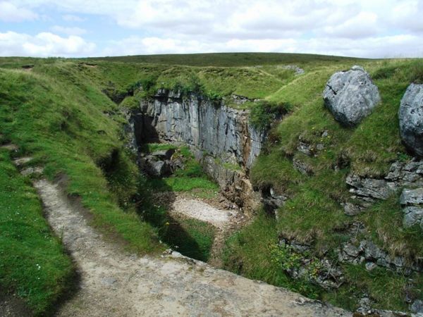
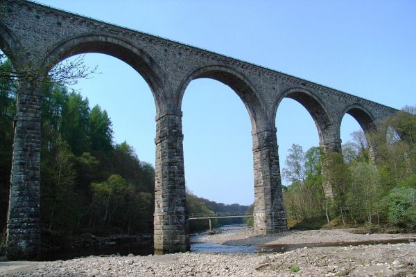
This new route, developed by David Pitt of the Wainwright Society, is a recreation of this walk adapted for today's roads and rights of way, taking a route that Wainwright might have chosen if he was planning it today. Called 'A Pennine Journey' it is a challenging circular walk, 247 miles long divided into 18 stages, passing through the wonderful variety of terrain and scenery that the north of England offers and touching on all the major rivers in the region.

Starting in the market town of Settle in north Yorkshire, in the heart of the Yorkshire Dales National Park, the route heads north on the eastern side of the Pennines through the delightful Yorkshire Dales and moorland stretches of Co. Durham before arriving at Hadrian's Wall. This World Heritage site, in the Northumberland National Park, is followed for 21 miles until the route heads south on the western side of the Pennines. After traversing the Pennines just below the highest point of Cross Fell, it enters and travels down the Eden valley before skirting the Howgills Fells then arrives back in Settle.

The walk is divided into 18 daily stages of varying length and offers a choice of possibilities. It can be undertaken as one continuous walk; split at Housesteads on Hadrian's Wall (Alfred Wainwright's primary objective) into two stages of roughly 120 miles each; or divided into three stages - eastern, northern and western - of around 80 miles each. There is an outline map on the website below.


Details:

Path Type: Paths Marked on OS mapping
Attributes: Challenging
Moorland
Mountain
Start and Finish: SD817635 - Settle, N Yorkshire
User Group: Pennine Journey Supporters Club Pennine Journey Supporters Club
Web Sites: Pennine Journey Wainwright Society - AW's Coast to Coast Walk Visit Cumbria - A Pennine Journey Welcome to Yorkshire - Wainwright's Yorkshire masterpiece North Pennines National Landscape - Wainwright's Pennine Journey Masarnen Ramblers - Wainwright's Pennine Journey [blog]

Publications, Badges and Certificates:

Guidebook Pennine Journey : the story of a long walk in 1938  (Frances Lincoln (an imprint of Quarto)  - 2004 )
Guidebook A Pennine Journey : from Settle to Hadrian's Wall in Wainwright's footsteps  (Sigma Press  - 2015 )

Maps:

You can use the interactive controls to zoom in and out and to move around the map, or click on a path or a marker for more info.(interactive map help)

Show Connected Path Outlines
E Routes
National Trails (England & Wales)
Paths Marked on OS mapping
Other Paths
Anytime Challenges

Show Accommodation
Hostel Accommodation
Camping Barn
Bunk House
Camp Site
Other
Group Accommodation
Campsite & Bunk Barn

Show Points of Interest
Walkers are Welcome

Contains Ordnance Survey data © Crown copyright and database right 2016.
© OpenStreetMap contributors under Open Database Licence.
Rights of way data from selected Local Authorities.
Large scale digital mapping is provided by John Thorn.
At high zoom levels the route is indicative only.
Purchase Ordnance Survey Maps (path is named on OS maps):
OS Landranger 86, 87, 91, 92, 97, 98
OS Landranger Active 86, 87, 91, 92, 97, 98
OS Explorer 2, 19, 30, 31, 41, 43, 307
OS Explorer Active 2, 19, 30, 31, 41, 43, 307

Accommodation within 5 km of this Path:


From
Path
Along
Path
Bunk House
< 1 km
22 km
Camp Site
< 1 km
31 km
Camping Barn
1 km
42 km
Bunk House
5 km
44 km
Bunk House
< 1 km
68 km
Group Accommodation
< 1 km
118 km
Bunk House
< 1 km
138 km
Campsite & Bunk Barn
< 1 km
180 km
Bunk House
3 km
183 km
Hostel Accommodation
< 1 km
196 km
Bunk House
< 1 km
197 km
Hostel Accommodation
< 1 km
207 km
Group Accommodation
3 km
210 km
Camping Barn
4 km
210 km
Hostel Accommodation
< 1 km
234 km
Campsite & Bunk Barn
4 km
240 km
Campsite & Bunk Barn
< 1 km
240 km
Hostel Accommodation
< 1 km
266 km
Walkers are Welcome
< 1 km
300 km
Hostel Accommodation
< 1 km
300 km
Hostel Accommodation
< 1 km
371 km
Group Accommodation
1 km
371 km

Click to show 30 more Accommodations


Additional Images:


Connected Paths:


Downloads:

Reminder: Material downloaded from this website is for personal or LDWA use only. Commercial use, reproduction, modification of all content is strictly prohibited without prior approval by the LDWA. Please Contact Us if you have any requests.


GPX Route File
Login to Download
(Members Only)
MemoryMap Route File
Wainwright's Pennine Journey Memory Map Route File - Route diversion to Little Musgrave
Login to Download
(Members Only)
Tracklogs Route File
Wainwright's Pennine Journey Tracklogs Route File - Route diversion to Little Musgrave
Login to Download
(Members Only)

Route Profile:

391.8 km (243.5 miles)
9,628 m (31,588 ft) ascent
789 m (2,589 ft)  maximum height

This website uses cookies

To comply with EU Directives we are informing you that our website uses cookies for services such as memberships and Google Analytics.

Your data is completely safe and we do not record any personally identifiable information.

Please click the button to acknowledge and approve our use of cookies during your visit.

Learn more about the Cookie Law