The King Charles III England Coast Path National Trail was originally planned to be complete in 2020, but progress has been slow. By the end of 2024, less than three quarters of Natural England's 67 'Stretches' of the England Coast Path (ECP) had been declared fully open. By contrast, the Wales Coast Path (WCP) has been open since 2012. Rather than wait for the rest of the ECP, the combined England & Wales Coast Path (EWCP) Register will cover those parts (Sectors, in the table below) of the England and Wales coast paths which have been declared open and/or are already walkable, adding new Sectors as they become available.
The EWCP Register operates on similar lines to the National Trails Register, with Bronze, Silver, Gold and Diamond Level Certificates awarded for completion of, respectively, five, ten, fifteen and twenty Sectors of the combined England & Wales coast. Completers of all twenty-four Sectors will qualify for a new Emerald Award Certificate (see below).
The day to day running of the Register and the writing of the annual Strider report are the tasks of the EWCP Recorder. The Register Recorder is Heather Ingram.
The England & Wales Coast Path Register was originally devised in 2021 by Ray Wilkes and Lindsey Chadwick, in consultation with Alan & Beryl Castle.
(Click to enlarge in new window or tab)
     |
(Click to enlarge in new window or tab)

For the purposes of this Register, the combined England & Wales Coast Path is divided into twenty-four Sectors whose lengths vary from 70 to 221 miles (113 to 356 kms), in seven Regions (North West, Wales, South West, South, South East, East, North East). Sector lengths are generally traded off against feet (or metres) of ascent, in that longer Sectors (in the South East of England, for example) are considered to be less strenous. The 18 England Coast Path Sectors do not necessarily correspond with Natural England's 67 'Stretches', some of which are based on geographical features rather than named places. Instead, the start and end points of the 24 Sectors were selected for accessibility by public transport (bus, train, or both; ferries for the Isle of Wight), with an average Sector length of roughly 145 miles (see table below).
The coastal National Trails (Pembrokeshire Coast Path, South West Coast Path, Norfolk Coast Path) are 'preserved' as single entities rather than split into shorter lengths. An exception is the South West Coast Path, which has five Sectors and is thus eligible for the EWCP Bronze Award in its own right. The Wales Coast Path is divided into six Sectors including the Pembrokeshire Coast Path (unlike the ECP, the WCP has not been designated as a UK National Trail). The coastal sections of other National Trails (South Downs Way, Cleveland Way, Thames Path) are 'embedded' in longer Sectors.
Fully open and already walkable Sectors are shown in red in the table below. (Red England Coast Path Sectors may also include those which have small or very small gaps: these are indicated in the table.) Clicking or tapping on a red Sector will take you to its path page. Included in the ECP path pages are links to one or more of National Trails UK's Interactive Maps, which are held at https://www.nationaltrail.co.uk/en_GB/trails/england-coast-path/trail-information/. The Wales Coast Path's Interactive Map is linked from https://www.walescoastpath.gov.uk/latest-news/temporary-path-diversions/. Both Maps show temporary path closures and diversions.
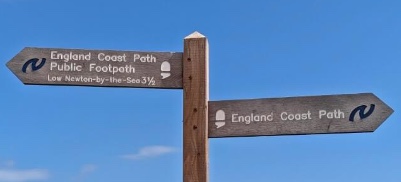
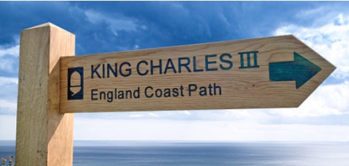
The England Coast Path is waymarked with the National Trails 'acorn' and, in many places, signposted as the 'King Charles III England Coast Path'. The Welsh Coast Path's waymarks are the yellow blue and white 'dragon shell'. Signposts may feature the waymarks of both coastal National Trails and other coast paths.
 |
 |
 (Photo: wibkestravels.net) (Photo: wibkestravels.net) |
|
|
(Photo: Iain Connell) |
(Photo: Iain Connell) |
(Photo: offtracktravel.ca) |
The start and end points of each Sector are the same as those devised by Wilkes et al. in 2021, with the addition of the five Sectors of the South West Coast Path. Where Sectors start or end at either side of a river or estuary with a bridge, tunnel or ferry, distances are measured from the larger conurbation at either end. The Mileages (and Kms) of each open ('red') Sector are as accurate as we can make them; other mileages are for guidance only until confirmed.
| Sector No. | Sector | Length (Miles) | Length (Kms) | Notes | See Rules |
|---|---|---|---|---|---|
| NORTH WEST | (NT = National Trail) | ||||
| 1 | Gretna to Barrow | 151 | 243 | ||
| 2 | Barrow to Chester | 123 |
198 |
||
| WALES | |||||
| 3 | Chester to Porthmadog | 186 | 299 | Wales Coast Path (1) | 5, 8 |
| 4 | Anglesey | 129 | 208 | Wales Coast Path (2) | 5, 8 |
| 5 | Porthmadog to Cardigan | 129 | 208 | Wales Coast Path (3) | 5, 8 |
| 6 | Cardigan to Amroth | 186 | 299 | Pembrokeshire Coast Path NT | 5, 8 |
| 7 | Amroth to Swansea | 123 | 198 | Wales Coast Path (5) | 5, 8 |
| 8 | Swansea to Chepstow | 112 | 180 | Wales Coast Path (6) | 5, 8 |
| SOUTH WEST | |||||
| 9 | Chepstow to Minehead | 113 | 182 | Gap (03/2026) between Cleveden and Weston-super-Mare | |
| 10 | Minehead to Bude | 122 | 196 | South West Coast Path NT (1) | 5, 8, 14(a) |
| 11 | Bude to St Ives | 110 | 177 | South West Coast Path NT (2) | 5, 8 |
| 12 | St Ives to Par | 140 | 225 | South West Coast Path NT (3) | 5, 8 |
| 13 | Par to Exmouth | 142 | 299 | South West Coast Path NT (4) | 5, 8 |
| 14 | Exmouth to South Haven | 116 | 187 | South West Coast Path NT (5). Includes Lulworth MoD Firing Range | 5, 8, 15(a) |
| SOUTH | |||||
| 15 | South Haven to Brighton | 196 | 315 | Hythe Ferry suspended since 2024 | 15(d) |
| 16 | Isle of Wight | 70 | 113 | Short Sector, but a single entity | |
| SOUTH EAST | |||||
| 17 | Brighton to Whitstable | 148 | 238 |
Includes part of South Downs Way NT. Gap (03/2026) at Rye-Camber, Kent |
5, 6 |
| 18 | Whitstable to Southend | 221 | 356 | Includes part of Thames Path NT, and Woolwich Foot Tunnel | 6 |
| 19 | Southend to Clacton | 202 | 325 | Excludes Foulness Island | 6 |
| EAST | |||||
| 20 | Clacton to Hopton | 196 | 315 | Includes Sizewell C | 15(b) |
| 21 | Hopton to Hunstanton | 84 | 135 | Norfolk Coast Path NT | 5 |
| 22 | Hunstanton to Hull | 161 | 260 | Gaps near Gibraltar Point, and between Immingham Docks and Grimsby | 5, 15(a) |
| NORTH EAST | |||||
| 23 | Hull to Middlesbrough | 166 | 267 | Includes part of Cleveland Way NT. Major erosion on Holderness (East Yorkshire) coast between Easington and Hornsea. | 5 |
| 24 | Middlesbrough to Berwick | 156 | 251 | Includes Holy Island. Ends at Scottish border. Inland 6 miles from Waren Mill | 16(b) |
| Totals | 3482 | 5604 | (Rounded up to nearest whole no.) | ||
| Averages | 145 | 234 | (Ditto) |
Rules for Entry into the England and Wales Coast Path Register
1. For inclusion on the EWCP Register, Sectors should be completed on foot. Exceptions to this include ferry crossings (such the South West Coast Path's), which may omit many miles of inland detour, and tidal fords (such as the Esk estuary in Sector 1), which may not be safe or practical at time of approach.
2. There are no time limits for claiming Sector completions. Retrospective claims are welcomed.
3. For entry into the register, each Sector should be walked in its entirety (with the possible exceptions noted below), but Sectors may be completed in any of the following ways:
(a) Over a sequential number of days with overnight stops with accommodation ('bricks and mortar', 'canvas', or a combination of these).
(b) In any number of day or multi-day walks over different Sectors, which may or may not be consecutive. Sectors may be walked in any order and in either direction, the only requirement being that the whole Sector is eventually completed.
(c) In 'one go' without overnight accommodation, such as a Challenge Walk run by the LDWA or other organisations.
4. Each completion of a specific Sector counts only once for the purpose of the Register.
5. Many parts of the England and Wales coast paths were walkable long before they were declared to be constituents of longer coastal Trails, and both the ECP and WCP include previously existing National Trails or part of National Trails, as well as other named Trails. EWCP Claimants who have already done these Trails do not need to repeat them, and holders of National Trails Register awards may already include (whole or parts of) coastal National Trails towards their claim. See also rule 6.
6. Most of the 18 Sectors of the England Coast Path are longer than any of the 67 'Stretches' demarcated by Natural England, and there are no necessary correspondences between them. However, some Sectors may already have been walked throughout all or almost all of their lengths, even though their constituent Stretches have not been declared fully open throughout. In such cases (e.g. Sector 18 Whitstable to Southend, Sector 19 Southend to Clacton), claims based on ('not yet red') Sectors may be accepted. See also rule 5.
7. Bronze, Silver, Gold, and Diamond level claims can be made of any combination of five, ten, fifteen, and twenty of the twenty-four Sectors in the table. For example, if you have walked from Amroth to Chepstow on the WCP (2 Sectors), and Minehead to Par on the SWCP (3 Sectors), you would qualify for the Bronze Level Award. See also rule 8.
8. In the specific cases of the South West Coast Path (SWCP) National Trail and the Wales Coast Path (WCP), previous completion of the whole of these Trails will qualify for, respectively, five and six Sectors of the EWCP. It is not necessary to have completed the whole of either the SWCP or WCP in order to include their Sectors as part of an EWCP claim. See also rule 7.
9. From time to time permanent changes may be made to the routes of individual Sectors. This may be for a variety of reasons including cliff edge erosion, water course changes, housing or road developments, or local campaigns. The lengths of individual Sectors may also increase as new sections of coast path are added; alternatively, changes such as new river crossings may reduce Sector lengths. For inclusion in the Register it is un-necessary to return to walk such amended routes. To count for completion, fully open Sectors need be included only as they existed at the time of walking.
10. When temporary but significant changes are made to the route of a Sector for reasons such as cliff-top erosion, footbridge damage or following major storms, such changes and if possible their durations will be notified on this website's individual Long Distance Path pages (see the table above for links to each fully open Sector's page). In particular, Natural England have allowed for 'roll-back' of cliff paths following the continual erosion of England's coastal fringe.
11. Where sectors start or end at rivers or estuaries with bridge, tunnel or ferry crossings, their lengths are measured from the larger conurbation at either end. For example, the eastern end of Sector 8 (Swansea to Chepstow) is Chepstow, and the northern end of Sector 22 (Hunstanton to Hull) is Kingston upon Hull. For the purposes of Register claims, it is not necessary to walk the Severn or Humber Bridges (in these examples) more than once.
12. Though there are no specific Awards for completion of all the Sectors in any of England & Wales's seven Regions (North West, Wales, South West, South, South East, East, North East), nor is there a requirement to complete all of one Region's Sectors before moving on to another Region, it may still be both practical and desirable to do so.
13. 'Embedded' National Trails:
(a) Pembrokeshire Coast Path: Sector 6 (Cardigan to Amroth) is this National Trail.
(b) South Downs Way: Sector 17 (Brighton to Whitstable) includes the Cuckmere Haven to Eastbourne section of this National Trail.
(c) Thames Path: Sector 18 (Whitstable to Southend) includes theWoolwich to Grain section of this National Trail.
(d) Norfolk Coast Path: Sector 21 (Hopton to Hunstanton) is part of the Peddars Way and Norfolk Coast Path National Trail, but only the Norfolk Coast Path needs to be included in EWCP claims.
(e) Cleveland Way: Sector 23 (Middlesbrough to Hull) includes the Filey Brigg to Saltburn-by-the-Sea section of this National Trail.
14. Permanent alternatives and loops:
(a) Sector 10 (Minehead to Bude) has lower and higher-level alternatives between North Hill and Hurlestone Point.
More will be added as they become known.
15. Temporary closures:
(a) Sector 22 (Hunstanton to Hull): (1) At Gibraltar Point, south of Skegness, and (2) Immingham Docks, Lincolnshire. (1) The footbridge across the Steeping River, 1km from Gribraltar Point Nature Reserve (grid reference TF 553585), was closed during 2025 to await replacement. (2) Both the inland route around Immingham Docks, and the coast path between Grimbsy and Immingham Docks, are closed during 2025-6 due to (respectively) major road improvements and major coastal work. (Natural England suggest public transport between Grimsby and Barrow Haven, near the Humber Bridge.) In neither case are there are alternative routes on public rights of way, and in 2025 there were no ECP signposts between Cleethorpes and Barrow Haven.
(b) Sector 20 (Clacton to Hopton): (1) Sizewell Beach, Suffolk, between late January 2026 and late March 2026, due to Sizewell C construction. Beach path reported re-opened by 4th April 2026. (2) At the end of July 2026, Rights of Way between Minismere Nature Reserve and Dunwich village were closed until further notice due to a wildfire on Dunwich Heath.
(c) Sector 1 (Gretna to Barrow): Two closures in July 2025 between Gretna and the Metal Bridge over River Esk. No advertised re-opening dates.
(d) (1) Sector 15 (South Haven to Brighton): Hythe Ferry suspended since August 2024 (and in "voluntary liquidation" in April 2026). Natural England suggest use of local bus round Southampton Water. (2) Thorney Island east sluice bridge re-opened by August 2025.
More will be added as they become known.
16. Annual closures:
(a) Sector 14 (Exmouth to South Haven): The coast path around Lulworth Cove is closed on many occasions during the year by the Ministry of Defence (MoD). See 'Lulworth Firing Times: details of road closures and live firing for Lulworth Ranges', https://www.gov.uk/government/publications/lulworth-firing-notice .
(b) Sector 24 Middlesbrough to Berwick: approximately 10 miles of coast path between Waren Mill (NU 144346) and Elwick Bird Hide (NU 100389) are closed between 1st August and 31st May every year (thus open only in June and July) in order to protect 'sensitive wildlife' which includes 'foraging and resting [migratory] birds ... which are present in internationally important numbers'. The (approx. 6 miles) year-round route follows part of the Northumberland Coast Path / St Oswald's Way and a minor road.
More will be added as they become known.
The EWCP Register is in five parts, corresponding to the Bronze, Silver, Gold, Diamond and Emerald Award Levels. Each part (see links below) lists the names of those at that Level, with numbers of Sectors walked and first & last dates of completion.
This Register contains the names of those who have walked at least FIVE different Sectors as defined above.
This Register contains the names of those who have walked at least TEN different Sectors as defined above.
This Register contains the names of those who have walked at least FIFTEEN different Sectors as defined above.
This Register contains the names of those who have walked at least TWENTY different Sectors as defined above.
This Register contains the names of those who have walked all TWENTY-FOUR different Sectors as defined above.
In order to be included on the EWCP Register, completers of EWCP Sections should download the EWCP Register Claim Form and send it by email attachment to the EWCP Recorder Heather Ingram.
Claims are accepted only on a Claim Form. Once accepted, the name of the claimant will be added to the Register at the appropriate Award level. Subsequent claims for higher Award levels should be made on a further Claim Form. Though entry to the Register is free, Award Certificates can be purchased from the Certificates page of the LDWA Shop.
The EWCP Register is open to both LDWA members and non-members, though the charge for Certificates is higher for non-members.
Last updated: 11th August 2026 (ic)
Last updated: 6th January 2025 (mh)