Last updated 30th November 2023.
I am going to, say, Cumbria for my holiday. How do I find which LDPs are in that area?
I want to find a list of, say, canal towpath walks. How do I search for them?
Do I need any special software to use the LDPs website area?
How can I see on a map online where a route starts or finishes if I don’t have the paper map?
What sort of publications do you list?
Do I need to buy all of the OS maps you list for each route?
How can I help with improving the LDPs site?
How does the LDPs area of this website work?
Publishers and Route Promoters: I am developing a new LDP – how can you help me?
What do you charge to have my information added to this site?
How do I obtain path maps and publications?
Have we answered your question?
Q. Who is responsible for maintaining LDP routes - e.g. putting up waymarkers and dealing with blocked paths etc?
The LDWAs role is to list and promote LDPs for the benefit of our members and the wider public. We do not have a role in maintaining LDP routes.
LDPs make use of existing footpaths and access areas. This website covers LDPs across the UK, but there are different legal regimes and different traditions of access in the four countries that make up the UK. The Ramblers is a charity that campaigns for access for walkers in Great Britain and its website includes more details of these access regimes and the types of paths.
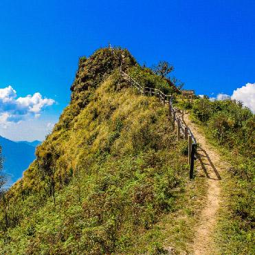
1) In England and Wales, LDPs use mostly public rights of way but may use other footpaths where walkers are permitted, mostly 'permissive' paths and routes on 'Access Land'. Local highway authorities are legally responsible for maintaining the surface of the rights of way themselves, ensuring they are free of undergrowth and obstructions, and for recording them on so-called 'definitive maps'. Rights of way normally have markings, yellow arrows for footpaths open only to walkers, blue for bridleways where cyclists and horses may also go, and red for byways open to all traffic, though byways are often only negotiable by off-road vehicles. On restricted byways, no motorised traffic is allowed.
Maintaining stiles and gates is primarily the landowner's responsibility. The local authority contributes 25% of the cost in certain cases and more if it wishes. If the owner fails to maintain stiles and gates the authority can do the job and recover the cost from them.
Path problems should always be reported in the first instance to the relevant local authority's public rights of way section. Councils will require details of the obstruction and its location, such as an Ordnance Survey Grid Reference.
Many LDPs now have user groups who are involved in helping with promotion and maintenance. These user groups can be identified on the supporting information for an LDP, e.g., website, guidebook. In addition to reporting path problems to the relevant Highway Authority it can be useful to inform the user group. User groups often have working links with Highway authorities and Landowners.
Highway Authorities have a statutory duty to signpost and waymark public rights of way. However, this is simply as a public right of way, e,g., public footpath, public bridleway, etc. Specific waymarking of LDPs is done by the promoter/user group of that LDP and it has to done with the Highway Authority’s agreement.
2) In Scotland, you can walk on nearly all land, provided you behave responsibly, thanks to Scotland’s world-class access rights. Cyclists, canoeists, swimmers, horse riders and other non-motorised users also have the legal right to access most land and inland water. This is thanks to the?Land Reform (Scotland) Act 2003.
In the first instance please report any obstructions such as locked gates or non-compliant signs to the local access officer.
Many LDPs now have user groups who are involved in helping with promotion and maintenance. These user groups can be identified on the supporting information for an LDP, e.g., website, guidebook. In addition to reporting path problems to the relevant Highway Authority it can be useful to inform the user group. User groups often have working links with Highway authorities and Landowners.
See LDWA’s role for LDPs.
(Paul Nellist, LDPs Officer 2026)
Q. I am going to, say, Cumbria for my holiday. How do I find which LDPs are in that area?
You will need to use the Search for Path and choose 'Passes Through' under Area and 'Cumbria' from the drop-down menu, then select either 'Show as List' or 'Show as Map'. That will return a list of all the known LDPs that start, pass through or finish in Cumbria. For a search on a particular location such as Keswick, select 'Show paths passing within' (e.g.) 10 miles of 'Keswick - Cumbria'. That will return either a list or a map of all the known LDPs which run within 10 miles of Keswick.
Q. I want to find a list of, say, canal towpath walks. How do I search for them?
Use the Advanced Search option and select the box for 'Canal', then select either 'Show as List' or 'Show as Map'. You could also use the Search for Path and enter ‘canal’ in the Path Name box and select either 'Show as List' or 'Show as Map'. Either will return a list. A similar Search for Publication will provide many canal walk publications.
Q: I would like to do a search that the site does not seem to allow, or need more information than I can see online. Can you help me with this?
A: Send us your question using the Contact Us form and we may be able to help you, as we can do other searches that are not included in the basic search pages. There may be copyright issues depending on what search you need, but we will advise you if that is the case. This LDPs site is aimed at helping individuals to walk LDPs by providing a free information service on a self-help basis with research by unpaid LDWA volunteers. If you need additional information we hold a library of over 1000 LDPs publications that we can access, including some items now out of print. Please see our Terms and Conditions.
Q. Do I need any special software to use the LDPs website area?
No, you only need a web browser, such as Chrome or Safari, plus an Internet connection. If you download files (e.g. .gpx or .mmo for use with navigation devices: members only for these), you will need the appropriate software to open or view them. Ordnance Survey's OSMapsExplore service enables you to view downloaded GPX track files on online OS Maps using your computer or smartphone, but you will need to be an OS member.
Q. How can I see on a map online where a route starts or finishes if I don’t have the paper map?
A scrollable segment of an OS Explorer map (1: 25,000 scale) or a street or road map (depending on the scale selected with the zoom control) allows you to follow the route. Remember that routes shown on OS mapping are named and marked with red diamonds on Landranger maps (not all ‘On OS’ routes are marked on Landranger maps) and with green diamonds on Explorer maps. The Streetmap site uses Mercator projections so the scale varies slightly across the maps.
Alternatives to Streetmap (no longer available) include GridReferenceFinder. (Grid Reference Finder is a commercial website and may include sponsored links.). Ordance Survey's Explore OSMaps service will find locations in the UK (Northern Ireland does not use the OS National Grid system), but to 'drill down' to OS maps you will need to be an OS member. Google Maps may also find a start or end location from the address data, but will not 'drill down' to OS map detail.
To identify which OS map (Landranger or Explorer) covers a location, OS provide an online map-based tool online.
If you don’t know the two grid letters but have the six or more figures, there is a grid of the letters on the Wikipedia page 'Ordnance Survey National Grid'.
Some LDWA Local Groups now include not only the Post Code and Grid Reference (now up to 8 digits) of route start places, but also the location in What Three Words. What3Words is claimed to be a world-wide identifier of unique locations using combinations of just three random words.
Revised 12th March 2026 (Streetmap no longer available).
Q: What sort of publications do you list?
A: Publications listed on this website include paper publications such as books and leaflets, maps such as OS and Harvey maps, digital maps, and numerous websites. Most paper publications cover a single route in detail; most OS maps cover a part or all of several routes; websites can cover one or many routes with some providing descriptions of the route and leaflets online, and many publishers and route promoters now have websites. Downloadable files are also included on some routes. These include route descriptions and digital mapping track files. To use the track files you will need the relevant digital maps from the same supplier, e.g. Tracklogs route files will open with Tracklogs maps. Many of the local authority and other websites we link to now supply route leaflets free as downloadable files.
Q: Do I need to buy all of the OS maps you list for each route?
A: We list all the maps that cover or show a route and you may not need to buy all of them. You may have some of them already. Some maps overlap meaning you will not necessarily need all the maps: this will also depend on how much additional area you want to see, to allow for leaving the route for say accommodation, or for errors in route finding. The route page will indicate if the route is marked with the 'diamond' symbols on OS mapping. For some routes there are alternative stripmaps that cover the route on a single sheet or on fewer sheets than if you use OS mapping, but you should check the scale as they may not be so detailed as the Explorer mapping. Public libraries in the UK can loan OS Landranger and Explorer maps if you are a library user – you may need to reserve maps in advance.
Q: How can I help with improving the LDPs site?
A: The main need is for volunteers to help update route and publication data. It can typically take an hour or two to update a route, more for the more complex routes. If you can spare some time to help on an ongoing basis, or just want to update your own route or one you know, there is a simple process to do this and you will then see the results of your updates on the site. Please Contact Us and we will send you details. It helps if you have local knowledge of a route or have walked it, or have walked in an area, but this is not necessary. Our role is to assemble information from many sources and make it available to our members and to other walkers that enquire about LDPs. For more information see About the LDPs Team.
Q: How does the LDPs area of this website work?
A: Our database of LDPs data is on the same computer that drives the whole site, so to use it you only need your ordinary ‘browser’ that you already have, such as Chrome or Safari. To make use of all the information, including the downloads, you do need to be an LDWA Member. To find the items of data you want, you use the search screens (such as Search for Path and Search for Publication) and specify what you are looking for. This will return a customised answer, either one item in detail, or a list of several where you can select one for its details. Where items have some text highlighted you can click on it for more information, e.g. a publisher's contact details. For detailed instructions, see the How to Use the LDPs Database page.
Q: Publishers and Route Promoters: My route is not listed on your website or my data is out of date. How do I ask you to fix this?
A: If your route qualifies as an LDP – see What is an LDP – please send us details of it and your own contact details using our Contact Us page. We can send you a proforma to complete if you request it. If your data for a route or publication is out of date, send us an update using Contact Us. New information can also be included in our members’ magazine, Strider, that also carries book reviews, and we can add significant news items to the LDPs News pages on this website.
Q: Publishers and Route Promoters: I am developing a new LDP – how can you help me?
A. We can help publicise your route on this website and in our members’ magazine, Strider. Please Contact Us with details.
Q. What do you charge to have my information added to this site?
A. There is no charge for a normal inclusion of your route data in our standard format.
Q: Accommodation Providers: I offer accommodation to walkers on or near an LDP or a walking event. Can you list this for me with a link on your site?
Following a meeting of the NEC in August 2020 (revised in January 2025), a moratorium on adding new properties other than Hostels, bunkhouses and bothies to the database was imposed. For any further information regarding this, please email ldp@ldwa.org.uk
If you operate accommodation in a UK location that may be useful to walkers, we can link you to walkers looking for places to stay in your area. Most of the walking trails (LDPs) and organised walks (group led walks, challenge walks and walking festivals) we list already include their location information on our database, so we link this with your accommodation's location to find and display the trails or walks you are near. When walkers and other users of our website view one of our trails or walks pages, they will then see your accommodation listed and located on our mapping. We only offer this service to two main classes of accommodation: budget hostels (including bunkhouses and camping barns in the UK) and selected online-bookable accommodation (such as B&Bs, hotels and self-catering in England and Wales). If you are a budget hostel and are not already listed, Contact Us with your details. If you are not in the budget hostel category, to qualify for inclusion here you must both be assessed and rated under the national quality scheme and also use the Guestlink online booking e-commerce facility. In England, this is the Visit England Quality in Tourism Quality Schemes (QIT) with its familiar 'Rose' quality mark, and in Wales, the parallel scheme awarding 'star ratings' is the Visit Wales Quality in Tourism grading. If you already qualify, you should already be listed on this website - see Search for Accommodation. If you are not on Guestlink, please contact them for registration details, and once you are registered you should appear on our listings.
When a customer books and pays to stay with you via the Guestlink booking panels shown on our site, the LDWA gains a small commission payment that assists with the maintenance of this online facility. The customer books with you, via Guestlink as a booking agent, under your terms and conditions. The LDWA has no role other than to bring you customers. Customers don't need to be LDWA members to make a booking. The LDWA website is well used by walkers; the majority of the 10,000+ pages viewed daily on this website are seen by walkers (both LDWA members and non-members) looking for trails to walk, or for challenge walking events and Walking Festivals (Other Walking Events). Many of them make overnight or extended trips away from home, so need to find accommodation. Once you are listed here, your accommodation will have its own page on our website, so you can provide your potential customers with information about the upcoming walks and the existing promoted trails near your location by including this page link on your website. This page link url is stable and unique to you, but the page's walking-related content updates whenever we add new walks and trails to our database. Linking is free and we welcome such links. For examples, use the Search for Accommodation screens and see how similar accommodation is presented - for each there is a map facility showing walking trails and organised walks near its location. There are other benefits open to you, such as registering under the related 'Welcome' schemes ('Walkers Welcome' and 'Cyclists Welcome' QIT in England and Wales) as well as listings in the Hudson's published paper directories such as Walkers and Cyclists Welcome. On this website there are already about 3800 bookable places to stay listed - why not join them? If you operate a holiday company providing walkers' services rather than accommodation only, see Listing My Walking Support Company.
Q. Walking Support/Holiday Providers: My company offers services on at least one full trail (LDP) you list; can you link us on your site?
If you operate a holiday company that provides full trail support on at least one UK trail in our List of Paths you may qualify for a listing on this website. Contact Us listing the LDPs you support and the nature of the services for each trail separately, such as baggage transfers, self-guided walking or guided walking on the trails. Once listed, your services will appear on our information pages for each path. Currently the listing is free and we welcome back-links to our site. When you add or change the services or LDPs you support you will need to Contact Us again with updates. LDWA does not provide a booking service for support providers. See Listing My Accommodation above.
Q: How do I obtain path maps and publications?
Some publications are free from their supplier using the address we list or can be downloaded.
As a user of this website, you can buy online some publications (those with ISBNs that are still available) and all Ordnance Survey (OS) Landranger and Explorer series using links – look for the ‘Buy Online’ link next to the publication name or map number and click it to go over to the Amazon website to buy online. You benefit from the discounted prices Amazon offer on many of the items. When you complete such a purchase the LDWA also benefits from a commission payment. (When you make such a purchase you do so as a customer of Amazon and you have no contractual relationship with the LDWA, nor can we resolve any problems you may have with the supply.) For Amazon's terms of business please see the links on their site.
To make multiple purchases, such as a full map list for a route, put the first item into the online cart, and please then return to this site to add the next item. The Amazon cart remains open until you check-out, or close it without a purchase. Be careful to check the items in the cart before completing a purchase.
We provide map lists for each LDP that covers all of each route. If you simply want to buy a map unrelated to an LDP, e.g. for an event or group walk, please use the Ordnance Survey Maps page, from which individual maps may be selected and purchased via Amazon.
If a publication is not listed for online sale, or you just want to buy it elsewhere, a supplier is listed with contact details, though there are often others as well we do not list. Many of the publications can be bought through normal bookshops; the ISBN (book number) is useful to bookshops. If you want an alternative map supplier, see Maps for Walkers for a list of some alternative suppliers.
If you cannot source your publication using these options, please let us know. A web search using one of the major search engines may help as some items are still available even when officially ‘out-of-print’ or you can try an online sales site to buy or request the item.
The prices we list are normally the item price from the listed supplier and we also give their p&p charge for orders by post. These item prices will often be a recommended retail price (RRP) that a bookshop will commonly charge. You can use these figures as a reference to judge the ‘buy online' prices to which you may need to add p&p. Amazon will normally offer a substantial discount to the RRP for items it currently stocks and it lists other suppliers of both new and used items who use Amazon to market their items. Many ‘out-of-print’ items can still be obtained in this way. Secondhand copies sold by or through Amazon may involve a substantial premium to the RRP.
Q. Have we answered your question?
A. Each section of this website contains separate Frequently Asked Questions pages, so if you haven't found what you want here please try one of the following:
If you still cannot find the answer to your question then please contact the relevant member of the National Committee.