


After the Walk August 2024
Wednesday August 21st. The Fourth Panopticon. 11.5 miles. Leader: Barbara Shelton.
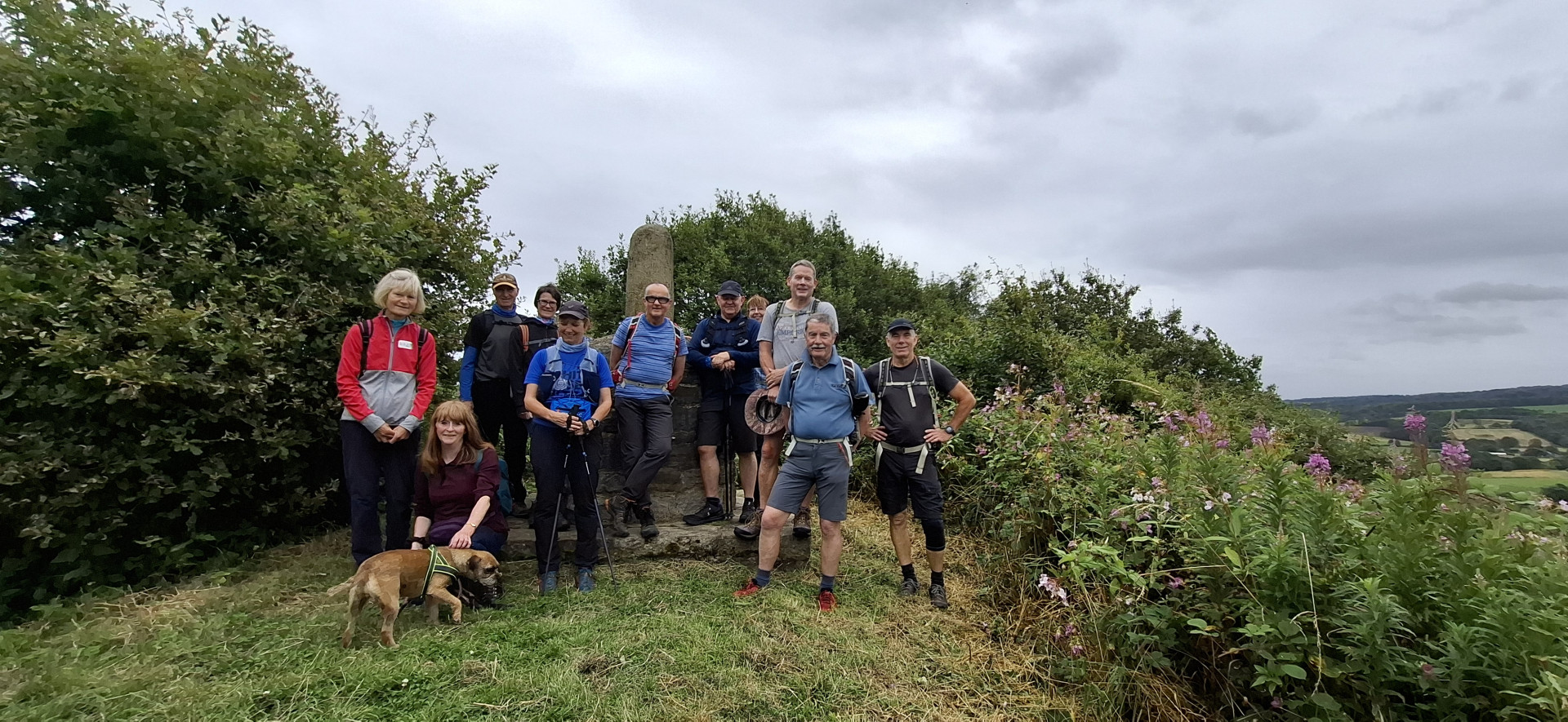
Most of the 19 people on this walk hadn’t seen the Panopticon of the title but many had seen the other three – The Atom, The Halo and The Singing Ringing Tree. The Panopticons are art installations with panoramic views. The one we went to see, called Colourfields, is high up in Corporation Park, Blackburn, and is basically a viewing platform situated on an old gun emplacement or battery. We headed there from Witton Country Park and had our coffee break there.
Heading west from the park, we had some more urban walking before branching off into rolling Lancashire farmland and lanes to reach the Nab’s Head pub at Nab’s Head village where some bought drinks (tea!!) and others lunched nearby. Then we were off to Salmesbury Bottoms on the Lancashire Way to join the River Darwen for a stretch, dropped steeply down to Hoghton Bottoms on the Witton weavers Way, and continued east along it all the way back to the cars. We encountered some fallen trees and branches along the way, and overgrown paths but nothing we couldn’t handle.
The weather was kind, with no rain at all during the 11.5 miles and 1,100 feet of ascent, and very little boggy ground to contend with – what’s not to like!
Many thanks to Dave for being back marker, and to everybody who came along.
Barbara Shelton


Sunday August 18th. From the Mucky Mountains in search of a 'Dream'. 20 miles. Leader:Ann Finnigan.
The walk began at the Mucky Mountain's car park in the Sankey Valley.
7 members began the walk by taking the left hand turn over the St Helens canal.
It was a mostly flat walk... the only hill was the actual Dream, or the Helens Knob as the locals call it!
Lunch was enjoyed in the garden of the Ferry Tavern which overlooks the river Mersey. Lovely to watch a couple of small sailing boats manouvering up and down the river.
Our next big view was the Fiddlers Ferry cooling towers. 4 were blown up last summer leaving just 4 behind. Rumour is that 3 more will go leaving just one as a piece of history.
The next stage was the only tricky bit really. Some quite narrow paths with lots of undergrowth, including the dreaded nettles... not good for those in shorts!
The brief climb up to the Dream was impactful, turning the final corner to see the full force of the white statue... impressive.
Then the final leg taking us through some outlying parts of St Helens.
All back to the Mucky Mountains safe and sound. Here's to the next one.
Ann


Wednesday August 14th. Longden End Circular. 12.5 miles. 1800' Ascent. Leader: Andy Griffin.
My walk started from Hollingworth Lake's old visitor centre car park. 16 walkers set off towards Rakewood in glorious sunshine, which stayed with us all day. Following the road under Rakewood Viaduct, we followed Longden Brook before turning sharp right to take a bridleway up to meet Tunshill Lane. Turning left up the hill, we followed this stoned track all the way up to the Ram's Head PH on Ripponden Rd, Denshaw.
From here, we headed east to Readycon Dean Reservoir and continued to Huddersfield Rd before turning north onto the Pennine Way. We stopped for lunch shortly afterwards. This section of the Pennine Way is part of an ancient Packhorse route between Marsden and Rochdale called Rapes Highway, named after the hill it crosses at this point on the walk. We then followed the route to the county boundary where the most easterly part of Lancashire is noted by a marker stone. White Hill is soon climbed, and Windy Hill repeater station can be seen.
Passing the mast, we head towards Blackstone Edge after crossing the M62. We turned off the Pennine Way below the summit of Blackstone Edge and descended to Hoar Edge and Clegg Moor down to the Pennine Bridleway, which we followed through the hamlet of Syke back to the starting point.
Andy


Patterdale Trip. Mon-Fri 5th-9th August.
East Lancs in Patterdale
Day 1 - Aira Force and Sheffield Pike, led by Roger Jackson
Of the 24 staying on the midweek holiday organised by Roger Jackson at the Patterdale Hotel, 22 set off in hot, humid conditions for a 14 mile route along the the western shore of Ullswater climbing up into the mountains.
We had all been suitably nutritioned from a hearty breakfast at the hotel for the 9.30a.m. start which saw very little of the road whilst utilising the paths and some beach of the Ullswater Way, through Glenridding to turn into the car park below Aira Force. The morning break was taken on various rocks overlooking the waterfalls upstream from the Force
A fairly steep grassy climb took us to Round How after which there was a small drop before contouring above the valley of Glencoyne, skirting Swinesdie Knott. This three mile section included a number of tricky stream crossings including Wintergroove Gill and Deepdale Slack. It also afforded us a suitable location for our lunch stop.
A short descent was followed by the climb up to Sheffield Pike where we had some exploration to take in the magnificent views over Ullswater. Gradually it clouded over and the wind chill made it feel somewhat cooler on Sheffield Pike. All that was now left was a steep descent of 1700ft in two and a half miles to Glenridding where we could then make our own way back along the Ullswater Way to the Hotel Bar or do some shopping.
Gordon.


Day 2 -Place Fell and Hallin Fell from Patterdale led by Steve Gilleard.
17 walkers from East Lancs LDWA set out from the Patterdale Hotel at 10am on Wednesday August 7th 2024.
The day was overcast with drizzle in the air and a gentle breeze.
We passed the White Lion Inn and soon left the road to cross over Goldrill Beck before joining the steep path leading to the cairn at Boredale Hause 399m.
Heading North now we ascended Steel Edge passing Round How to reach the Rocky Summit of Place Fell 657m.
Not lingering long on the summit due to the very blustery conditions we descended a little way to take a ten minute break.
Walking North East on a good path we then passed the restored sheepfold on Low Moss before taking the steep and in places slippery path through thick bracken down to Boredale.
After crossing the stone footbridge over Boredale Beck we found an idyllic spot and with views up Bordale and absolutely none of the sounds of human activity, we had lunch.
Refreshed in both body and mind, we continued on our way with the short climb over Winter Crag and before dropping down into Martindale.
A short break was taken for those who wanted to view the 16th century St Martin’s Church, which is unusual in having its pews arranged along the side walls facing each other and also has a huge 1300 year old Yew tree at its back which completely hides the church from that side of the valley.
Continuing now along the road a short way we then started climbing again to soon reach the obelisk at the summit of Hallin Fell with its stunning views up and down Ullswater.
A Short and very steep descent on a path through bracken now took us down to the lakeside path of the Ullswater way. Following the Ullswater way along its winding and undulating path we completed the walk back to the Patterdale Hotel around 6pm.
12.5 miles (20km)
3800 feet of ascent (1135m)
Steven Gilleard


Day 3. Patterdale to Pooley Bridge, led by Paul Banks.
16 walkers completed a walk much reduced in length than planned - due to the adverse weather forecast. Rather than the 20 mile Ullswater Way, the group walked 10 miles from the Patterdale Hotel on the Eastern side of Ullswater on the Ullswater Way to Pooley Bridge. As far as Howtown, the walk was very challenging underfoot in the damp weather due to the rocks and tree roots and stony paths. We had a single morning break in Hallinghag Wood overlooking a misty lake and hills and watching the ferries go by. The path leaves the waterside after Howtown and climbs under Barton Fell, before returning to the Lakeside where many families were enjoying water-sports and camping irrespective of the constant drizzle.
On reaching Pooley Bridge, most walkers enjoyed the refreshments on offer in local cafes. All walkers returned to the Patterdale Hotel on one of the regular buses or via the lake ferries.
Jeanette.


Wednesday August 7th. Beacon Bish (No Beacon today, just a Windmill) 12 miles. Leader: Stephen Martin
The first part of the two part Beacon Bash started at 10am on the free large car park at Bramble Lane, Parbold WN8 7HZ. There where twelve LDWA members, Otis the terrier and myself who attended.
It was an overcast day, light winds with a temperature of 17 degrees and threatening rain showers pm. We headed off along the Leeds Liverpool canal and a short divert to Douglas Chapel, the location marked with a cross. Built around 1420, it was demolished in 1875 and the stone used to build a school half way up Parbold Hill. Reciprocating, we continuing along the canal taking a left turn at the first bridge over the canal and railway before passing Gillibrand House (once an hotel ) and ascending Parbold Hill. It was a steep climb on an overgrown path traversing a small quarry; one of many on the route. To the left was once an active quarry and refuse tip, now grassed over. To the right, Peters Moore’s estate and an old golf course. At the top of the hill, we walked the short distance to the ‘Bottle’ a monument to commemorate the Reform Act 1832. A great view point over Lancashire plains. We reciprocated once more before crossing the busy A5209 and upto High Moor. We then about turned to head back down to Parbold village, along Lancaster Lane, turning right just passed Parbold Douglas school heading up to the top of Hunter Hill. We took a short drinks stop at the top of Hunters Hill quarry taking in the surrounding views.
It was a quick descent down Bannister Lane to Jackson’s Lane before the final steep climb of the day up Harrock Hill and to the Harrock Old Windmill; mentioned in documents dated 1660 and on the first OS map of 1840. The windmill was destroyed by a fire in 1880, however a good proportion still remains. Here we took a 20 minute lunch break. After lunch just prior to our decent down to High Moor, we had a short sharp shower, coats were don, but not necessary as the shower was over before it started. Heading further down the hill we crossed the A5206 for the second time before crossing and into Fairy Glenn. Passing another small quarry in the glen, a left turn across fields took us to Appley Lane North, down to Appley Bridge and the Leeds Liverpool canal. A nice gentle walk returned us back to the start at around 15.15hrs.
A pleasant walk in great company, some travelling over 1 hour to attend, plus a member who it was his first social walk.
Stephen Martin
Walk leader