


Tring circular
Sun 5th Mar 2017
Walk Details:
Event Type
Group Walk
Region
Southern England
Local Group
London
Distance
20ml.
Start Time
09.29
Route
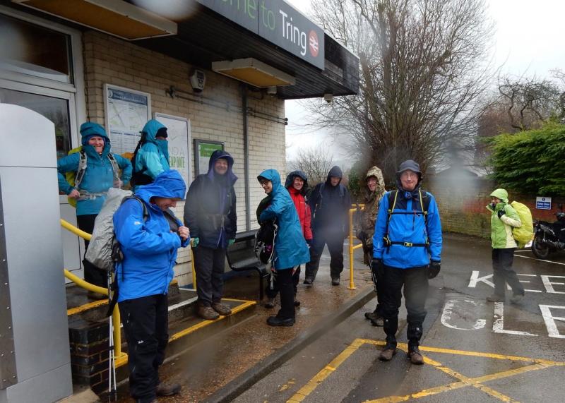
Meet Tring station (08.55 Euston)
Via Grand Union canal, Aylesbury ring, meandering footpaths, Two Ridges way and Ridgeway
General Notes
Possible LATE lunch The Village Swan, Ivinghoe Aston; probably best to bring sandwiches
Web Site
Start and Finish
Entry Details:
Cost
Walk Report
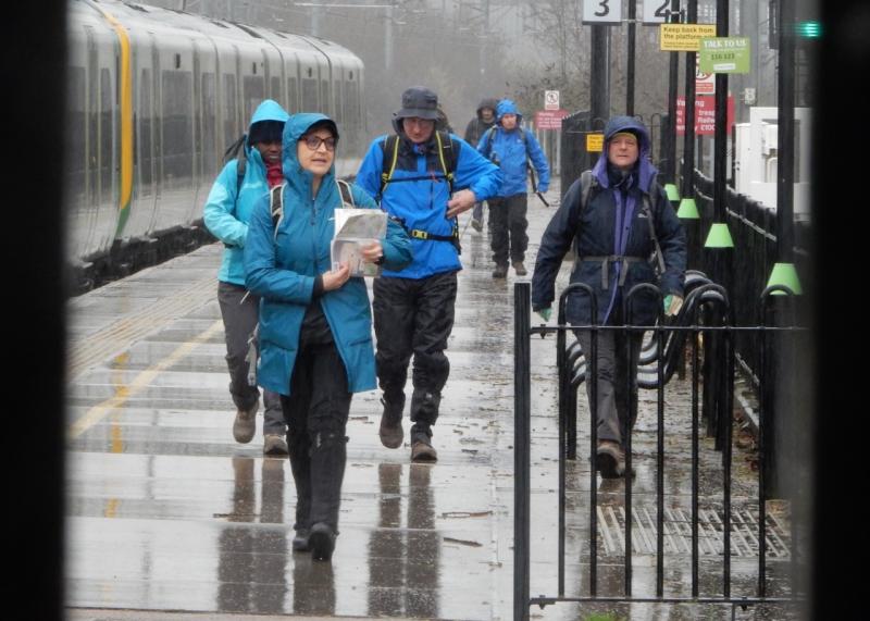
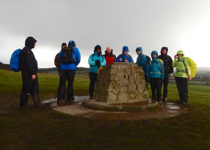
Tring Circular, Saturday 4th March 201710 walkers, 20 miles - leader Steve Plested
Despite the rather grim weather forecast 10 hardy souls joined me at Tring, it was raining at first but as we walked along the canal the clouds broke up and 2 kingfishers were spotted just as the sun came out.
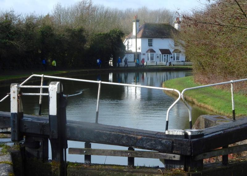
We walked along the canal for a couple of miles with the towpath gradually getting more muddy, and then ventured on to the Aylesbury ring and open countryside, generally sunny and rather breezy but the threatening clouds seemed to keep passing us by fortunately.
We saw a number of hares racing around and the occasional roe deer in the distance with red kites above at times. The going underfoot was generally ok but with the odd field of clinging mud just to make things more interesting.
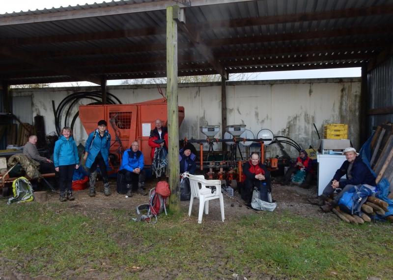
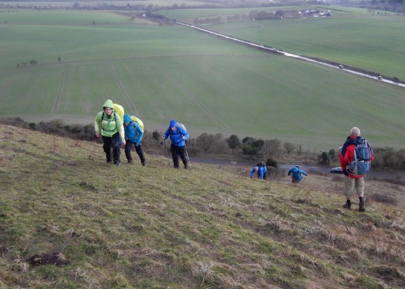
After a late lunch in a barn on a pick your own farm (obviously not open for trade) we headed for the sting in the tail and the first proper bit of rain. The ups and downs of the ridgeway path and plenty more mud beginning with a steep ascent to Ivinghoe Beacon which reduced some members to their hands and knees, but it was worth it for the views, or so most said. There were a few falls due to the slippery conditions but all eventually arrived safely back at Tring.
Photographs by Godfrey O'Callaghan
Other Files
Download Walk ReportGallery


Maps:
You can use the interactive controls to zoom in and out and to move around the map, or click on a marker for more info. (interactive map help)
Contains Ordnance Survey data © Crown copyright and database right 2016.
© OpenStreetMap contributors under Open Database Licence.
Rights of way data from selected Local Authorities.
Large scale digital mapping is provided by John Thorn.
© OpenStreetMap contributors under Open Database Licence.
Rights of way data from selected Local Authorities.
Large scale digital mapping is provided by John Thorn.


