


+++NOTE CHANGE OF DAY!!+++ Walthamstow wander
Sun 19th Feb 2017
Walk Details:
Via Walthamstow Marshes & down the River Lea to take in views of the Olympic Stadium, then into Victoria Park & then following the Regents Canal past the Mile End wastelands! After lunch at Canary Wharf, onto Greenwich & then following the Thames with a diversion through Russia Docklands
Entry Details:
Walk Report
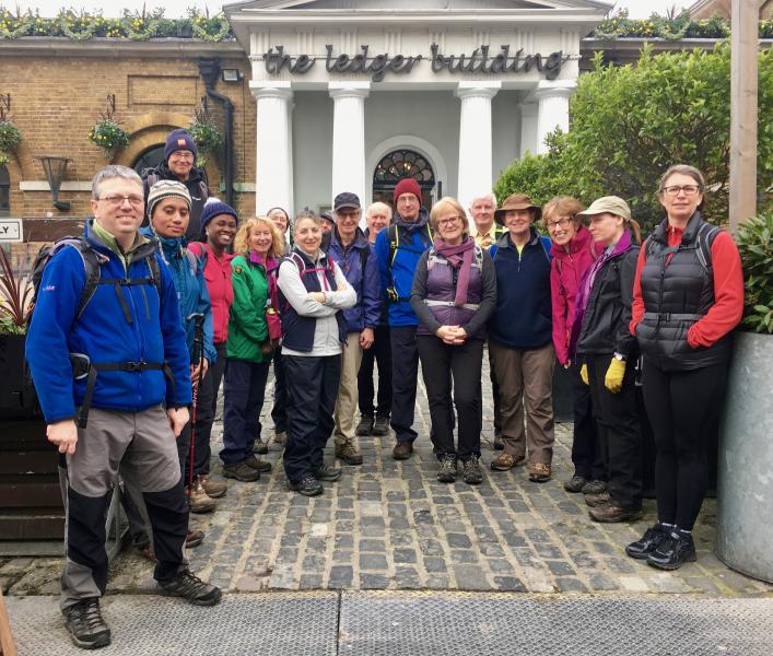
Walthamstow Wander, Sunday 19th February 201721 walkers, 19 miles - leader Dave Williams
19 of us assembled at Walthamstow for a quite urban but mud-free saunter.
There was plenty to keep the walkers interested including the famous Middlesex Filter Beds, the first few miles of the 2012 "100", and a couple of Victorian chimneys!
To the leader's immense relief the Wetherspoon's at Canary Wharf had re-opened after it's refurbishment for our lunch stop, although apart from a lick of paint it was hard to work out what exactly had been refurbished!
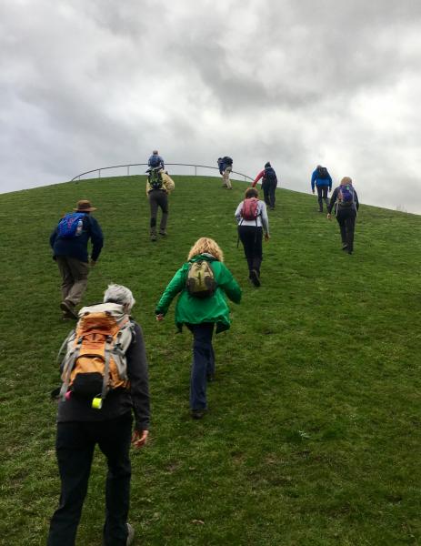
A couple of the less hardy souls departed but we were joined by a couple of part-time walkers & a pleasant amble along the Thames with the undoubted highlight of the day, the ascent of Stave Hill being accomplished with the magnificent views it afforded from the summit! A majority departed at London Bridge, with just 6 making it to the end at Liverpool Street, where 3 of us adjourned to the Wetherspoons for a well-earned pint or two!
Photographs by Keith Lane; more by Bola Baruwa and Gavin Fuller on the group Facebook page
Other Files
Download Walk ReportGPX
A GPX file of the above route may be downloaded by clicking the link below.
Note: GPX files of Group Walks are created by LDWA Group members, and may be downloaded only by other LDWA members. They should not be made available outside the LDWA, and are used at members' own risk.
Login to Download (Members Only)You can use the interactive controls to zoom in and out and to move around the map, or click on a path or a marker for more info. (interactive map help)
You can use the interactive controls to zoom in and out and to move around the map, or click on a path or a marker for more info. (interactive map help)
© OpenStreetMap contributors under Open Database Licence
Rights of way data from selected Local Authorities
Large scale digital mapping is provided by John Thorn
At high zoom levels the route is indicative only.
Gallery
Maps:
You can use the interactive controls to zoom in and out and to move around the map, or click on a marker for more info. (interactive map help)
© OpenStreetMap contributors under Open Database Licence.
Rights of way data from selected Local Authorities.
Large scale digital mapping is provided by John Thorn.


