


Pilgrimage to Dreamland (linear)
Sat 28th May 2016
Walk Details:
Details:
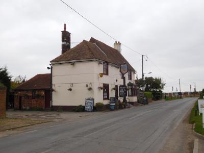
In the morning leave Canterbury via the Stour Valley Walk, passing through Fordwich village and woodland before traversing at Stodmarsh (al-fresco refreshment stop) to Wickhambreaux village and the Little Stour, hence via more woods and farms to lunch in Preston (Half Moon and Seven Stars - no frills, but substantial).
Afternoon route takes us across farmland and through orchards to Plucks Gutter, then along the banks of the River Stour and fields to afternoon refreshment in Minster (either the Bell or the New Inn), continuing across northern Thanet to a beachside finish in Margate (unfortunately - unless hours are extended - the Dreamland Scenic Railway stops operating about 30 minutes before we arrive; Wetherspoons will be open)
Entry Details:
Walk Report
Pilgrimage to Dreamland (Canterbury to Margate), Saturday 28th May 20168 walkers, 21.6 miles - leader Dick Bowman
8 starters and 7 finishers for this never-to-be-repeated traverse of the varied countryside of Thanet.
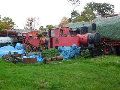
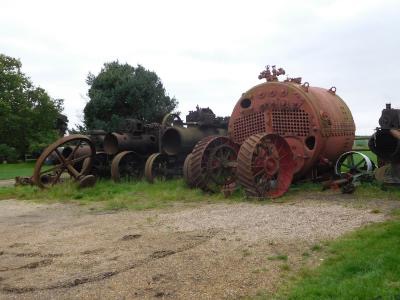
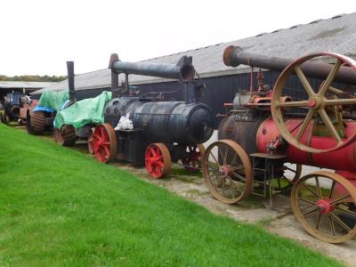
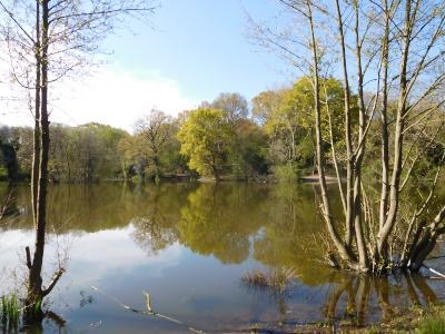
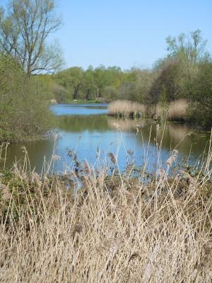
The morning spent mostly in the woodlands along the Stour Valley Path, passing through the villages of Fordwich and Wickhambreaux (the latter a shining example of car ownership leading to environmental ruination), admiring three jolly piglets and the industrialised strawberry factory along with the steam and traction engine collection at Preston Court Farm before a lunch stop in Preston.
Afternoon with completely different landscape, first through orchard to recross the Stour Valley Path and continue making our way to Margate along the banks of the Stour. Final refreshment stop in Minster before crossing the Thanet Prairies to finally drop down into Birchington and along the beachside to Dreamland (arriving exactly one minute after the rides stopped, and our leader having failed to negotiate an LDWA Late Opening).
Then the Low Speed Train (at the High Speed fare) back along the North Kent coast.
Observations:
These Kent villages seem to have been able to retain at least a few amenities by way of pub, shop and school.
Our leader can't tell the difference between a stoat and a scrawny squirrel.
If bluebells are your thing, then the Canterbury-Preston stretch is highly recommended in late April (and for misty woods, try it in October).
Margate closes at 5pm on Bank Holiday Saturday.
Photographs by Dick Bowman
Other Files
Download Walk ReportGPX
A GPX file of the above route may be downloaded by clicking the link below.
Note: GPX files of Group Walks are created by LDWA Group members, and may be downloaded only by other LDWA members. They should not be made available outside the LDWA, and are used at members' own risk.
Login to Download (Members Only)You can use the interactive controls to zoom in and out and to move around the map, or click on a path or a marker for more info. (interactive map help)
You can use the interactive controls to zoom in and out and to move around the map, or click on a path or a marker for more info. (interactive map help)
© OpenStreetMap contributors under Open Database Licence
Rights of way data from selected Local Authorities
Large scale digital mapping is provided by John Thorn
At high zoom levels the route is indicative only.
Gallery


Maps:
You can use the interactive controls to zoom in and out and to move around the map, or click on a marker for more info. (interactive map help)
© OpenStreetMap contributors under Open Database Licence.
Rights of way data from selected Local Authorities.
Large scale digital mapping is provided by John Thorn.


