Latest News: Read more


National Trail AcornCleveland Way National Trail

Cleveland, N Yorkshire

175 km / 109 miles
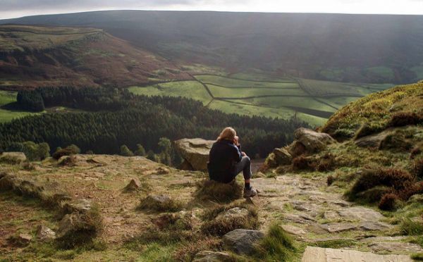
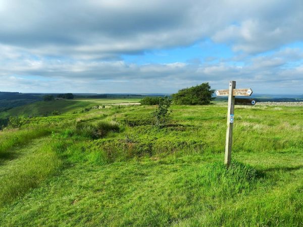
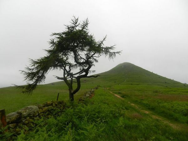
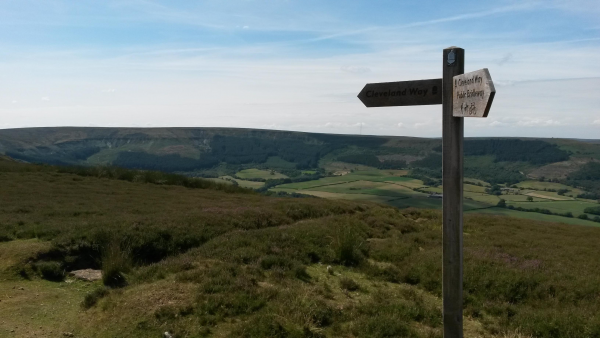
The Way climbs to the North York Moors at Sutton Bank, where there is a short extension to the Kilburn White Horse, and then heads north along the western edge of the high heather moors to Osmotherley from where it follows tracks along the northern escarpment to Greenhow Moor. It turns over Kildale Moor, Roseberry Topping and Guisborough Moor to leave the North York Moors National Park and to reach the coast at Saltburn-by-the-Sea then following a varied and undulating coastal path southwards along clifftops, sands and passing several harbours and resorts.

This roughly horseshoe-shaped trail has led to the development of suggested routes linking the start and finish including the waymarked Tabular Hills Link Walk (48 miles). Relevant publications for the link are listed. The Cleveland Way and Yorkshire Wolds Way meet at Filey, enabling a longer continuous route on National Trails.

The waymarked Cleveland Street Walk (11 miles), which is included on OS mapping, connects Guisborough with Loftus (and easy access to the coast/Cleveland Way National Trail), crossing the Cleveland Way National Trail inland at Slapewath to provide alternative options.

The route can be completed as a series of circular day walks using the 'Cleveland Circles' guide.

The National Trails website now includes a 'Google Trekker' journey along the route - see www.nationaltrail.co.uk/cleveland-way/google-trekker

For National Trails website alerts see 'Cleveland Way Interactive Map (National Trails UK)' below.


UPDATE November 2021: There is a very short permanent diversion at the eastern end of Mount Pleasant North, Robin Hood's Bay due to coastal erosion. This takes users across Rocket Post Field and down an accessible ramp to join a short stretch of the Cinder Track as the route enters Robin Hood's Bay. Further information is available on the National Trails website. It is not proposed to amend our GPX files at the present time.

January 2026: The Cleveland Way cliff path immediately south of Robin Hood's Bay was closed on January 5th 2026 and diverted inland via Middlewood Farm, the cinder (old railway) path, and Mark Lane.

The LDWA National Trails Register offers certificates for completers of several British National Trails.

See also E-Routes (E2).


Details:

Waymark: National Trail Acorn
Path Type: National Trails (England & Wales)
Waymark: National Trail Acorn
Attributes: National Trail (England and Wales)
Challenging
Coastal
Moorland
Start: SE612838 - Helmsley, N Yorkshire
Finish: TA130815 - Filey Brigg, N Yorkshire
Open Date: 1969
Web Sites: National Trails - Cleveland Way Moorland Challenge - Cleveland Way Welcome to Yorkshire - Routes & downloadable maps Pete's Trip Reports - Cleveland Way [blog] Cleveland Way parts 1-6 [YouTube video] BBC news : the Cleveland Way celebrates 40 Trailplanner - Cleveland Way [blog] Outdoor Scott - Guide to Walking the Cleveland Way [blog] A walker's journal - The Cleveland Way [blog] Griffmonster - Cleveland Way posts [blog] Chris Stuart's Walks - Cleveland Way [blog] Cleveland Way - Filey to Helmsley [YouTube video] Cleveland Way [YouTube video] National Trails - Cleveland Way Interactive Map Waypoint51 - Cleveland Way

Publications, Badges and Certificates:

Guidebook Cleveland Way  (Trailblazer  - 2024 )
Guidebook Cleveland Way and the Yorkshire Wolds Way  (Cicerone Press  - 2024 )
Guidebook Cleveland Way  (Rucksack Readers  - 2021 )
Guidebook Cleveland Way : National Trail Guide  (Aurum Press (an imprint of Quarto)  - 2019 )
Guidebook Cleveland Circles  (Dales Court Press  - 2006 )
Guidebook Tabular Hills Walk  (North York Moors National Park  - 2004 )
General Interest Book National Trails : 19 long-distance routes through England, Scotland and Wales  (Cicerone Press  - 2015 )
Badge Badge for Cleveland Way National Trail  (North York Moors National Park )
Badge Badge for National Trails  (Trails Shop )
Badge Badge for Cleveland Way  (Lyke Wake Company Limited )
Certificate Certificate for National Trails  (Long Distance Walkers Association )
Certificate Certificate for National Trails  (Trails Shop )
Other National Trail mug  (Trails Shop )
Guidebook Cleveland Way  (Dalesman  - 1997 )
General Interest Book Tales from the Big Trails  (Vertebrate Publishing  - 2021 )
General Interest Book Big Trails: Great Britain & Ireland  (Vertebrate Publishing  - 2020 )
Guidebook Trekking the Cleveland Way: two-way trekking guide  (Knife Edge Outdoor Guidebooks  - 2023 )

Click to showhide 13 more Publications, Badges and Certificates


Maps:

You can use the interactive controls to zoom in and out and to move around the map, or click on a path or a marker for more info.(interactive map help)

Show Connected Path Outlines
E Routes
National Trails (England & Wales)
Paths Marked on OS mapping
Other Paths
Anytime Challenges

Show Accommodation
Hostel Accommodation
Camping Barn

Show Points of Interest
Walkers are Welcome

Contains Ordnance Survey data © Crown copyright and database right 2016.
© OpenStreetMap contributors under Open Database Licence.
Rights of way data from selected Local Authorities.
Large scale digital mapping is provided by John Thorn.
At high zoom levels the route is indicative only.
Purchase Ordnance Survey Maps (path is named on OS maps):
OS Landranger 93, 94, 99, 100, 101
OS Landranger Active 93, 94, 99, 100, 101
OS Explorer 26, 27, 301, 306
OS Explorer Active 26, 27, 301, 306
Other Paper Maps:
Harvey National Trail map
Cleveland Way (Harvey Maps - 2017)
A-Z Adventure Series
Cleveland Way National Trail Official Map (Geographers' A-Z Map Company (an imprint of HarperCollins) - 2017)
Map (Other)

Accommodation within 5 km of this Path:


From
Path
Along
Path
Camping Barn
< 1 km
67 km
Walkers are Welcome
2 km
99 km
Hostel Accommodation
< 1 km
126 km
Hostel Accommodation
< 1 km
137 km
Hostel Accommodation
< 1 km
138 km

Click to show 2 more Accommodations


Additional Images:


Connected Paths:


Downloads:

Reminder: Material downloaded from this website is for personal or LDWA use only. Commercial use, reproduction, modification of all content is strictly prohibited without prior approval by the LDWA. Please Contact Us if you have any requests.
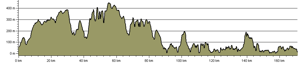

Route Profile:

170.9 km (106.2 miles)
5,031 m (16,506 ft) ascent
448 m (1,470 ft)  maximum height

This website uses cookies

To comply with EU Directives we are informing you that our website uses cookies for services such as memberships and Google Analytics.

Your data is completely safe and we do not record any personally identifiable information.

Please click the button to acknowledge and approve our use of cookies during your visit.

Learn more about the Cookie Law