E Yorkshire, N Yorkshire, W Yorkshire, York
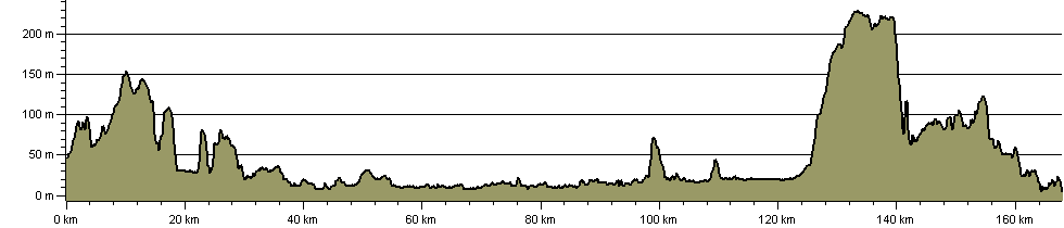
167 km / 104 miles
(click to enlarge)
This route begins a journey to Scarborough from the Black Prince statue in Leeds' City Square. Ultra modern and Victorian developments give way to ribbons of parkland, following sections of The Dales Way link and the Ebor Way to Wetherby. Continuing across vast agricultural plains, the walk follows the River Wharfe as it passes through Boston Spa and Tadcaster, before following an old Roman road into suburbs of the city of York.
From here, we link up with the Minster Way, on to historic Stamford Bridge and the River Derwent. We then head upriver through the Howardian Hills Area of Outstanding Natural Beauty to join the Centenary Way into Malton and the chocolate-box village of Thornton Le Dale. Forestry now dominates as the path pushes deep into the North York Moors National Park and the impossibly beautiful Dalby Forest, along part of The Blue Man Walk, into Wykeham Forest and then alongside the infant Derwent into remote Harwood Dale.
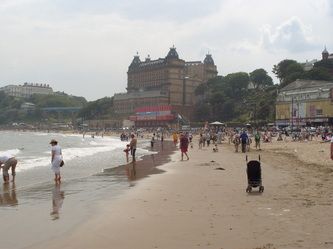
The final stretch fills the nostrils with sea air as we hit the coast and drop southwards on the cliff tops, along the Cleveland Way. A beach and headland walk around the magnificent Scarborough Castle completes the journey as we reach the glorious South Bay, and the finish line.
This is a truly varied and magnificent; there are numerous fascinating local history points of interest included as the walk passes them.
The new Woodhall Bridge near Wetherby is now again open (for Easter 2015), after a 3-year closure due to storm damage. This enables walkers to use the Ebor Way, Tidewater Way and White Rose Way that involve this crossing.
UPDATE September 2021 - We have been advised that as part of the Transpennine Route Upgrade, Network Rail are proposing to close Copmanthorpe (Bishopthorpe) level crossing. This LDP currently uses this crossing. If, and when, a decision is made to reroute the PROW in this area, we will adjust our GPX files.
UPDATE December 2024: Network Rail announced in November 2023 that they had withdrawn their plan to close the crossing and replace it with a stepped footbridge. It is not known in December 2024 whether they will submit a revised plan for the footbridge.
September 2025: report of a blockage at Scoreby Lodge, just off the A1079 near Dunnington, east of York. The short length of footpath in question had been omitted from York's Definitive Map.
UPDATE October 2025: the gate which had been locked is reportedly open.
Details: