Plodding through Spring
Wednesday April 3rd. Thirlmere Way part 1.
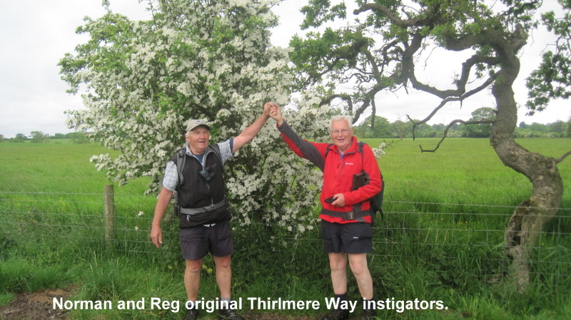
10 miles from Heaton Park. 11 walkers and 1 dog. Leader: Reg Kingston
Thirlmere Way.Section 1. Heaton Park Reservoir to Blackleach Country Park.
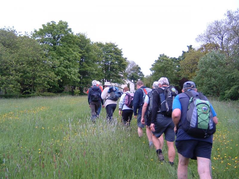
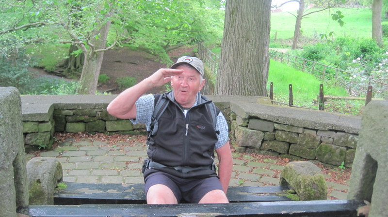
Some eleven Plodders and Maude gathered outside the Heaton Park Station on a cool but sunny morning. Reg handed out the guide to gate spotting researched and compiled by the ‘Nutters Mobile Surveillance Unit’. Apart from it’s humour the document lists the serious research the Nutters have undertaken relating to the Aqueduct.
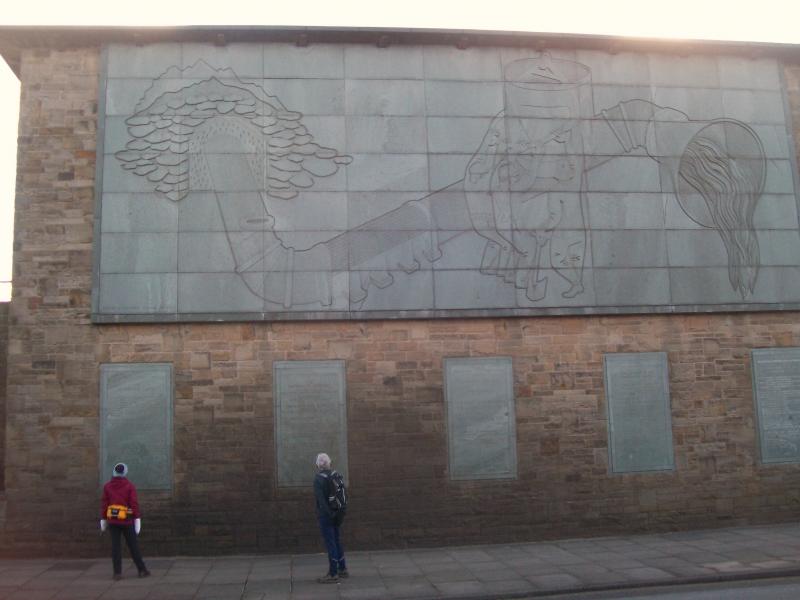
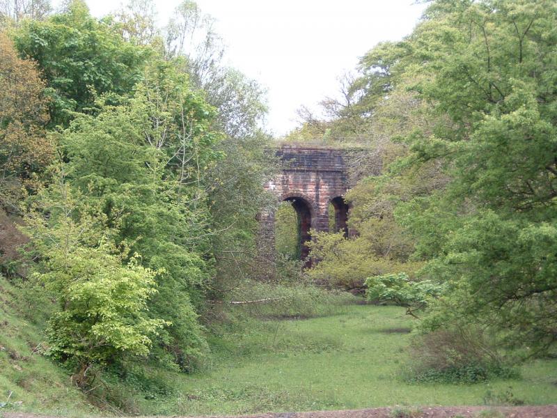
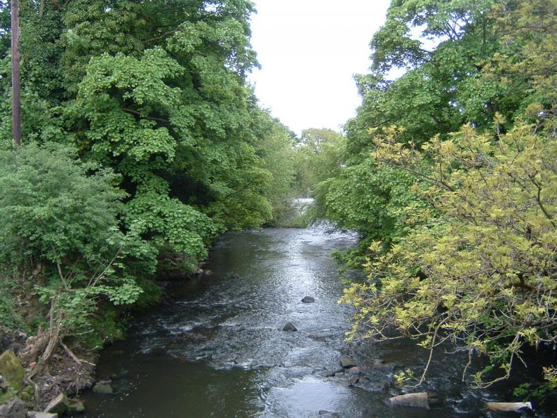
Briskly walking into the park we reached the Hall and turned towards the Reservoir. The Reservoir is hidden from view by high banks and it is not possible to see where the Thirlmere Aqueduct enters. We saw two pipes which may have been connected with the Aqueduct but Water Engineers said that was not the case and said it enters near to where the Haweswater Aqueduct enters. By contrast the Haweswater Aqueduct is acknowledged by a mural on the Pumping House and below the mural are details of its construction, the engineers concerned and how much of the various materials were used. Alongside the Pumping House is a low wall which on climbing up allowed us to see the reservoir.
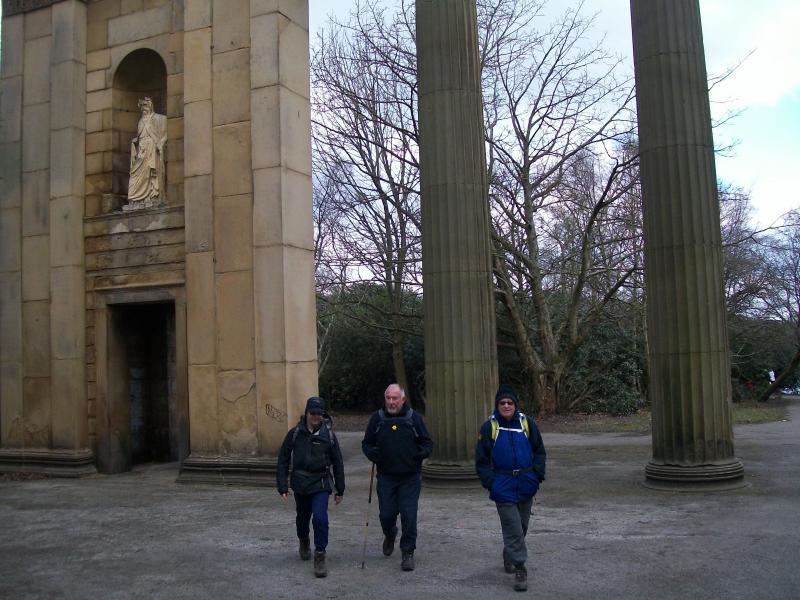
Continueing around the perimeter of the reservoir we walked back into the park and had our first break of the day close to the farm seeing en route some Highland cattle. Leaving the park by the Grand Lodge exit we briefly examined the impressive Collonade which was previously the front of Manchester Town Hall.
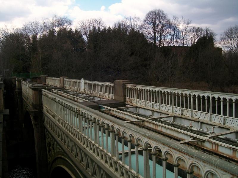
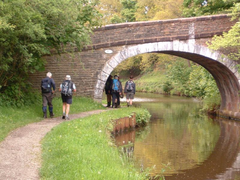
The Aqueduct travels beneath the roads leading from the park down to the bridge across the Irwell at Agecroft. To avoid walking along these busy roads we cut down Sedgley Park Road and after some urban walking reached the Prestwich Golf Course. Walking around the golf course and down Heathlands Drive we took a path leading into an modern housing estate. Emerging onto the A6044 we walked downhill to the bridge at Agecroft. This very ornate and impressive Victorian bridge gave us our first sight of two Aqueduct pipes.
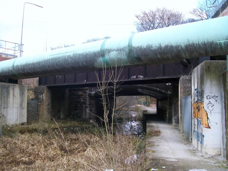
From the bridge we continued along the road passing the entrance to the former Power Station at Agecroft. Further on we reached the former Manchester to Bury/Bolton canal. Walking down to the canal we obtained good views of the Aqueduct pipes as they cross the canal. Walking on a little further the pipes are again visible as they cross the Manchester to Bolton railway line. Continuing along the road we passed the site of the former Agecroft Colliery, now a retail park, forward under the railway bridge and up hill to the A666. It is interesting to note that over this last section how many steep climbs the Aqueduct takes and testifies to the power of the hydrostatic pressure as the result of the height difference between Lake Thirlmere and Heaton Park Reservoir (approximately 500 feet).
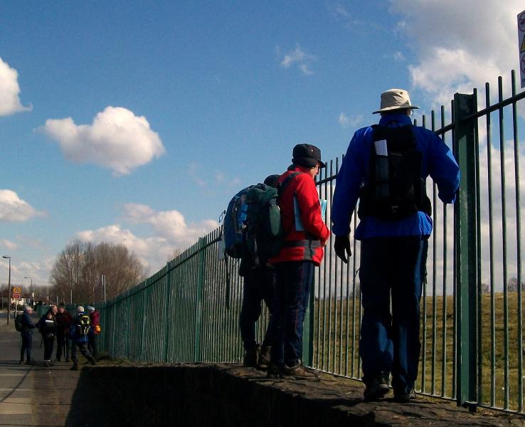
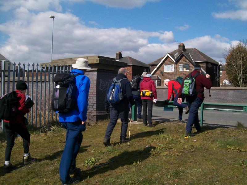
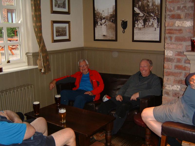
Crossing into Ranelagh Rd we examined the inspection hatch on the grass verge. Lifting the hatch and seeing the valves below we then had difficulty in closing the hatch! Passing what was Pendlebury Hospital, now a building site, we crossed to a footpath leading to Swinton Hall Road. The Aqueduct is below the A6 from this point,until it reaches Walkden,so we took a very urban cross country route to eventually reach Blackleach Country Park. At the far end of Swinton Hall Road some of us enjoyed a cuppa in Morrison’s cafe whilst others sat on the wall and enjoyed their lunch bathing in the sun.
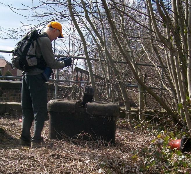
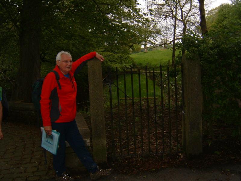
Reaching the A6 again via Cromwell Road we saw the Aqueduct pipes crossing the railway at Moorside Station. Continuing along the A6 we passed beneath the Motorway bridges and eventually came to the bridge over a disused railway and further Aqueduct pipes, inspection hatches and what would have been sight of the first gate. Unfortunately some one has removed the iron gate leaving the stone posts. Reg had a photo of the gate and was able to show what it had looked like
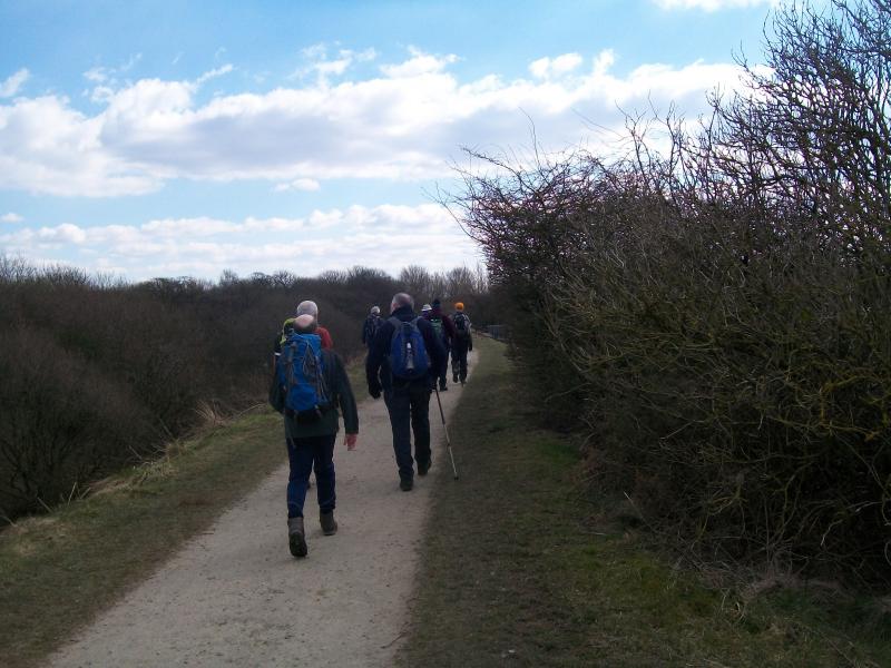
Walking down the old railway track bed we reached Blackleach Country Park, its lake and eventually the Information Centre for 3.30pm. As arranged the Rangers let us us their lecture room to take a further tea break and discuss future events and dates. Reg estimated the distance to be around ten miles,but no doubt Martin will tell us more accurately what the distance was. Thanks once more to Martin’s generous gift of chocolate cake.The date of the next section, Blackleach to Adlington,is 1st May.
Reg


Please click on the link below for Martins blog and slideshow.
http://phreerunner.blogspot.co.uk/2013/04/wednesday-3-april-2013-thirlmere.html
Wednesday May 1st.
Thirlmere Way. Part 2 (Blackleach to Horwich) A Plodder Walk. 10 miles.
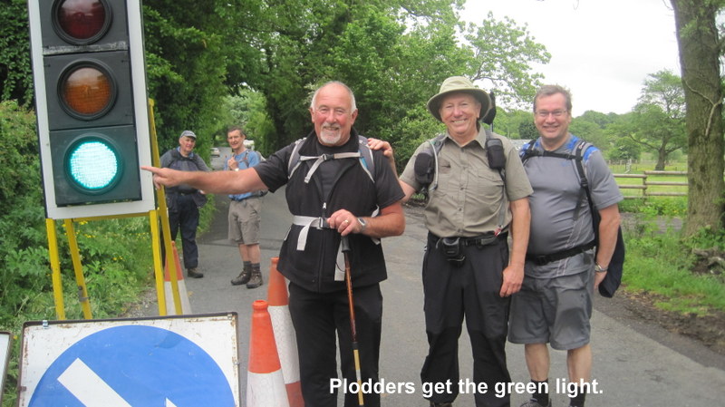
After a hectic 30 minutes putting together future Plodder Walks, enjoying the hospitality of the Blackleach Information Centre,12 Plodders fired with the urge to spot gates set off in bright sunlight. Within 10 minutes we were literally on top of the Aqueduct admiring the valve House which is situated on the recreation ground off Ridyard Street. The splendid building, protected from vandals by a fence, has the Manchester Corporation logo on one side and is identical to buildings seen near Kendal and one surprisingly in Stretford (?connected to water ringmain around Manchester.)
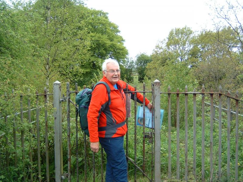
Moving on through a litter strewn council estate we found a rather sad gate with one stone pillar, a twisted but complete iron gate.Walking down Thirlmere road we reached the bridge over the former Eccles to Bolton (Great Moor Street) railway.Here for the first time were three pipes. Crossing to Seddon Street we saw more inspection hatches and then crossed an even more litter strewn council estate and industrial estate noting en route several stone gate posts but no iron gate. Eventually after crossing recreational fields,with unused football pitches, we reached our first complete gate.This gate has been cared for by the man living in the house next to the gate. In front of his garden are inspection hatches.The gentleman came out to talk with us. He has painted the gate black and has the key to the padlock which is a feature of many of the gates we will see. We were able to talk about our walk and how his is the first complete gate on our journey from Heaton Park.
Moving on to the A6 we had our first sight of the vast open cast mining site. Enormous slag heaps,referred to locally as the ‘Great Wall of China’ have been levelled and landscaped. Crossing a bridge over a former colliery railway Aqueduct pipes were seen. A mile further on we were able to turn off the A6 and passed two farms, Adises and Umbertons and find further complete gates, one almost completely hidden in the hedge. We enjoyed our first break overlooking the huge open cast site which is now being actively landscaped. Being a clear day we enjoyed views over towards the Welsh Hills.
Walking now through a private estate with it’s carefully kept gardens, no litter and quiet, we passed further inspection hatches and another hidden but complete(with padlock!) gate in the front garden of a local GP on the main road. Walking through another private and well kept estate we reached the A6 and walked along to find two more gates as the Aqueduct leaves the Hulton Estate.The Estate, recently sold to Peel Holdings was in the ownership of the Hulton Family for 1,000 years. It comprises over 1,000 acres of agricultural land and woodland. Everyone hopes it will remain a country estate.
Further along the A6, immediately before Chequerbent Island we studied the plaque telling us this was where the Leigh to Bolton railway crossed the A6, and was the first such level crossing in the world. The picture of what looks like Stephenson’s Rocket would fit with this railway, the first public railway in what was then Lancashire, being opened in 1828. Walking through an industrial estate which was previously the site of Chequerbent Station we crossed fields towards the M61 and next to a bridge over which the Leigh to Boltonrailway line crossed we had lunch. Through the bridge pass the three Aqueduct pipes. Both ends of the bridge are sealed off by gates and strong padlocks but there is enough space above the gates to see the pipes which here are at ground level.
Passing beneath the M61, and noting further gates and hatches en route we headed down Lock Lane and at Chew Gate passed four more complete gates. We headed for the railway via Wicken Lees Farm and the various free range chickens,hens,lambs,ducks etc. Allan kindly returned one lamb keen on following us. Via the Horwich Golf Course we headed towards the underground reservoir (Aqueduct originally intended to end here), passing further on a most impressive number of beautifully kept soccer,hockey,tennis and other pitches to reach the old chlorinating works and the end of the walk at Horwich Parkway.Walk ended at 3.30pm.
The next Plodder Walk,again Thirlmere Aqueduct Part 3, Horwich to Wheeldon, is on Wednesday 15th May. Further details of Plodder Walks 2013 to follow.
With regards the Thirlmere Aqueduct we felt it would be good to get north of the Ribble and into great Lancashire scenery, by the end of May, hence another walk planned for 29th May.(Wheeldon-River Ribble)
Reg


Thanks to Don for the pictures.
Thirlmere Way. Part 3.(Horwich to Wheelton) Weds May 15th
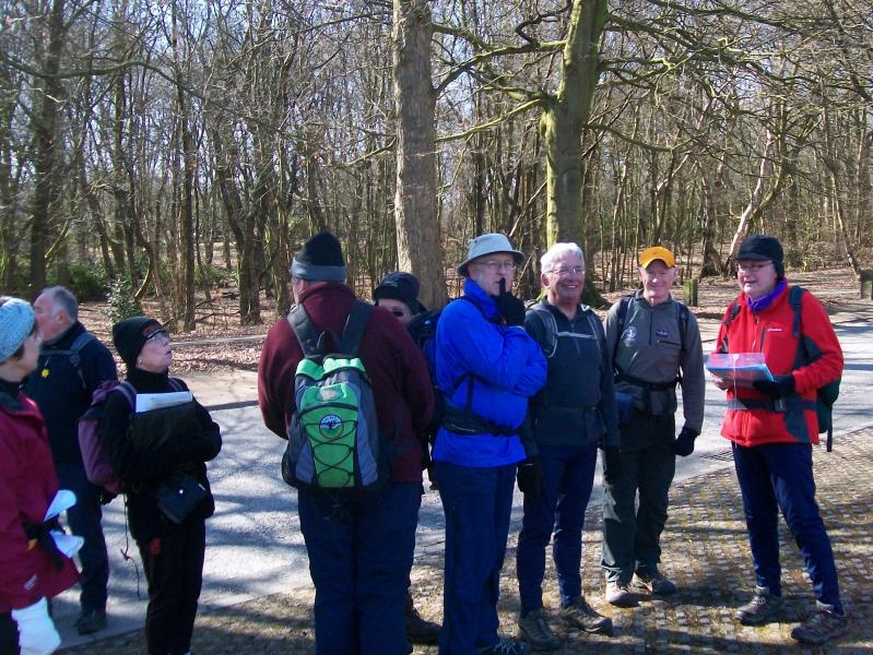
On a very wet morning some nine brave Plodders and Maude set forth. Chas bade us farewell with something along the lines that we should all be locked up!
Walking from our first gate near St Josephs School we rapidly walked along Chorley New Road to the boundry fence of the former Railway Works. Battling through large pools, litter and driving rain we reached the main road again and immediately in front of the Fire Station turned down to the entrance of the former railway works to view the inspection hatches.These are in line with the boundry fence, the Aqueduct running just inside the fence.
Norman, looking for a short cut through Thirlmere Gardens, improved his knowledge of where he now lives by realising there was no short cut!
Passing on via Mason Street and Leicester Avenue we came to the inspection hatches and gates situated in the island in the middle of the road.The hatches, in line with several others we were to see, have recently been strengthened and provided with security cameras. After debate we think this is to prevent terrorists from putting poison into the Aqueduct.
Walking through the playing fields towards Squirrel Lane we met a Water Board Diviner, equipped with his divining sticks, which in this case were metal ones. He had just located the pipes to the Aqueduct carrying water to Liverpool. He explained that he used metal ones because the pipes were plastic and the wooden sticks do not work. It is interesting that at this point the two Aqueducts are yards apart, one carrying water to Liverpool thirty miles away and the Thirlmere Aqueduct which starts ninety miles away.
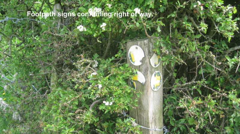
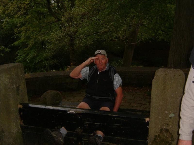
Passing Anderton Manor Farm and into Lancashire and countryside we found five complete gates in quick succession and then needed Norman’s hedge cutting skills to cross a overgrown stile and onto the recently rerouted path leading into the backyard of the house opposite the Millstones Inn. We inspected the so called Headless Cross, which dates back to pre Norman Invasion times and was used as a way sign to Bolton, Blackburn and Preston.
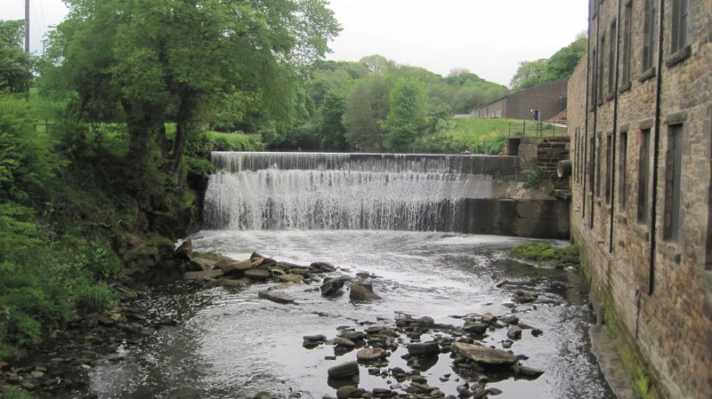
Rapidly passing the Motorway and more hatches and gates in Shawes Lane we reached number 62,Sutton Lane and coffee/tea and biscuits provided by Saro. After this refreshment break the rain subsided and stopped. Passing more gates, we reached The Hall on the Hill,(Chorley Golf Club) and walking down the main drive could see enough of the West Pennine Moors to appreciate the view which is outstanding.Onwards past the former Fever Hospital Site, now a very up market estate, we reached the Yarrow. Walking along this very green and peaceful valley we reached the very impressive Aqueduct pipes as they cross the river. The four pipes and bridge work are a surprise in this otherwise rural spot.
Walking in the direction of Healey’s Nab we reached White House Farm with it’s views over Chorley, over to Parbold and it was clear enough to see Blackpool Tower. After further refreshments we headed downhill past two small reservoirs, an interesting small post box, further gates to head in the direction of Heapey. Crossing the former Blackburn to Chorley railway track bed we reached a further inspection hatch site with security cameras but a gate to allow access. Walking down to further hatches on the route of Norman’s Sunday charity walk and up to further gates and hatches we reached Wheelton at 4.15 pm and the bus back to Chorley/Adlington. The distance was recorded as 12 miles.
Reg


Thirlmere Way. Part 4. Wheelton to River Ribble. Weds May 29th
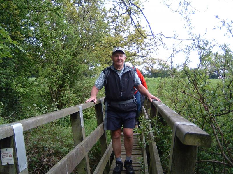
Some 11 Plodders set out from Wheelton with a spring in their steps anxious to cover ground before the forcast rain.The previous walk had started in heavy rain! Leaving behind the sight of five complete gates they made cross country to reach the Leeds to Liverpool canal and the delightful valley which runs along side the canal. Bluebells and meadows full of wild flowers were pleasing to the eye. Just before bridge 87 we were able to admire the three arched bridge which carries the Aqueduct across a valley. Turning off the canal we were able to see the Aqueduct close up and the accompagning gates. Passing the hamlet of Higher Wheelton we made for Wheelton Fold.
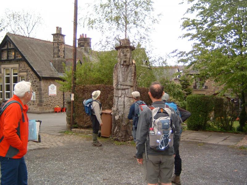
Having secured Norman in the stocks we admired the gate next to the stocks and again the Aqueduct close by. We took pictures of the fascinating tree that has been sculptured into many different animals. Passing the chimney and former print works(thought to have printed notes for the Bank of England)we reached the canal and made for the motorway. Norman drew our attention to how the workers houses were close to the works (cotton mill also here at one time) which shortened journey to work but meant difficult to take a ‘sicky’as everyone knew each other very well!
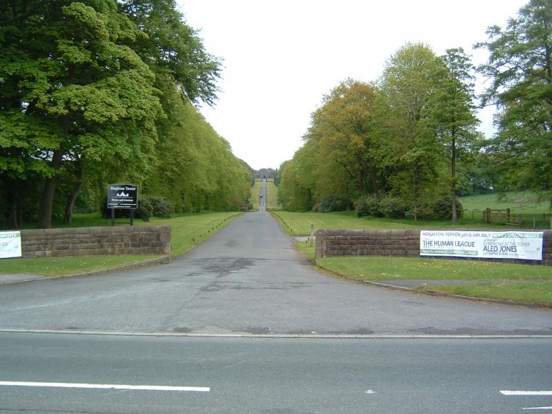
Looking to our right over the fields we saw another inspection hatch site with fencing and security cameras. Under the motorway bridge we took our first break admiring the natural stone brick work and concrete beams. Taking the next footpath on the left we headed uphill over the fields towards Hoghton Tower the entrance to which we passed as we walked down the main road towards the Sirloin Inn and railway bridge. The coaching Inn dates back centuries and made famous by King James 1st who knighted a loin of beef he had enjoyed whilst staying at Hoghton Castle.
Turning off and walking under the railway bridge,passing further inspection hatches, we made alongside the railway, for a difficult to find path, probably seldom walked. As we crossed a farm road the farmers wife stared in amazement at our party of walkers the sight of which on this overgrown path she probably had never seen or expected before. We gave her a smile or two. Crossing three further fields with no visible path on the ground we made for Stanley Grange. Walking past the Grange which is now a care home we heard the sound of a dog in some distress.Thought at first it might have been human.
Crossing several fields,seeing further gates and hatches, all classified by Bernard who has his reference pictures to check, we learned all were standard. At Cardwell Farm we had further sight of the Aqueduct both on the surface but at a little distance away the pipes crossing a valley on private land. At Roach Bridge sitting on handy sized concrete blocks we enjoyed our second break. Still no rain!
Ascending the hill from the bridge with pace we headed for the A59, under and over and down the lane leading to Lower Hall Farm and the Ribble. Sadly,although the bridge is visible from the lane the farmer would not allow access across his land so we could inspect it closer up. Reg had a picture taken from the other side where hopefully when we start the next section we can see the bridge closer up.
Retracing our steps we took a footpath leading to a delightful green lane, through woods full of bluebells,to avoid walking up a very busy A59. Coming out,after seeing our final two gates(classified as standard by Bernard) we came out on the A59,next to the Swallow Hotel and bus stops. We had left cars on this occasion and as we climbed aboard it started to rain. The distance was just under 11 miles and the time taken 5 hours(3.15pm finish)
Bernard had been looking forward to finding a different type of gate said to be near the Brewery but must have been on the road past the entrance to the Brewery which we did not take. I may have the opportunity to check on this. We drowned his sorrows at the Moat House in Wheelton where he consumed an enormous tuna sandwich whilst the rest of us enjoyed some tasty chips with our pint. Full marks to the Plodders who are turning into excellent gate spotters and who have achieved the target we set of crossing the Ribble by the end of May.
Reg.


Thanks to Don and Reg for the pictures.
Thirlmere Way. Part 5. River Ribble to Brock Valley. Weds June 12th.
Nine male Plodders arrived, not without some navigational difficulties, at the Brock Valley Picnic Park at 10.0 am. Leaving some cars for the return journey we headed cross country, down some narrow and winding country lanes to the delightful starting area overlooking the Ribble and most importantly for our budding Gate Inspector, Bernard, a brand new gate! Revived by this finding and the wonderful views looking back over the Ribble to where we finished the last section, we headed off along the Ribble Way towards Longridge. The Aqueduct at this stage was in the field immediately to our left. Leaving the Ribble Way at Alston Hall, we walked along Alston Lane taking a footpath to our left to reach the main road(A5269) and across to Suddell’s Farm. Along the farm road we could clearly see a Valve House with the Manchester Water Works Logo. Since it was across private land we could not get too close but our leading Scout, Norman,had his binoculars with him and confirmed the details.
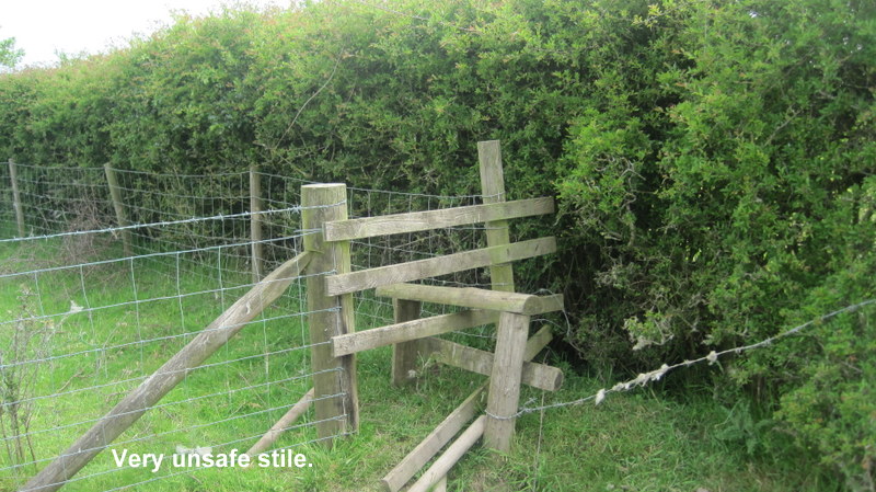
Heading for Piggots House we lost the path on the ground, as was the case for a lot of the walk to come, due to the paths not being walked. Coming to a path blocked by ?a farmer with barbed wire Reg produced wire cutters and with the help of Norman with his secateurs we found our way through thus avoiding a considerable detour and several unsafe stiles which Reg and Peter had encountered on the Reccy. Moving forward past the very expensive looking house we had to climb a ladder stile which was no longer secured to the ground and required to be held in place whilst we climbed it. Crossing a field recently planted with young trees we found the farm road to lead us to the road to Cuneragh Village and a bus shelter where we had lunch. The Nutters Surveillance Unit is based in this area. Interestingly we noted new signs to a Whittingham Walk and having crossed fields knee high in grass and no signs of a path we wondered what sort of local walkers there are.
Refreshed we headed to New Ashley Farm where on a previous occasion Norman and Reg had talked with a very helpful Farmers wife who had not realised the two gates in her drive were related to the Aqueduct. Fortunately we had our Thirlmere Way book to show her and she realised we were not spinning a yarn. Interestingly the gates are now almost completely hidden by vegetation.
Passing through the quiet and deserted Ashley house community we headed across fields with knee high grass soaked by the recent rains to cross two footbridges and come to Horn’s Reservoir and Caravan site. We reached the road via a very overgrown path full of apple mint which had escaped from the garden near by. Smelling of mint we headed for the Horn’s pub and restaurant. After a quick vote it was decided to carry on.(what self control these Plodders have)
Enjoying good views of Beacon Fell and very pleasant weather, no sun but a nice temperature, we passed Higher and Lower Barker Farm and headed along the road to Whitechapel and our final cross field trek down to the Brock Valley and our cars.
The walk took 4 hours 30 minutes and was measured as 10 miles.Although when we reached the picnic site at 10,0am it was raining; by the time we started it had stopped raining and did not rain on us during the walk. Reg explained that from now onwards the Thirlmere Way walks would be monthly and the ‘Rossendale Walks’ would be the other monthly Plodder walk.
Roughly the next section takes us to Dolphinholme and then to Caton and the River Lune by August.The sections for September, October and November should see us reach beyond Kendal, leaving two(three at the most)sections for our time at Ghyll Head.This will leave two other days for other walks at Ghyll Head. I have ten definate(deposits paid) bookings for Ghyll Head, with four other potential bookings, which leaves just two places!
Finally a big thanks to Peter Smith who helped me with the reccy of this tricky section. Those Plodders who did this section appreciated the difficulties posed by unwalked paths but also the scenic interest of this situation, Rural Lancashire at it’s best.
Reg