


High points of Kent (part 2)
Sun 22nd Oct 2017
Walk Details:
Second in a series of walks visiting the highest point in each of Kent's council areas
Entry Details:
Walk Report
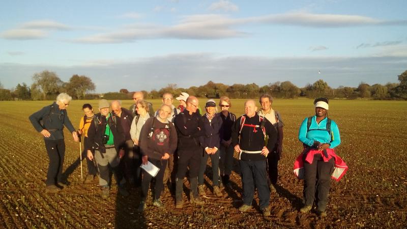
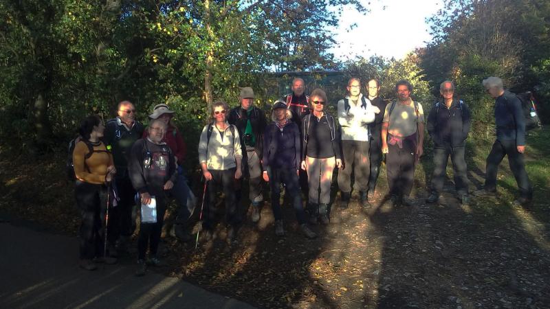
Kent Peaks - Ashford & Swale, Sunday 22nd October 201718 walkers, 19 miles - leader Peter Jull
The 18 who left Charing station were soon 16 when it became clear that for a newbie intent on fitness improvement it was a step up to far from Sheerness sea wall, especially when the route started up the steep scarp of the North Downs.
With an LDWA group in full flow gently downhill the other side, speed was also go to be a problem and with a kindly word that an intermediate challenge might be more suitable he & companion were left with a map to explore at their own pace. The morning was pheasant country with birds frequently flushing from path side. A flock of fledglings herded in front for a field edge furlong. Despite the Brian associated heavy & blustery showers of the previous day the fields were pleasingly unmuddy. Children were monopolising the swings and picnickers also eschewed the seesaw in favour of the sit height playground wall.
The adjacent Alma at Painter's Forstal was full and the roast beef sold out but sitting in a sheltered garden corner was comfortable enough and food served commendably quickly but the landlord did bemoan the lack of notice of so many ordering coffees. The lengthy ladies loo queue completed, the afternoon route turned back south and being exposed to air movement increased from breeze to wind, it was in your face chilling. But that soon abated, clouds diminished revealing the sun and in sheltering woods layers were lost. The rustle of feet through autumnal leaves became so constant to almost be an irritant.
The high point in Swale's council area is spectacularly underwhelming, being a roadside hedge corner before continuing the gentle climb into Ashford. Photography to attest our passing concluded it was but half a mile to Ashford's only a few feet higher point in the middle of a fairly flat field before decent almost imperceptibly began. Its unremarkableness was redeemed by a nascent view but the setting sun required the requisite photographs to exclude it. That view became more spectacular as the descent gradient steepened revealing Charing laid out below. But a lame knee was lagging and left limping across the racecourse while the leading lot were led though the village back paths before the leader returned for the chivalrous Londoners waiting for their laggard. All 5 were still in good time for the 5:50 train home.
Photographs by Peter Jull; more by Bola Baruwa and Gavin Fuller on the group Facebook page
Other Files
Download Walk ReportGPX
A GPX file of the above route may be downloaded by clicking the link below.
Note: GPX files of Group Walks are created by LDWA Group members, and may be downloaded only by other LDWA members. They should not be made available outside the LDWA, and are used at members' own risk.
Login to Download (Members Only)You can use the interactive controls to zoom in and out and to move around the map, or click on a path or a marker for more info. (interactive map help)
You can use the interactive controls to zoom in and out and to move around the map, or click on a path or a marker for more info. (interactive map help)
© OpenStreetMap contributors under Open Database Licence
Rights of way data from selected Local Authorities
Large scale digital mapping is provided by John Thorn
At high zoom levels the route is indicative only.
Gallery
Maps:
You can use the interactive controls to zoom in and out and to move around the map, or click on a marker for more info. (interactive map help)
© OpenStreetMap contributors under Open Database Licence.
Rights of way data from selected Local Authorities.
Large scale digital mapping is provided by John Thorn.


