Latest News: Read more


Herriot Way

N Yorkshire

79 km / 49 miles
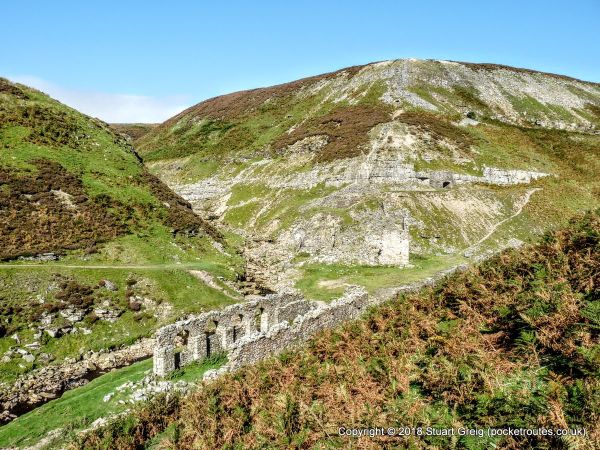
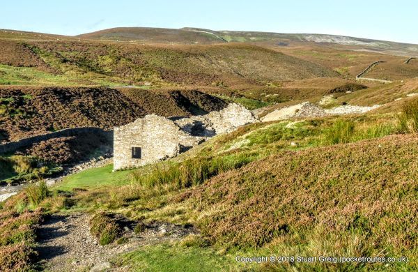
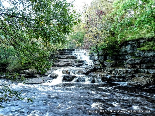
The Herriot Way is a circular long distance path that runs through some of the best scenery in the Yorkshire Dales; including the world famous Wensleydale and picturesque Swaledale. Along its length walkers will visit beautiful valleys, high, open fells and rolling, heather-clad moorland. The route crosses one of the highest points in Yorkshire, visits historic monuments and passes through a barren industrial wilderness; laid bare through lead mining. Beginning in Aysgarth and passing through Askrigg, Hawes, Keld, Reeth and Castle Bolton, anyone walking the Herriot Way will have had a fantastic introduction to the Yorkshire Dales. The walk is named after James Herriot; the fictional persona of the real-life veterinary surgeon who lived and worked in the Dales for many years and based on places he visited regularly.


Details:

Path Type: Other Paths
Attributes: Challenging
Moorland
Literary
Start and Finish: SE004884 - Aysgarth, N Yorkshire
Web Sites: Herriot Way Jasmine Goes for a Walk - Herriot Way [blog] Masarnen Ramblers - Herriot Way [blog] Colin Johnston - Herriot Way [YouTube video] Stuart Greig - Herriot Way [blog]

Publications, Badges and Certificates:

Guidebook Walking the Herriot Way  (Pocket Routes  - December 2025 )
Badge Herriot Way Badge  (Pocket Routes )
Certificate Herriot Way Certificate  (Pocket Routes )

Maps:

You can use the interactive controls to zoom in and out and to move around the map, or click on a path or a marker for more info.(interactive map help)

Show Connected Path Outlines
E Routes
National Trails (England & Wales)
Other Paths
Anytime Challenges

Show Accommodation
Hostel Accommodation
Camping Barn
Bunk House
Group Accommodation

Contains Ordnance Survey data © Crown copyright and database right 2016.
© OpenStreetMap contributors under Open Database Licence.
Rights of way data from selected Local Authorities.
Large scale digital mapping is provided by John Thorn.
At high zoom levels the route is indicative only.
Purchase Ordnance Survey Maps:
OS Landranger 91, 92, 98
OS Landranger Active 91, 92, 98
OS Explorer 2, 19, 30
OS Explorer Active 2, 19, 30
Digital Maps:
Downloadable Digital Mapping
Herriot Way Wall Map (Pocket Routes)
Downloadable Digital Mapping
Herriot Way eMaps (Pocket Routes)

Walking Support Providers:

Support Providers
Self-Guided Walking Holidays (Sherpa Expeditions)

Accommodation within 5 km of this Path:


From
Path
Along
Path
Camping Barn
5 km
12 km
Bunk House
< 1 km
18 km
Hostel Accommodation
< 1 km
19 km
Camping Barn
2 km
19 km
Bunk House
< 1 km
39 km
Hostel Accommodation
< 1 km
57 km
Hostel Accommodation
< 1 km
59 km
Group Accommodation
1 km
74 km

Click to show 6 more Accommodations


Additional Images:


Connected Paths:


Downloads:

Reminder: Material downloaded from this website is for personal or LDWA use only. Commercial use, reproduction, modification of all content is strictly prohibited without prior approval by the LDWA. Please Contact Us if you have any requests.

GPX Route File
Herriot Way GPX Exchange Format Route File
Last Updated 15/09/2024 15:02:59
Login to Download
(Members Only)
MemoryMap Route File
Herriot Way Memory Map Route File
Last Updated 15/09/2024 15:02:59
Login to Download
(Members Only)
Tracklogs Route File
Herriot Way Tracklogs Route File
Last Updated 15/09/2024 15:02:59
Login to Download
(Members Only)

Route Profile:

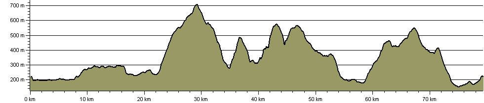
78.2 km (48.6 miles)
2,093 m (6,867 ft) ascent
709 m (2,326 ft)  maximum height

This website uses cookies

To comply with EU Directives we are informing you that our website uses cookies for services such as memberships and Google Analytics.

Your data is completely safe and we do not record any personally identifiable information.

Please click the button to acknowledge and approve our use of cookies during your visit.

Learn more about the Cookie Law