Every part of England, Scotland and Wales is covered by 403 maps specially designed for walkers, off-road cyclists, horse riders and all involved in outdoor activities. The Active maps are an encapsulated map that is tough, durable and weatherproof. The maps are covered in a protective plastic coating that can be written on, so your favourite routes can be easily highlighted. They are more costly but more durable and may obviate the need for a map case, though they are bulkier and heavier. The Outdoor Leisure map series and the Pathfinder map series have been integrated with the OS Explorer Map series.

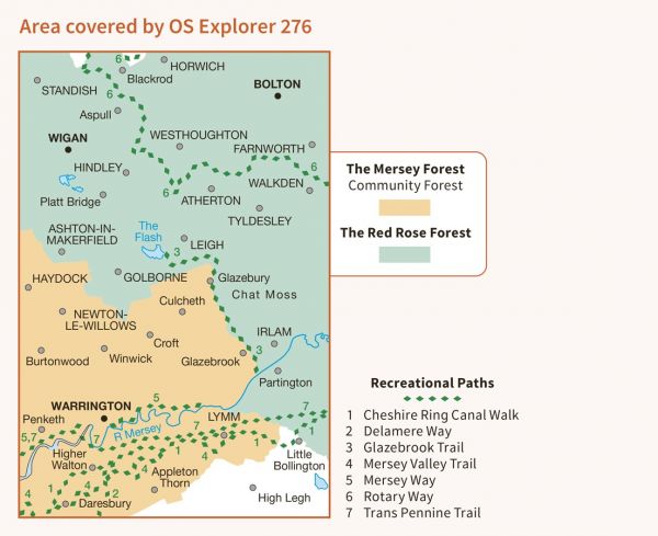
| Altrincham Circular | 27 km / 17 miles |
| Bollin Valley Way | 40 km / 25 miles |
| Bolton Rotary Way Footpath | 80 km / 50 miles |
| Bridgewater Way | 63 km / 39 miles |
| Cheshire Ring Canal Walk | 158 km / 98 miles |
| Delamere Way | 34 km / 21 miles |
| E-Path 8 UK Section - Liverpool to Hull | 296 km / 184 miles |
| Glazebrook Timberland Trail | 18 km / 11 miles |
| GM Ringway | 319 km / 198 miles |
| Lancashire Trail | 116 km / 72 miles |
| Lancashire Way - Southern Loop | 134 km / 83 miles |
| Leeds and Liverpool Canal Walk | 203 km / 126 miles |
| Mersey Valley Timberland Trail | 35 km / 22 miles |
| Mersey Way | 35 km / 22 miles |
| Palatine Plod | 612 km / 380 miles |
| Round Manchester Hiking Trail | 249 km / 155 miles |
| Salford Trail | 85 km / 53 miles |
| Thirlmere Way | 209 km / 130 miles |
| Trans Pennine Trail | 346 km / 215 miles |
