Every part of England, Scotland and Wales is covered by 403 maps specially designed for walkers, off-road cyclists, horse riders and all involved in outdoor activities. The Active maps are an encapsulated map that is tough, durable and weatherproof. The maps are covered in a protective plastic coating that can be written on, so your favourite routes can be easily highlighted. They are more costly but more durable and may obviate the need for a map case, though they are bulkier and heavier. The Outdoor Leisure map series and the Pathfinder map series have been integrated with the OS Explorer Map series.

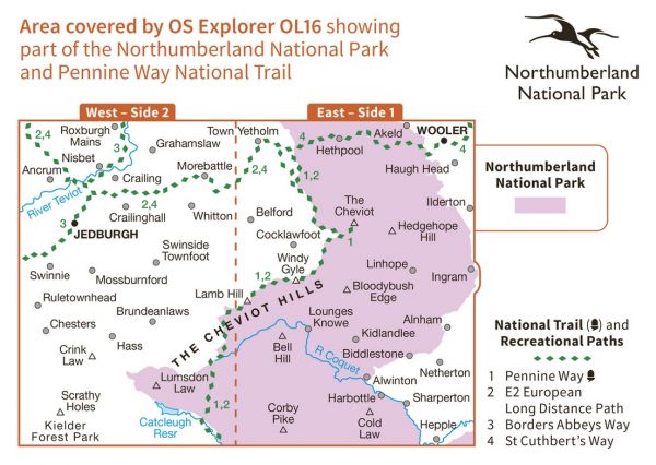
| Alternative Coast to Coast | 320 km / 199 miles |
| Berwick Borough Boundary Walk | 174 km / 108 miles |
| Borders Abbeys Way | 109 km / 68 miles |
| Central Scottish Way | 235 km / 146 miles |
| Cheviot 2,000's | 40 km / 25 miles |
| E-Path 2 UK Section - Stranraer to Middleton-in-Teesdale | 499 km / 310 miles |
| Emblehope Trail | 92 km / 57 miles |
| Hillfort Round | 48 km / 30 miles |
| Inn Way ... to Northumberland | 158 km / 98 miles |
| Kirk Yetholm to Milngavie | 216 km / 134 miles |
| Northern Crossway | 315 km / 196 miles |
| Northern Trek | 895 km / 556 miles |
| Pennine Way Cheviot Spur | 2 km / 1 miles |
| Pennine Way National Trail | 407 km / 253 miles |
| Pennine Way Whitelaw Nick Bypass | 5 km / 3 miles |
| Ravenber Way | 338 km / 210 miles |
| Reiver's Way | 242 km / 150 miles |
| Scottish National Trail | 864 km / 537 miles |
| St Aelred's Way | 277 km / 172 miles |
| St Cuthbert's Way | 101 km / 63 miles |
| St Wilfrid's Way | 225 km / 140 miles |
| Three Peaks of Cheviot | 48 km / 30 miles |
| Tops of the North (Carlisle and Cheviot to Cat and Fiddle) | 713 km / 443 miles |
