Latest News: Read more


Letters MW on standard waymarksTwo Moors Way (Devon's Coast to Coast)

Devon, Somerset

188 km / 117 miles
Devon's Coast to Coast is a composite route made up of the Two Moors Way from Ivybridge to Lynmouth and the Erme-Plym Trail, also marked on OS mapping, from the coast at Wembury to Ivybridge. This combined route was relaunched in 2016. The GPX file downloadable here shows the combined 'Devon's Coast to Coast' route.

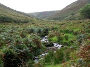
From Wembury Bay on Devon's south coast the Erme-Plym Trail provides a gentle introduction before the more demanding section across Dartmoor where the National Park is entered at Ivybridge. Exposed moorland leads to the highest point on this section over Hamel Down (532m). Two lower-level variants are offered to avoid the moorland sections: 1) Ivybridge to Holne section, 2) Hamel Down.

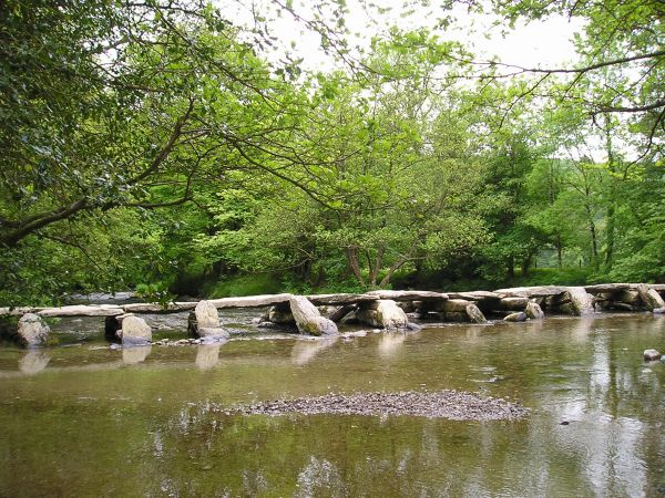
A pastoral section follows to Teigncombe from where the River Teign is followed to Castle Drogo. Exmoor National Park is reached at Tarr Steps and the River Barle is followed to Simonsbath. Another moorland section leads to Exe Head and along the Cheriton Ridge before the final descent to the sea at Lynmouth.

Although termed 'Devon's Coast to Coast' part of the Exmoor section is in Somerset.

The Cicerone guidebook describes the complete route from south to north: Wembury to Lynmouth.


Details:

Waymark: Letters MW on standard waymarks
Path Type: Paths Marked on OS mapping
Waymark: Letters MW on standard waymarks
Attributes: Challenging
Coast-to-Coast
Moorland
River
Start: SX517485 - Wembury, Devon
Finish: SS722497 - Lynmouth, Devon
Open Date: 1976
User Group: Two Moors Way Association Two Moors Way Association
Web Sites: Two Moors Way - Route Explore Devon - Two Moors Way Explore Devon - Erme-Plym Trail Two Moors Way - Exmoor National Park [YouTube video] Walking the Two Moors Way [YouTube video] The Two Moors Way needs your help Backpack Artist - Two Moors Way [blog] A walker's journal - The Two Moors Way [blog] Two Moors Way [YouTube video]

Publications, Badges and Certificates:

Guidebook Two Moors Way: Devon's coast to coast walk  (Cicerone Press  - 2026 )
Guidebook Two Moors Way: from Lynmouth to Ivybridge  (Trail Wanderer  - 2018 )
External download Two Moors Way - Introduction  (Exmoor National Park Authority  - 2016 ) Download
External download Two Moors Way  (Devon County Council  - 2021 ) Download
Guidebook Two Moors Way: Devon's Coast to Coast  (R M Young Bookseller  - 2008 )
Badge Badge for Two Moors Way  (Two Moors Way Association )
Certificate Certificate for Two Moors Way  (Two Moors Way Association )
Guidebook The Two Moors Way : Recreational Path Guide  (Aurum Press (an imprint of Quarto)  - 1997 )

Click to showhide 4 more Publications, Badges and Certificates


Maps:

You can use the interactive controls to zoom in and out and to move around the map, or click on a path or a marker for more info.(interactive map help)

Show Connected Path Outlines
Path Variants
E Routes
National Trails (England & Wales)
Paths Marked on OS mapping
Other Paths

Show Accommodation
Camping Barn
Bunk House

Contains Ordnance Survey data © Crown copyright and database right 2016.
© OpenStreetMap contributors under Open Database Licence.
Rights of way data from selected Local Authorities.
Large scale digital mapping is provided by John Thorn.
At high zoom levels the route is indicative only.
Purchase Ordnance Survey Maps (path is named on OS maps):
OS Landranger 180, 181, 191, 201, 202
OS Landranger Active 180, 181, 191, 201, 202
OS Explorer 9, 20, 28, 108, 113, 114, 127
OS Explorer Active 9, 20, 28, 108, 113, 114, 127
Other Paper Maps:
ZigZag 25 Stripmap
Two Moors Way 1: Ivybridge to Down St Mary (Yellow Publications - 2023)
ZigZag 25 Stripmap
Two Moors Way 2: Down St Mary to Lynmouth (Yellow Publications - 2023)
Harvey National Trail map
Two Moors Way (Harvey Maps - 2021)
ZigZag 16 Stripmap
Two Moors Way: Ivybridge to Chagford (Yellow Publications - 2023)
Map (Other)

Click to show 2 more Other Paper Maps


Walking Support Providers:

Support Providers
Self-Guided Walking Holidays (Encounter Walking Holidays)
Support Providers
Baggage Handling and Self-Guided Walks (Walk & Cycle Britain Limited)

Accommodation within 5 km of this Path:


From
Path
Along
Path
Camping Barn
1 km
185 km

Additional Images:


Connected Paths:


Downloads:

Reminder: Material downloaded from this website is for personal or LDWA use only. Commercial use, reproduction, modification of all content is strictly prohibited without prior approval by the LDWA. Please Contact Us if you have any requests.

GPX Route File
Two Moors Way (Devon Coast to Coast) GPX Exchange Format Route File
Last Updated 07/03/2021 20:25:19 - Updated to route in 2019 guidebook
Login to Download
(Members Only)
MemoryMap Route File
Two Moors Way (Devon Coast to Coast) Memory Map Route File
Last Updated 07/03/2021 20:25:19 - Updated to route in 2019 guidebook
Login to Download
(Members Only)
Tracklogs Route File
Two Moors Way Tracklogs Route file
Last Updated 07/03/2021 20:25:20 - Updated to route in 2019 guidebook
Login to Download
(Members Only)

Route Profile:

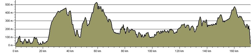
171.8 km (106.8 miles)
4,545 m (14,911 ft) ascent
528 m (1,732 ft)  maximum height

This website uses cookies

To comply with EU Directives we are informing you that our website uses cookies for services such as memberships and Google Analytics.

Your data is completely safe and we do not record any personally identifiable information.

Please click the button to acknowledge and approve our use of cookies during your visit.

Learn more about the Cookie Law