Latest News: Read more


Named discs with stylised hills and seaNorth Wales Path

Conwy, Denbighshire, Gwynedd

96 km / 60 miles
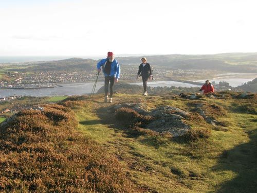
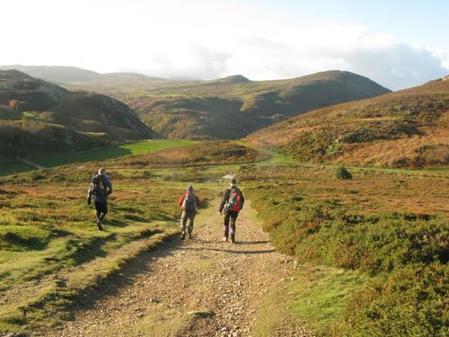
This partly coastal route has significant stretches that allows the walker to explore some of the hilly hinterland. However, most of the larger resorts situated along the North Wales coastline are accessible. The western section is the more challenging, climbing onto moorlands below Moel Wnion, passing Aber Falls, and continuing below Foel Fras and Tal y Fan and then over Conwy Mountain with fine views along the coast and inland towards Snowdonia's peaks. The Great Orme and Llandudno are encircled to reach Colwyn Bay. The eastern section runs along or closer to the coast with much less ascent, passing Abergele and Rhyll to reach Prestatyn. It links with the Offa's Dyke Path National Trail, and the Clwydian Way, at Prestatyn bus station.

It should be noted that between the main railway line just south of Bangor and the overhead power lines just north of Moel Wnion there is a significant variation between the OS route and the one in the dowloadable leaflet from Conwy Council. The leaflet route incorrectly goes south and through Bethesda. The correct route goes east to Bryn, then south over the A55 to Afon Ogwen (see below) then south east on paths and lanes and finally north east on paths and lanes to the powerlines. After this the OS route and the leaflet follow the same route.

It should also be noted that the OS route is incorrect between Bryn and the bridge over Afon Ogwen to the south. The OS route incorrectly follows roads clockwise through Llandygai and Talybont, while the waymarked route takes the footpath south-south-west from Bryn along the front of the houses then east alongside the A55 on a footpath and service road that goes under the road, before bending left along a crash barrier and descending to the river.

The LDWA gpx file shows the correct route, as does the 1999 guide book if you can obtain a second hand copy.

The 1999 guide book also suggests a slight ridgetop variation of the route approaching Conwy to take in the fort at Castell Caer Seion and Conwy Mountain, leaving the main route at SH 75925 77663.


Details:

Waymark: Named discs with stylised hills and sea
Path Type: Paths Marked on OS mapping
Waymark: Named discs with stylised hills and sea
Attributes: Challenging
Coastal
Moorland
Start: SH592726 - Bangor, Gwynedd
Finish: SJ065829 - Prestatyn, Denbighshire
Web Sites: Conwy County Borough Council - North Wales Path

Publications, Badges and Certificates:

Guidebook North Wales Path : and 10 selected walks  (Gwasg Carreg Gwalch  - 1999 )
External download Wales Coast Path & North Wales Path  (Conwy County Borough Council  - 2012 ) Download

Maps:

You can use the interactive controls to zoom in and out and to move around the map, or click on a path or a marker for more info.(interactive map help)

Show Connected Path Outlines
National Trails (England & Wales)
Paths Marked on OS mapping
Other Paths
Anytime Challenges

Show Accommodation
Hostel Accommodation
Bunk House
Group Accommodation

Show Points of Interest
Walkers are Welcome

Contains Ordnance Survey data © Crown copyright and database right 2016.
© OpenStreetMap contributors under Open Database Licence.
Rights of way data from selected Local Authorities.
Large scale digital mapping is provided by John Thorn.
At high zoom levels the route is indicative only.
Purchase Ordnance Survey Maps (path is named on OS maps):
OS Landranger 114, 115, 116
OS Landranger Active 114, 115, 116
OS Explorer 17, 263, 264, 265
OS Explorer Active 17, 263, 264, 265

Accommodation within 5 km of this Path:


From
Path
Along
Path
Bunk House
3 km
31 km
Hostel Accommodation
< 1 km
37 km
Hostel Accommodation
< 1 km
52 km
Group Accommodation
< 1 km
61 km
Walkers are Welcome
< 1 km
96 km

Click to show 4 more Accommodations


Additional Images:


Connected Paths:


Downloads:

Reminder: Material downloaded from this website is for personal or LDWA use only. Commercial use, reproduction, modification of all content is strictly prohibited without prior approval by the LDWA. Please Contact Us if you have any requests.

GPX Route File
North Wales Path GPX Exchange Format Route File
Last Updated 30/05/2026 14:38:44 - Minor correction to route west of Conwy Mountain
Login to Download
(Members Only)
MemoryMap Route File
North Wales Path Memory Map Route File
Last Updated 30/05/2026 14:38:44 - Minor correction to route west of Conwy Mountain
Login to Download
(Members Only)
Tracklogs Route File
North Wales Path Tracklogs Route file
Last Updated 30/05/2026 14:38:45 - Minor correction to route west of Conwy Mountain
Login to Download
(Members Only)

Route Profile:

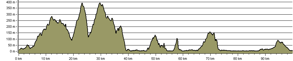
97.4 km (60.5 miles)
2,318 m (7,605 ft) ascent
395 m (1,296 ft)  maximum height

This website uses cookies

To comply with EU Directives we are informing you that our website uses cookies for services such as memberships and Google Analytics.

Your data is completely safe and we do not record any personally identifiable information.

Please click the button to acknowledge and approve our use of cookies during your visit.

Learn more about the Cookie Law