Latest News: Read more


Cam Valley Walk

Cambridgeshire, Essex

89 km / 55 miles
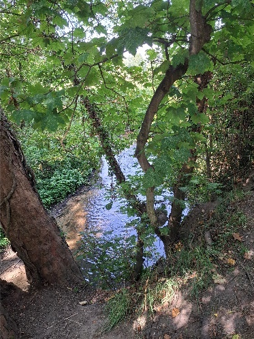
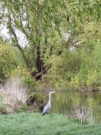
The River Cam runs from its source near the village of Widdington in Essex, to its junction with the Great Ouse at Pope’s Corner south of Ely. The Cam Valley Walk is a 55-mile walk following the Cam from its source to its confluence with the Great Ouse. It is divided into five stages, chosen to be convenient for public transport. It starts at Newport in Essex, and begins with a loop to the source of the Cam near Widdington. It then follows the Cam Valley northwards, following the river where paths exist, and along the most scenic alternatives where there is no riverside path. The walk passes through Saffron Walden, Duxford and Cambridge, and ends 3.5 miles south of Ely.


Details:

Path Type: Other Paths
Attributes: Easy
River
Start: TL522336 - Newport station, Station Rd, Newport, Saffron Walden CB11 3PL, Essex
Finish: TL535745 - Fish and Duck Marina, Holt Fen, Little Thetford, ELY CB6 3HR, Cambridgeshire
Open Date: 2026

Publications, Badges and Certificates:

Guidebook Cam Valley Walks  (Independent publisher  - 29/07/2026 )

Maps:

You can use the interactive controls to zoom in and out and to move around the map, or click on a path or a marker for more info.(interactive map help)

Show Connected Path Outlines
Paths Marked on OS mapping
Other Paths

Show Accommodation
Hostel Accommodation

Contains Ordnance Survey data © Crown copyright and database right 2016.
© OpenStreetMap contributors under Open Database Licence.
Rights of way data from selected Local Authorities.
Large scale digital mapping is provided by John Thorn.
At high zoom levels the route is indicative only.
Purchase Ordnance Survey Maps:
OS Landranger 143, 154, 167
OS Landranger Active 143, 154, 167
OS Explorer 195, 209, 226
OS Explorer Active 195, 209, 226

Accommodation within 5 km of this Path:


From
Path
Along
Path
Hostel Accommodation
1 km
65 km

Additional Images:


Connected Paths:


Downloads:

Reminder: Material downloaded from this website is for personal or LDWA use only. Commercial use, reproduction, modification of all content is strictly prohibited without prior approval by the LDWA. Please Contact Us if you have any requests.
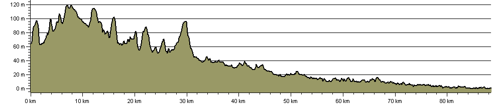

Route Profile:

88.4 km (54.9 miles)
628 m (2,060 ft) ascent
120 m (394 ft)  maximum height

This website uses cookies

To comply with EU Directives we are informing you that our website uses cookies for services such as memberships and Google Analytics.

Your data is completely safe and we do not record any personally identifiable information.

Please click the button to acknowledge and approve our use of cookies during your visit.

Learn more about the Cookie Law