Latest News: Read more


National Trail AcornCotswold Way National Trail

Bath & NE Somerset, Gloucestershire, S Gloucestershire, Worcestershire

164 km / 102 miles
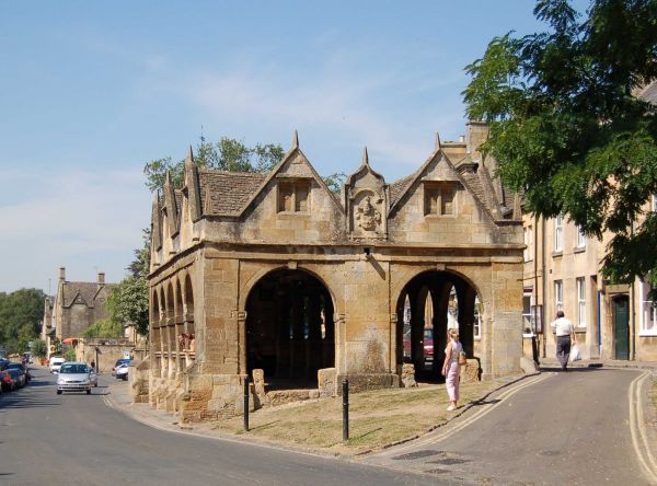
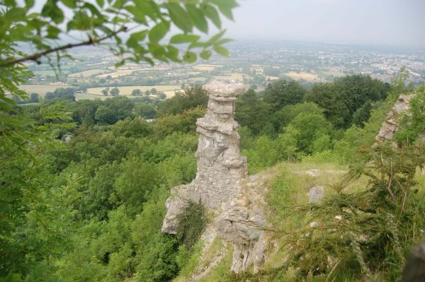
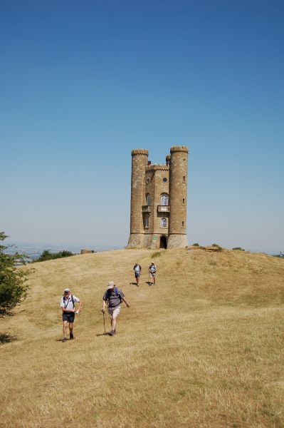
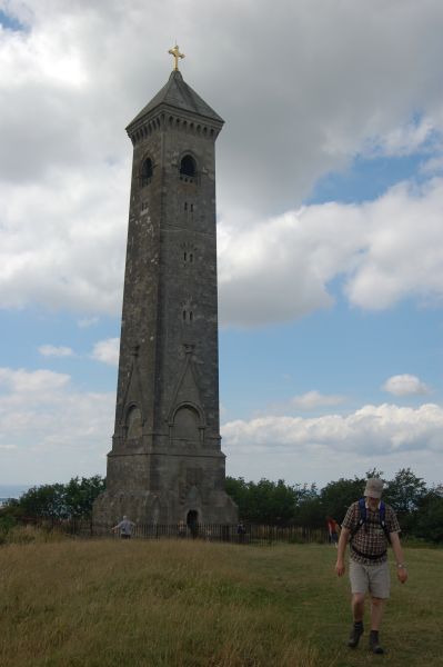
The Cotswold Way National Trail meanders along the western edge of the Cotswold Hills, mainly following the often-wooded top of this limestone escarpment, from where there are extensive views over the Severn Vale to the Malverns and the distant hills of the Mendips and the Welsh borders. The trail descends from time to time to visit attractive villages nestling under the shelter of the edge. It crosses stone-walled farming countryside, passing villages and country houses built from the local limestone, and many sites of archaeological interest.

The waymarked Frome Valley Walkway (18 miles and on OS mapping) provides a link from Old Sodbury via Frenchay to the confluence with the Avon in Bristol. The waymarked Jubilee Way (South Gloucestershire) (17 miles and on OS mapping) is another link from Old Sodbury but ending at the Severn Bridge.

For National Trails website alerts see 'Cotswold Way Interactive Map (National Trails UK)' below.


May 2023:
Re-alignment of the 3-mile single-carriageway stretch of the A417 between Air Balloon roundabout (SO 935161) and the Cowley roundabout (SO 949134) is scheduled to begin in the Autumn of 2023. Large parts of the existing road will be 'repurposed' into a multi-user (walkers, cyclists, horse riders) Right of Way. The Cotswold Way will either be incorporated into, or cross, the re-designated route.
https://www.nationaltrail.co.uk/en_GB/trails/cotswold-way/news/
https://nationaltrails.s3.eu-west-2.amazonaws.com/uploads/A417MissingLinkschememap.jpg
UPDATE February 2026: The realignment scheme is scheduled to continue until 2028

The LDWA National Trails Register offers certificates for completers of several British National Trails.


Details:

Waymark: National Trail Acorn
Path Type: National Trails (England & Wales)
Waymark: National Trail Acorn
Attributes: National Trail (England and Wales)
Challenging
Path Passport
Downland/Wolds
Heritage
Start: SP151391 - Chipping Campden, Gloucestershire
Finish: ST751647 - Bath, Bath & NE Somerset
Open Date: 2007
User Group: Cotswold Way Association Cotswold Way Association
Web Sites: National Trails - Cotswold Way Cotswold Way Association - Walking the Cotswold Way Cotswolds National Landscape - Cotswold Way National Trail Annierak - Cotswold Way National Trail [blog] British Walks - Cotswold Way [blog] Brian's Walks - Cotswold Way [blog] Trailplanner - Cotswold Way [blog] Walking the Cotswold Way: an in-depth guide [blog] London Hiker - Walking the Cotswold Way [blog] Outdoor Scott - Guide to Walking the Cotswold Way [blog] A walker's journal - The Cotswold Way [blog] Cotswold Way [YouTube video] Chris Stuart's Walks - Cotswold Way [blog] Cotswold Way (five days) [YouTube vodeo] Cotswold Way National Trail [YouTube video] Masarnen Ramblers - Cotswold Way [blog] National Trails - Cotswold Way Interactive Map Waypoint51 - Cotswold Way

Publications, Badges and Certificates:

Guidebook Cotswold Way National Trail: two-way trail guide: Chipping Campden to Bath  (Cicerone Press  - 2026 reprint )
Guidebook Cotswold Way: Chipping Campden to Bath  (Trailblazer  - 2023 )
Guidebook Cotswold Way : National Trail Guide  (Trails Shop  - 2017 )
Guidebook Cotswold Way : an archaeological walking guide  (History Press  - 2013 )
General Interest Book Tales from the Big Trails  (Vertebrate Publishing  - 2021 )
General Interest Book National Trails : 19 long-distance routes through England, Scotland and Wales  (Cicerone Press  - 2015 )
E-Book Big walks of the south  (Summersdale Publishers  - 2010 )
External download Exploring the Cotswold Way National Trail : six walks in South Gloucestershire  (South Gloucestershire Council  - 2007 ) Download
Other BBC Radio 4 : Ramblings : Iconic Walks : Cotswold Way  (BBC  - 2007 )
Other BBC Radio 4 : Ramblings : the Cotswold Way  (BBC )
Path Passport Cotswold Way Passport  (Cotswold Way Association  - 2024 )
Certificate Certificate for National Trails  (Long Distance Walkers Association )
Certificate Certificate for National Trails  (Trails Shop )
Badge Badge for National Trails  (Trails Shop )
Badge Cotswold Way embroidered cloth patch  (Cotswold Way Association )
Badge Cotswold Way enamel pin badge  (Cotswold Way Association )
Badge Cotswold Way enamel badge  (Trails Shop )
Other National Trail mug  (Trails Shop )
General Interest Book Big Trails: Great Britain & Ireland  (Vertebrate Publishing  - 2020 )
Guidebook Trekking the Cotswold Way: two-way trekking guide  (Knife Edge Outdoor Guidebooks  - 2023 )
Phone app https://cotswoldway.app/  (Cotswold Way (app)  - 2026 )

Click to showhide 17 more Publications, Badges and Certificates


Maps:

You can use the interactive controls to zoom in and out and to move around the map, or click on a path or a marker for more info.(interactive map help)

Show Connected Path Outlines
E Routes
Paths Marked on OS mapping
Other Paths

Show Accommodation
Hostel Accommodation

Show Points of Interest
Walkers are Welcome

Contains Ordnance Survey data © Crown copyright and database right 2016.
© OpenStreetMap contributors under Open Database Licence.
Rights of way data from selected Local Authorities.
Large scale digital mapping is provided by John Thorn.
At high zoom levels the route is indicative only.
Purchase Ordnance Survey Maps (path is named on OS maps):
OS Landranger 150, 151, 162, 163, 172
OS Landranger Active 150, 151, 162, 163, 172
OS Explorer 14, 45, 155, 167, 168, 179
OS Explorer Active 14, 45, 155, 167, 168, 179
Other Paper Maps:
Harvey National Trail map
Cotswold Way (Harvey Maps - 2017)
Map (Other)
A-Z Adventure Series
Cotswold Way (Geographers' A-Z Map Company (an imprint of HarperCollins) - 2024)
ZigZag 16 Stripmap
ZigZag 16 Stripmap
Cotswold Way 2: Devil's Chimney to Dursley (Yellow Publications - 2024)
ZigZag 16 Stripmap
Cotswold Way 3: Dursley to Bath (Yellow Publications - 2024)
Map (Other)
Cotswold Way illustrated map (Reardon Publishing - 1996)

Click to show 4 more Other Paper Maps


Walking Support Providers:

Support Providers
Support Providers
Baggage Handling and Self-Guided Walks (Nearwater Walking Holidays)
Support Providers
Baggage Handling and Self-Guided Walks (Walk & Cycle Britain Limited)

Accommodation within 5 km of this Path:


From
Path
Along
Path
Walkers are Welcome
< 1 km
29 km
Walkers are Welcome
< 1 km
101 km
Hostel Accommodation
< 1 km
164 km
Hostel Accommodation
< 1 km
164 km
Hostel Accommodation
1 km
164 km

Click to show 2 more Accommodations


Additional Images:


Connected Paths:


Downloads:

Reminder: Material downloaded from this website is for personal or LDWA use only. Commercial use, reproduction, modification of all content is strictly prohibited without prior approval by the LDWA. Please Contact Us if you have any requests.

GPX Route File
Cotswold Way National Trail GPX Exchange Format Route File
Last Updated 12/12/2020 16:22:43 - Includes North Nibley diversion
Login to Download
(Members Only)
MemoryMap Route File
Cotswold Way National Trail Memory Map Route File
Last Updated 12/12/2020 16:22:43 - Includes North Nibley diversion
Login to Download
(Members Only)
Tracklogs Route File
Cotswold Way Tracklogs Route file
Last Updated 12/12/2020 16:22:53 - Includes North Nibley diversion
Login to Download
(Members Only)

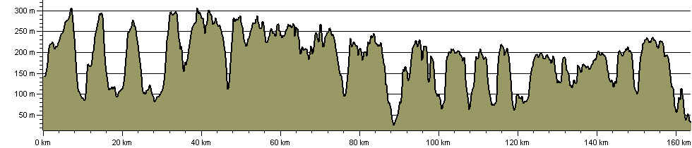
Route Profile:

163.7 km (101.7 miles)
4,535 m (14,879 ft) ascent
310 m (1,017 ft)  maximum height

This website uses cookies

To comply with EU Directives we are informing you that our website uses cookies for services such as memberships and Google Analytics.

Your data is completely safe and we do not record any personally identifiable information.

Please click the button to acknowledge and approve our use of cookies during your visit.

Learn more about the Cookie Law