Every part of England, Scotland and Wales is covered by 403 maps specially designed for walkers, off-road cyclists, horse riders and all involved in outdoor activities. The older Outdoor Leisure map series and the Pathfinder map series have been integrated with the OS Explorer Map series.

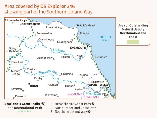
| Berwick Borough Boundary Walk | 174 km / 108 miles |
| Berwickshire Coastal Path | 48 km / 30 miles |
| Forth to Farne Way | 116 km / 72 miles |
| John Muir Link | 16 km / 10 miles |
| Middlesbrough to Berwick (England & Wales Coast Path Sector 24) | 251 km / 156 miles |
| North Sea Trail (British North East Coast Section) | 2000 km / 1243 miles |
| Northumberland Coast Path | 101 km / 63 miles |
| Ravenber Way | 338 km / 210 miles |
| Sir Walter Scott Way | 148 km / 92 miles |
| Southern Upland Way | 344 km / 214 miles |
