Every part of England, Scotland and Wales is covered by 403 maps specially designed for walkers, off-road cyclists, horse riders and all involved in outdoor activities. The older Outdoor Leisure map series and the Pathfinder map series have been integrated with the OS Explorer Map series.

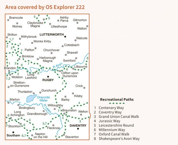
| Centenary Way (Warwickshire) | 159 km / 99 miles |
| Church2Church Walks in Warwickshire | 251 km / 156 miles |
| Coventry Way | 64 km / 40 miles |
| Grand Union Canal Walk | 222 km / 138 miles |
| Harry Green Way | 32 km / 20 miles |
| Jurassic Way | 142 km / 88 miles |
| Leicester Line Canal Walk | 127 km / 79 miles |
| Leicestershire Round | 164 km / 102 miles |
| Macmillan Way - Shakespeare's Avon Way | 148 km / 92 miles |
| Millennium Way (Warks) | 161 km / 100 miles |
| Northamptonshire Boundary Walk | 325 km / 202 miles |
| Oxford Canal Walk | 133 km / 83 miles |
| Via Beata | 731 km / 454 miles |
