Latest News: Read more


Lancashire Way - Western Loop

Lancashire

121 km / 75 miles
The Western Loop is the final part of the Lancashire Way. It is the shortest of the Loops at 75 miles and much easier with a total ascent of just 2,800 feet. It is estimated that it will take on average around 30 hours walking. It is not as spectacular as the other loops but is nevertheless full of interest.

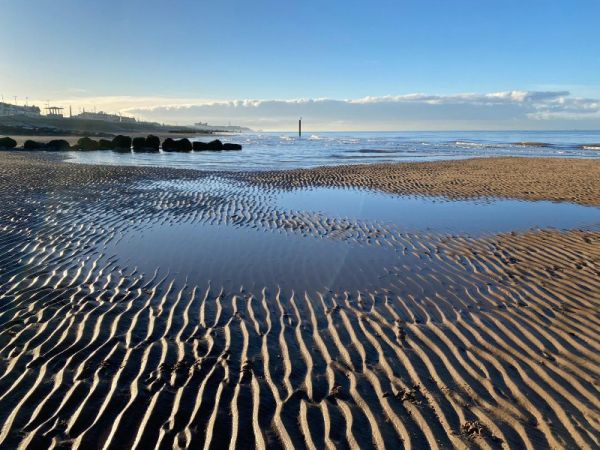
It begins and ends in Blackpool with its razzmatazz. There are fourteen stages in total, with the longest being just under 8 miles. The area has good bus and rail links which helps with logistics. The first two stages make their way from Blackpool in a southerly direction along the coast to Lytham. The busy promenade gives way to vast quiet sandy beaches and then the salt marches of the Ribble Estuary. After visiting the Hall and Windmill at Lytham, the route heads east first to Kirkham and then up to Bilsborrow via the Lancaster canal. The best section leads to Garstang via the beautiful Brock valley, Beacon Fell – an outlier of the Bowland Fells, Bleasdale with its prehistoric circle and the village of Calder Vale. The homeward stretch heads west again visiting pretty Fylde villages along the River Wyre such as Churchtown and Great Eccleston. Before the final coastal section back to Blackpool the ferry is taken across the Wyre estuary from Knott End to Fleetwood.

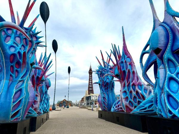
This final part of the Lancashire Way is dominated by the River Wyre and in particular the coastal section which is almost one third of the route. Whilst the latter is flat there has been much development of the promenade especially around Cleveleys and the sight of the Tower getting ever closer at the end of the route is a special way to end a long distance path.


Details:

Path Type: Other Paths
Attributes: Easy
Coastal
Start and Finish: SD424321 - Blackpool, Lancashire
Open Date: 2025
Web Sites: Lancashire Way - Western Loop

Maps:

You can use the interactive controls to zoom in and out and to move around the map, or click on a path or a marker for more info.(interactive map help)

Show Connected Path Outlines
Related Paths
Paths Marked on OS mapping
Other Paths

Contains Ordnance Survey data © Crown copyright and database right 2016.
© OpenStreetMap contributors under Open Database Licence.
Rights of way data from selected Local Authorities.
Large scale digital mapping is provided by John Thorn.
At high zoom levels the route is indicative only.
Purchase Ordnance Survey Maps:
OS Landranger 102
OS Landranger Active 102
OS Explorer 41, 286, 296
OS Explorer Active 41, 286, 296

Additional Images:


Connected Paths:


Downloads:

Reminder: Material downloaded from this website is for personal or LDWA use only. Commercial use, reproduction, modification of all content is strictly prohibited without prior approval by the LDWA. Please Contact Us if you have any requests.

Route Profile:

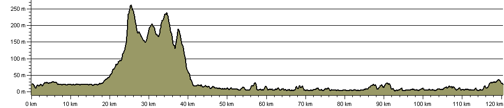
120.4 km (74.8 miles)
1,076 m (3,530 ft) ascent
262 m (860 ft)  maximum height

This website uses cookies

To comply with EU Directives we are informing you that our website uses cookies for services such as memberships and Google Analytics.

Your data is completely safe and we do not record any personally identifiable information.

Please click the button to acknowledge and approve our use of cookies during your visit.

Learn more about the Cookie Law