Latest News: Read more


Furness Haematite Trail

Cumbria

40 km / 25 miles
The wealth and growth of Barrow was not due to shipbuilding but to the steelmaking industry that developed from the discovery of superior grade haematite ore in the area. The Furness Peninsula was internationally renowned for its iron ore industry in the 19th and 20th centuries.

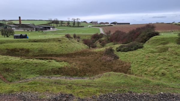
In the early 2000’s Barrow Borough Council devised a 19-mile walking trail, which had since faded with neglect. To preserve the history of the haematite industry, the trail has been revived and extended, staying true to the original route while visiting more mining sites and telling more of the story. The route of the Furness Haematite Trail includes historic sites of over 20 iron ore mines, Hindpool and Askam Steelworks, and other historic industrial sites.

(March 2026)


Details:

Path Type: Other Paths
Attributes: Industrial History
Start and Finish: SD190692 - Barrow-in-Furness Dock Museum, Cumbria
Open Date: 25th March 2026
User Group: Furness PathFix Furness, Cumbria
Furness PathFix
Web Sites: Furness Haematite Trail

Publications, Badges and Certificates:

Leaflet - PDF Furness Haematite Trail - Introductory Leaflet  (Furness PathFix ) Download File
Route Description - PDF Furness Haematite Trail - RD and notes for printing  (Furness PathFix ) Download File
Route Description - PDF Furness Haematite Trail - RD and notes for phone  (Furness PathFix ) Download File

Maps:

You can use the interactive controls to zoom in and out and to move around the map, or click on a path or a marker for more info.(interactive map help)

Show Connected Path Outlines
Other Paths
Anytime Challenges

Contains Ordnance Survey data © Crown copyright and database right 2016.
© OpenStreetMap contributors under Open Database Licence.
Rights of way data from selected Local Authorities.
Large scale digital mapping is provided by John Thorn.
At high zoom levels the route is indicative only.
Purchase Ordnance Survey Maps:
OS Landranger 96, 97
OS Landranger Active 96, 97
OS Explorer 6
OS Explorer Active 6

Connected Paths:


Downloads:

Reminder: Material downloaded from this website is for personal or LDWA use only. Commercial use, reproduction, modification of all content is strictly prohibited without prior approval by the LDWA. Please Contact Us if you have any requests.

GPX Route File
Haematite Trail GPX Exchange Format Route File
Last Updated 29/03/2026 15:21:22
Login to Download
(Members Only)
MemoryMap Route File
Haematite Trail Memory Map Route File
Last Updated 29/03/2026 15:21:22
Login to Download
(Members Only)
Tracklogs Route File
Haematite Trail Tracklogs Route File
Last Updated 29/03/2026 15:21:22
Login to Download
(Members Only)

Route Profile:

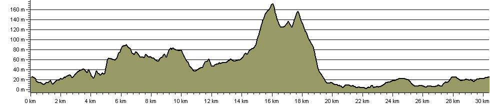
39.5 km (24.5 miles)
606 m (1,988 ft) ascent
171 m (561 ft)  maximum height

This website uses cookies

To comply with EU Directives we are informing you that our website uses cookies for services such as memberships and Google Analytics.

Your data is completely safe and we do not record any personally identifiable information.

Please click the button to acknowledge and approve our use of cookies during your visit.

Learn more about the Cookie Law