Every part of England, Scotland and Wales is covered by 403 maps specially designed for walkers, off-road cyclists, horse riders and all involved in outdoor activities. The Active maps are an encapsulated map that is tough, durable and weatherproof. The maps are covered in a protective plastic coating that can be written on, so your favourite routes can be easily highlighted. They are more costly but more durable and may obviate the need for a map case, though they are bulkier and heavier. The Outdoor Leisure map series and the Pathfinder map series have been integrated with the OS Explorer Map series.

| Blackpool to Bridlington (Aerospace Way) | 238 km / 148 miles |
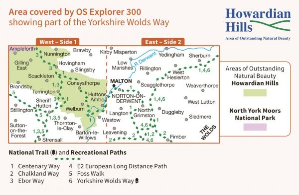
| Centenary Way (North Yorkshire) | 134 km / 83 miles |
| Chalkland Way | 64 km / 40 miles |
| Coastliner Way | 153 km / 95 miles |
| Coastliner Way - Malton to Whitby | 71 km / 44 miles |
| E-Path 2 UK Section - Middleton-in-Teesdale to Harwich | 853 km / 530 miles |
| Ebor Way | 122 km / 76 miles |
| Foss Walk | 45 km / 28 miles |
| Howardian Way | 48 km / 30 miles |
| Lake Pickering Circuit | 216 km / 134 miles |
| North Wolds Walk (20) | 32 km / 20 miles |
| Saint Aelred’s Pilgrim Trail | 66 km / 41 miles |
| Whitby Way | 106 km / 66 miles |
| White Rose Way | 167 km / 104 miles |
| Wild Yorkshire Way | 797 km / 495 miles |
| Wold Rangers Way | 69 km / 43 miles |
| Wold Top Trail | 29 km / 18 miles |
| Yorkshire Wolds Way National Trail | 127 km / 79 miles |
