Every part of England, Scotland and Wales is covered by 403 maps specially designed for walkers, off-road cyclists, horse riders and all involved in outdoor activities. The Active maps are an encapsulated map that is tough, durable and weatherproof. The maps are covered in a protective plastic coating that can be written on, so your favourite routes can be easily highlighted. They are more costly but more durable and may obviate the need for a map case, though they are bulkier and heavier. The Outdoor Leisure map series and the Pathfinder map series have been integrated with the OS Explorer Map series.

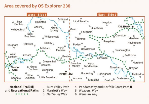
| Blickling Hall Link Path | 2 km / 1 miles |
| Bure Valley Path | 14 km / 9 miles |
| Cross Norfolk Trail | 154 km / 96 miles |
| Great Chalk Way | 605 km / 376 miles |
| Marriott's Way | 34 km / 21 miles |
| Nar Valley Way | 54 km / 34 miles |
| Weavers' Way (Norfolk) | 100 km / 62 miles |
| Wensum Way | 19 km / 12 miles |
