Bill Orme - from Striders 109
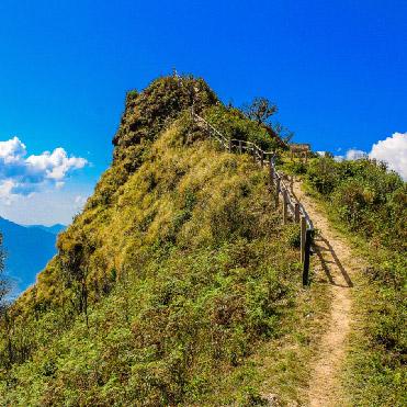
There are numerous excellent books on navigation with information that I could not hope to cover here. The following are more a concise list of tips I find valuable. While they are more for longer walks of two weeks or more, most equally apply to shorter ones.
Getting lost is not always a waste of time; one finds all sorts of interesting places. Paddy Pallin, one of Australia's great bushwalkers called his memories 'Never Truly Lost' : I share the sentiment. However, nor should lack of preparation or carelessness give rise to an unnecessary search!
1. Prior to departure
- Use a dye pen to mark the route you plan to take on the map.
- On dangerous routes like the Mont Blanc to Matterhorn (I was being doubly cautious as I was walking it alone) I marked the route I planned in green, the alternatives for bad weather in blue, and all escape routes in red. As most injuries and problems arise in bad weather, not then having to search for options is important.
- Carefully read any guides or notes you have about the route, and compare them with the map, for better understanding of the route.
- Sketch out a plan for the whole route with all camping and accommodation options on or near the route, and the distances and times between each.
- By having all the options, it becomes easy to make adjustments for weather, staying an afternoon for an unexpected local fête, or changing the route to go through a valley that someone coming the other way tells you about.
- When planning overnight stops, look five days ahead, as by doing an extra two hours one day can reduce a huge day two days later.
- Cross sections of the route are very helpful, and many guidebooks include them, giving times in both directions. If not I rough one out. Check them against the map regularly as I find the guidebook one often shows the top or bottom of a section as the accommodation point, and in fact the actual route goes a few hundred meters above or below that point, annoying when tired or running out of time before dark.
- I prefer to carry all maps for the route with me from the start, even though the extra weight can be significant. Relying on buying maps along the way is fraught with danger. Out of print or stock, shops closed for Sunday, public or local holidays can be a problem, and you can't carry on through difficult sections without maps.
- When guides are in a foreign language, I laboriously translate them, as it makes me understand the notes and teaches me local or unusual words, which can be essential. I type the translation throwing the local and unusual words onto a separate page with their meaning, which I then sort alphabetically to create a glossary for that walk.
2. Maps
- The Three Golden Keys: Check the
- Date - particularly when it was last field checked (not the printing date). Closed paths, new roads, avalanches, forests, etc can mean a long return back to the other option.
- North - make sure the map has north at the top. If not, draw lines parallel to north across the map to remind yourself and to help taking compass bearings.
- Scale - It is common to have two maps at 1:25,000 and the middle one at 1:50,000 and not notice the difference.
- As well as the walking map (say 1:50,000 scale) which only shows a narrow corridor, mark the route on a larger scale (say 1:200,000) which tells you where you are generally and in relation to towns etc.
- A number of British walkers tell me they don't walk in continental Europe (France particularly) as 'they don't have decent maps', but when questioned have never seen one. France has the largest and best walking network, maps and Topo-guides in the world. While I enjoyed Land's End - John O'Groats a few years ago, walking from one side of France to the other is immensely easier due to the better materials available from their volunteers, see the web site www.ffrandonnee.fr.
- I find that large map holders (especially when worn around the neck) flap in the wind and get caught in bushes. I restrict the current map area to 31x21cms and there are a number of plastic map holders that size. I put the map to one visible side and the section of the guidebook on the other. Maps and guides kept in the pack, especially in bad weather, are rarely consulted, and this is when you will get lost.
- I find it better to face the way I am going with the map similarly orientated when reading the map.
- When uncertain or lost, look for major features such as powerlines, roads, rivers, and ridges to guide you. A fascinating book is 'Nature is Your Guide' by Harold Getty ISBN 0006345107 written in World War II for pilots downed behind enemy lines.
- Walking from Lands End to Lyme Regis I liked the simple instruction 'keep the sea on your right'.
3. Maps, Compass, Watch
- Maps (and compass and watch): these must be kept readily available and regularly checked. Check more regularly when you are in areas with which you are not familiar, such as another country. If you are used to the sun being in the south (Europe) you will still tend to relate that way when in areas where it is to the north (Southern Africa, Australia). This will turn you 180 degrees from your route.
- Compass: I tie it to my belt and put it in my pocket so I won't lose it and can check it regularly (I carry a spare). Note: Due to variations in the magnetic inclination (not deviation which is well-known), there used to be about five different compasses for the different zones of the world. Newer compasses have only two types, one for the northern hemisphere and one for the southern. Make sure you have the right one, especially if it is an older model!
- Watch: I use a simple plastic watch that I strap to the compass. Time can be a good indication of distance, adjusted to an assessment of the current rate of walking. At each point where I know where I am, I estimate the time to the next known point (roughly at spaces of about half an hour), and if I am not there by then, why?
4. GPS ('Global positioning system')
These can be valuable, but too often I see users so absorbed with them that they don't look around and in fact get lost. They seem more interested in the GPS than the scenery, and by misreading the GPS get lost. In ravines in the Alps in bad weather when you most need them, they have problems with 'fixes'. They need accurate maps with appropriate coordinates, and some maps, particularly in Italy are not accurate. I find good maps and compass, with keen observation of surrounding features best.
5. Waymarking
Britain is bedevilled with individual markings for most of its over 800 marked walks. These are often damaged by vandals, weather, and fire or disappear by such things as the instillation of a new gate, and the mark thrown away with the old. Continental Europe has mainly standardised on the 10x2 cm bars (usually red and white) with the turn arrow and cross for the wrong way. This is on most paths, doesn't require posts etc, and is easily refreshed by their volunteer network. One tip, when you cannot find the next mark and are in doubt, look or walk back the way you came, looking for the mark for going the other way. Your directional mark might be missing as the tree has fallen, but the opposite direction one is still there.
This article was written by Bill Orme, Walking Volunteers, and first appeared in Strider.
Anyone is free to copy it with this acknowledgement.