Cheshire, Merseyside
146 km / 91 miles

(click to enlarge)
Eric Thurston was an eminent Cheshire naturalist and also an experienced and skilful photographer. He was one of the founder members of the Cheshire Conservation Trust (now called the Cheshire Wildlife Trust) and chairman of the former Mid-Cheshire Group for many years, sharing his passion for wildlife and the countryside with old and young throughout Cheshire. He would be seen actively working in the reserves, recording wildlife and leading nature walks - with time off for photography, fungus forays and dawn walks. Eric Thurston was a life-long supporter of the Cheshire Wildlife Trust that recognises his contribution to them by giving an annual award in his name.
The Eric Thurston Wildlife Way has been created by his son John in his memory. It is a 90-mile transit of what was historically the county of Cheshire (now divided into Wirral, Cheshire West and Chester, and Cheshire East) that visits many nature reserves and wildlife areas, including a number of SSSIs.
The focus of this walk is very much on environmental issues and what is being done on the ground to conserve and restore local wildlife habitats. The route starts at Hoylake in Wirral, and progressing east, crossing Cheshire West and Chester, and Cheshire East to end at Shining Tor. It explores the conservation work of the Cheshire Wildlife Trust, the National Trust, RSPB, Canal and River Trust and local councils.
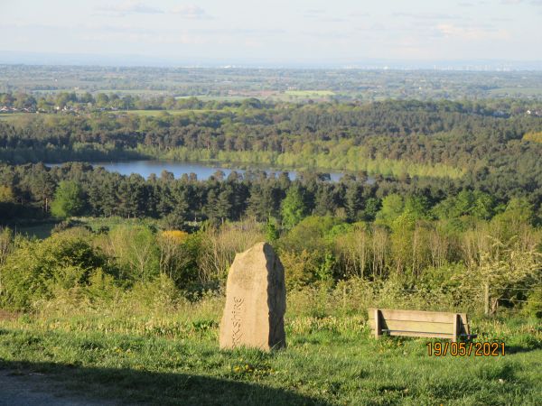
Along the way, it celebrates some of the best scenery of the area including viewpoints like Thurstaston Hill and Shining Tor, and historic sites like Chester, the Anderton Boat Lift and Gawsworth. The route starts with some coastal and estuary walking on The Wirral, then heads inland to reach and traverse Chester along the Shropshire Union Canal. Heading north-east it traverses the central Cheshire sandstone ridge and crosses Delamere Forest, then heads to Northwich. The eastern half of the route visits Holmes Chapel and Gawsworth to ascend progressively onto the gritstone and shale moorlands of the Dark Peak on the western side of the Peak District National Park, to Shining Tor summit on the border with Derbyshire, the highest point on the walk at 559m (1844 feet), to descend finally to the Cat and Fiddle pub. The full route has about 2000m (6500 ft) of ascent.
The route, with maps and pictures, is available for printing or viewing from the website below, and walkers are encouraged to raise sponsorship for wildlife causes.
The website describes the route in eight sections, each ranging from 7 to 16 miles, with starting points that are linked with public transport. There are detailed notes about the many reserves and the wildlife to be found there, and the route description includes turn-by-turn instructions and shows the route line on OS Landranger mapping, along with more detailed mapping for some smaller areas. The route is mostly on public rights of way, but includes sections that use permissive access and minor paths not shown on OS mapping that can be intricate to follow on the ground. The coastal option from Hoylake along the beach is only safe if the tide is out so there is an inland alternative. The GPX file provided below is based on OS Explorer scale mapping and approximates the route in these areas, so the website's narrative route description should always be used when navigating the route.
The route starts in Hoylake and the eight sections have breaks at Heswall (9 miles), Chester (16 miles), Kelsall (9 miles), Oakmere (10 miles), Northwich (9 miles), Holmes Chapel (7 miles), Gawsworth (11 miles) and the final section (12 miles) visits Shining Tor and walkers can end at the Cat and Fiddle pub below that has bus transport back to Macclesfield.
Source: Eric Thurston's Wildlife Way website.
Details:
| Path Type: |
Other Paths |
| Attributes: |
Other Paths
Average Gradients
Former Railway
Agricultural land
Canal
Coastal
Forest/Woodland
Heath
Lake/Reservoir/Loch
Moorland
River
Urban
Wildlife
|
| Start: |
SJ216888 -
Roundabout near Hoylake Station, Holylake, Merseyside

|
| Finish: |
SJ995737 -
Cat & Fiddle Inn after visiting Shining Tor, Cheshire

|
| Open Date: |
2023 |
| Web Sites: |
Eric Thurston Wildlife Way
|