Latest News: Lean Project Update Read more

Latest News: LDP Update Read more

Latest News: Digital Platform Update Read more

Latest News: Podcasts Read more

Latest News: Hazel Bound Read more


Archangel Way

48 km / 30 miles
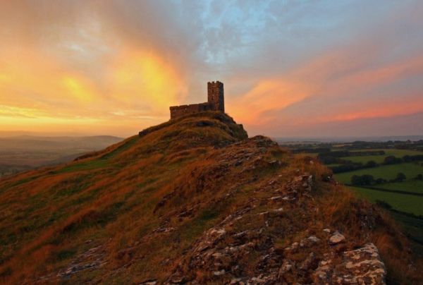
The route follows paths for 30-35 miles from Brentor around the northern slopes of the moor to Chagford, broken down into 5 stages. It’s an ancient and remote landscape that connects you to the people who have lived here via the buildings and artefacts they have left behind. You can investigate historic churches and other sacred sites dating back thousands of years. You will feel a long way away from everyday life, but accommodation and other facilities can be found along the route at the delightful village locations of Lydford and Belstone.

There is a choice of routes from Stages 2-5. If the weather is bad and the cloud cover such that the tors are not visible, then inexperienced walkers should consider staying on the Low routes. Moorland routes (denoted with an ‘A’) are available for more experienced walkers. (Text and main photo from The Devon Pilgrim website).

GPX files cover the low route option only, other optional routes and relevant GPX files are available from the Devon Pilgrim and British Pilgrimages Trust website Trust website.

Not walked by a LDP team member.


Details:

Path Type: Other Paths
Start: SX469805 - St Micheal’s Church - Brentnor
Finish: SX701875 - St Michael the Archangel’s - Chagford
User Group: Devon Pilgrim The Old Deanery 1 The Cloisters, Exeter, EX1 1HS
07415774494
Devon Pilgrim
Email: devon.pilgrim@exeter.anglican.org
Web Sites: The Devon Pilgrim - The Archangel Way British Pilgrimages Trust - The Archangel Way

Maps:

You can use the interactive controls to zoom in and out and to move around the map, or click on a path or a marker for more info.(interactive map help)

Show Accommodation
Hostel Accommodation
Bunk House

Contains Ordnance Survey data © Crown copyright and database right 2016.
© OpenStreetMap contributors under Open Database Licence.
Rights of way data from selected Local Authorities.
Large scale digital mapping is provided by John Thorn.
At high zoom levels the route is indicative only.
Purchase Ordnance Survey Maps:
OS Landranger 191, 201
OS Landranger Active 191, 201
OS Explorer 28, 112, 113
OS Explorer Active 28, 112, 113

Accommodation within 5 km of this Path:


From
Path
Along
Path
Hostel Accommodation
< 1 km
25 km
Hostel Accommodation
< 1 km
25 km

Downloads:

Reminder: Material downloaded from this website is for personal or LDWA use only. Commercial use, reproduction, modification of all content is strictly prohibited without prior approval by the LDWA. Please Contact Us if you have any requests.

GPX Route File
MemoryMap Route File
Tracklogs Route File

Route Profile:

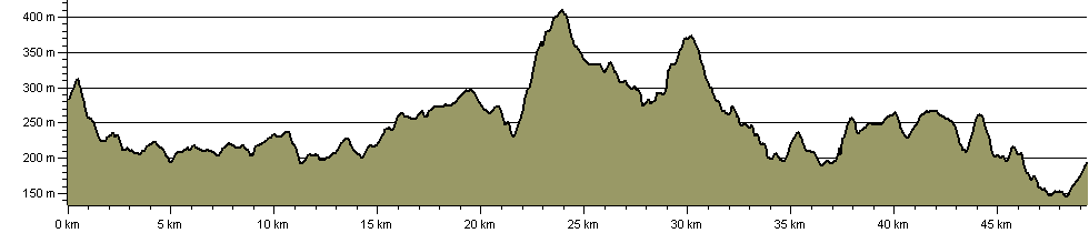
49.3 km (30.6 miles)
1,119 m (3,671 ft) ascent
410 m (1,345 ft)  maximum height

This website uses cookies

To comply with EU Directives we are informing you that our website uses cookies for services such as memberships and Google Analytics.

Your data is completely safe and we do not record any personally identifiable information.

Please click the button to acknowledge and approve our use of cookies during your visit.

Learn more about the Cookie Law