

Route Highlights
Leg A – Axminster to Wootten Fitzpaine
The route leaves Axminster Football Club heading north (crossing the Roman Fosse Way, see Leg O) along lanes and tracks to climb east out of East Devon. After the village of Hawkchurch, you will climb to reach the highest point on the whole route, at Lambert’s Castle, an iron age hillfort which also was part of a signal chain between Plymouth and London to warn of a possible Napoleonic French invasion. Lambert’s Castle is the last westerly high point on the stunning Wessex Ridgeway, part of the Greater Ridgeway joining Devon to Norfolk. Here we enter into Dorset, and the Dorset National Landscape (formerly Area of Outstanding Natural Beauty) which we stay within until we cross into the East Devon National Landscape after Lyme Regis. The route then descends via another hillfort (Coney’s Castle) across beautiful farmland with views to the sea.
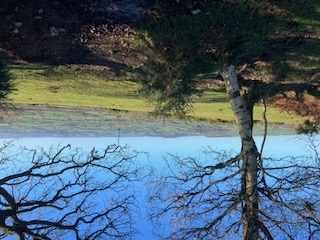
Photo: View from Lambert's Castle
Leg B – Wootten Fitzpaine to Lyme Regis
The route continues down the valley to Charmouth, famous for its fossils, before turning back inland and steeply uphill briefly to avoid Black Ven, a coastal landslide area renowned for its fossil finds . We approach the lovely and very popular seaside town of Lyme Regis via ‘the Spittles’ where Mary Anning (‘She Sells Sea-Shells by the Sea-Shore’) found the first scientifically described ichthyosaurus . There is a statue of Mary on the path at the beginning of the next leg.
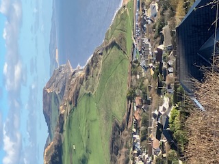
Photo: View eastwards from above Charmouth
Leg C – Lyme Regis to Axmouth
Re-entering Devon, this leg is almost entirely along ‘the Undercliff’, a National Nature Reserve thought to be one of the most important wilderness reserves in Britain. Formed during an enormous landslide on Christmas Eve in 1839, it remains an active landslip area, and was the first landslip ever scientifically recorded. It developed into an important mix of wild and humid woodland habitats, and was immortalised in the book by John Fowles “The French Lieutenant’s Woman”. The only route in, through and out of the area is the one you will take!
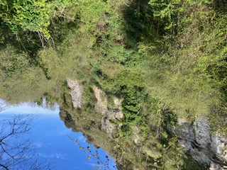
Photo: inside the Undercliff
Leg D – Axmouth to Branscombe
This leg crosses the Axe estuary, above which important wetland bird reserves have been developed, enjoys the shingle seafront of Seaton, then climbs over the cliff into the lovely sheltered fishing village of Beer. As well as fishing, and smuggling, Beer is well-known for its historic quarries whose limestone has been used for building across southern England, and high-quality Victorian lace-making. After Beer, the path continues along the Jurassic coast, with (hopefully) magnificent 180 degree views of the coast before descending into another picturesque village, Branscombe, home to the oldest working forge in Devon. Branscombe had an exciting moment in 2007 as the site of the beaching of the MSC Napoli. Containers from the ship washed up on the beach; goods scavenged from the containers included 17 BMW motorcycles, empty wine casks, nappies, perfume and car parts. Look out for the ship’s anchor, installed alongside the path.
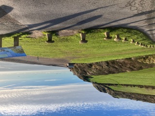
Photo: Branscombe Beach
Leg E – Branscombe to Sidmouth
We stay mainly up on the cliffs for this section, saving legs by circumnavigating the steep combes at Weston and Salcombe Regis. Shortly after attaining the cliff west of Branscombe, you cross Berry Camp Fort, an iron age hillfort which is now half disappeared into the sea, thanks to the very actively eroding cliffs. At Weston we will traverse the Donkey Sanctuary, the largest of its kind in the world, and often rumoured to be the richest charity in Britain! Just over the hill from Salcombe Regis we pass close to the Norman Lockyer Observatory and Planetarium founded by (surprise!) Sir Joseph Norman Lockyer in 1912. He also founded the famous science journal Nature and discovered the element helium in the sun’s corona in 1869. If you get here after dark, look up!
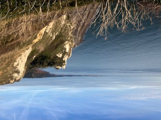
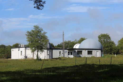
Photos: LEFT: the cliffs looking westwards from Beer; RIGHT: the Norman Lockyer Observatory and Planetarium
Leg F – Sidmouth to Otterton
We will regain the coast at Sidmouth’s elegant Regency seafront via ‘the Byes’, the park alongside the River Sid. Back up the cliffs, we cross into the Otter Valley, and detour down to the river for the next checkpoint in the gorgeous village of Otterton. The stunning thatched cottages might just be discernible in the dark, but you will have to come back in the day if you want to see one of the oldest working water mills in Britain where the river was formerly navigable to boats exporting its produce.
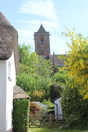
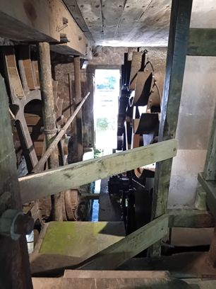
Photos LEFT: Otterton church; RIGHT: the working waterwheels at Otterton Mill
Leg G – Otterton to Knowle
Back up on the cliffs, the Brandy Head Observation Post, named for former smuggling activities in the local bays, was used to monitor gunnery training in Lyme Bay in World War 2. The path continues around the cliffs of Otter Head, to descend to the River Otter and the exciting Lower Otter restoration project (see more here). East Budleigh is reached on this leg – a village renowned for being the birthplace of Sir Walter Raleigh, whose parents are buried in the churchyard of the 14th century church here. There’s a long slow climb up onto the pebblebed heaths, to reach the Nature Reserve of Bystock Ponds – we will come back to the heaths after the breakfast stop. We will skirt the town of Budleigh Salterton, a genteel seaside town, named for its Roman-era estuary salt-pans.
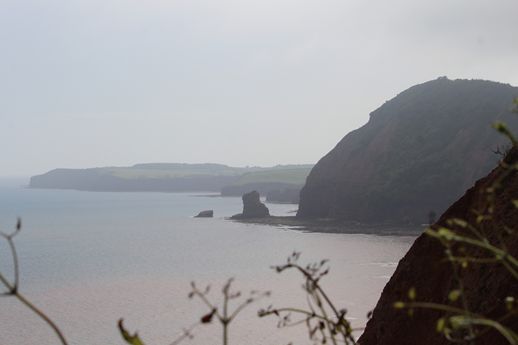
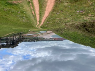
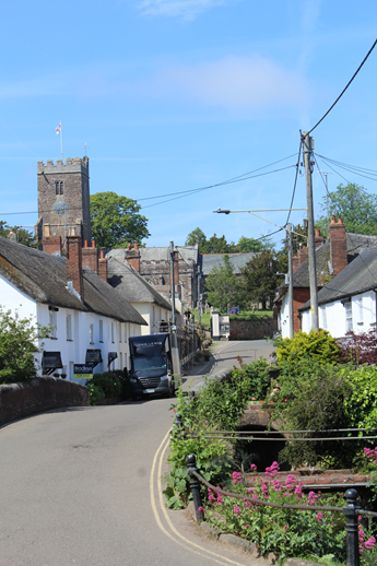
Photos: LEFT: Otter Head, in the distance, viewed from Sidmouth; MIDDLE: Walking round Otter Head down toward the Otter Estuary; RIGHT: East Budleigh
Leg H – Knowle to Exmouth
The route follows the old railway line which formed a loop down the Otter Valley to Exmouth and Exeter, but which closed to trains during the Beeching cuts and is now a multi-use path. We will regain the coast just before Orcombe Point – stop and have a look at the Geoneedle, which celebrates (and marke the end of) the UNESCO World Heritage Jurassic Coast and contains samples of all the rocks over which you will have walked since Charmouth. The path is now blissfully flat until the baggage stop (and for a while beyond) as we follow the Exe estuary coastline. If there is daylight, the sand spit at Dawlish Warren can be seen very close, on the other side of the estuary, with its 200 hectare nature reserve. The centre of Exmouth inland from us, we will pass the redeveloped marina (the former working docks, see here for how it used to look ) before stopping for a shower or at least a change of socks, at the baggage stop.
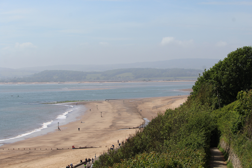
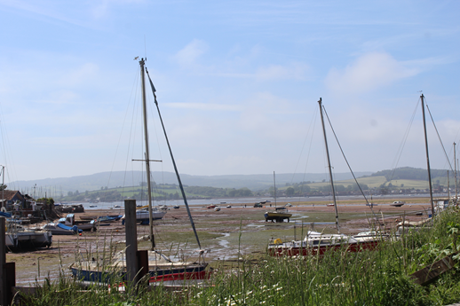
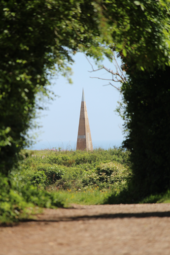
Photos LEFT: Exmouth beach and Dawlish Warren; MIDDLE: fishing boats on the Exe at low tide, Exmouth; RIGHT: Geoneedle, Orcombe Point
Leg I – Exmouth to Woodbury
We now follow the bank of the Exe Estuary, following the excellent cycle route built alongside the railway towards Exeter. This line is known as the Avocet Line, thanks to the large numbers of them seen overwintering in the nature reserves around the Exe estuary. Across the water (daylight depending) you may be able to see Powderham Castle and its deer park, a fortified manor house dating from the 14th century and still owned by the Courtenays, the Earls of Devon. A country house just above the path on this side of the estuary (Nutwell Court, owned and remodelled by Sir Francis Drake at one time) is harder to spot. After the quaint village of Lympstone, you will pass alongside the Marine Commando Training Centre, with its training equipment looking like a giant’s playground. Look out for its unusual railway request stop. After Exton we leave the sea/river to start climbing back inland, but breakfast awaits in the village of Woodbury.
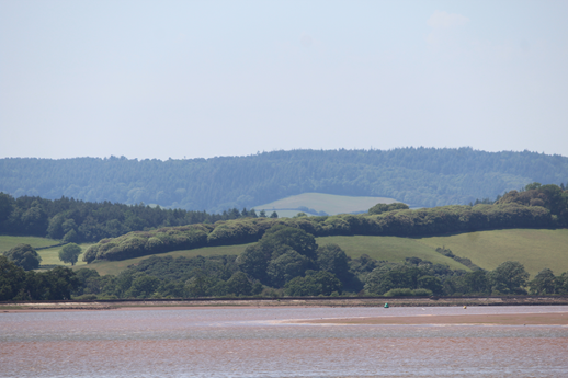
Photo: Across the Exe estuary at low tide
Leg J – Woodbury to Newton Poppleford
From Woodbury, we re-enter the East Devon National Landscape (formerly AONB). Whilst most of the route since Lyme Regis was in this designated area, it was dominated by the coast, but from now on, the experience is more rural and rolling. Starting with a leg stretcher up to Woodbury Castle, a very well preserved iron age fort, we join the East Devon Way waymarked path. We will contour around the ‘Commons’, the pebblebed heaths which form a rare and important lowland moorland habitat, with populations of endangered birds and reptiles (see here). The going is quite stony due to the underlying geology (see here) but the views east can be very lovely. After some ‘undulations’, we will descend to Newton Poppleford – the ‘popples’ being the local name for the pebbles you have been enjoying underfoot! The descent comes through a cider apple orchard for which this part of Devon was formerly renowned.
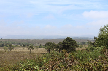
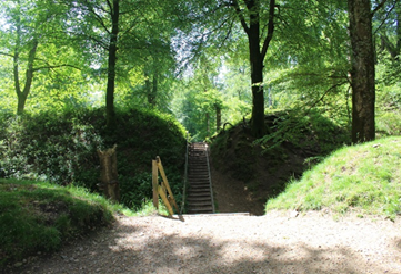
Photo: LEFT - Woodbury Common looking east; RIGHT - earth embankments and entrance to Woodbury Castle hillfort
Leg K - Newton Poppleford to Sidbury
Climbing out of the Otter Valley, along a deep wooded tributary, we pass under the disused railway line that linked Sidmouth to the main line to London. A steep climb takes us up to the moorland at Fire Beacon Hill, another local nature reserve, used as a staging beacon to warn London of the approaching Spanish Armada. You should have lovely views to the south and west, including the hills of Dartmoor and Exmoor if daylight and weather allow. After another viewpoint at White Cross, the East Devon Way descends to Sidbury, a medieval village whose church has a Saxon crypt. Joan Hickson (the most famous Miss Marple) is buried in the churchyard!
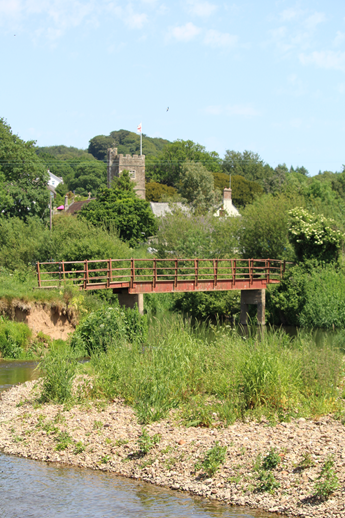
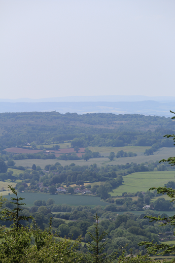
Photo: LEFT Crossing the Otter at Harpford; RIGHT View from White Cross across the Otter Valley
Leg L - Sidbury to Farway
We continue along the East Devon Way through the East Devon National Landscape – and the stunning scenery comes with some stiff climbs, including the second highest point on the entire route. Climbing out of the Roncombe valley, a tributary of the Sid, the route passes through Knapp Copse local nature reserve (see here), a former landfill site. The flat top of the hill is known for its neolithic barrows (tumuli, see here), which are particularly clear on aerial and LIDAR surveys. The village of Church Green, on the way down to Farway has a 12th century church, with magnificent ancient yew tree.
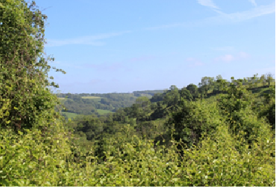
Photo: view from Knapp Copse, Roncombe Valley
Leg M - Farway to Musbury
The route down to Colyton follows the East Devon Way gently down the River Coly, and provides some respite after the previous section. Colyton revels in the title of ‘the most rebellious town in Devon’ due to the number of its inhabitants who joined the 1685 Monmouth Rebellion. It is full of little lanes, reflecting its Saxon architecture. We will pass by the northern terminus of the Seaton Tramway, which is what remains of a former Victorian tramway linking Seaton to the railway further north. Then crossing the River Axe we reach the CP at Musbury, a village known as the location of Hugh Fearnley-Whittingstall’s River Cottage.
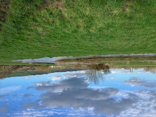
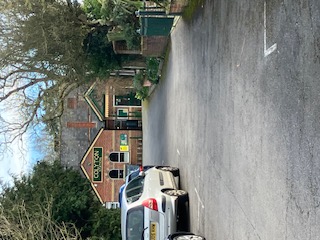
Photo LEFT: River Axe between Colyton and Musbury; RIGHT: the Seaton tram terminus in Colyton
Leg N - Musbury to Uplyme
Heading uphill, the route avoids yet another hill fort (Musbury Castle) but instead climbs more gently up the Bruckland Valley to reach the ridge, from which there are views to the south of the spectacular Cannington viaduct, which had less than sixty years of active service as part of the branch line from Axminster to Lyme Regis. There was a Romano-British villa excavated here in the 19th century (marked on the map) but sadly nothing for us to see now.
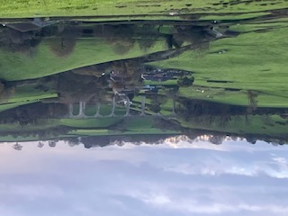
Photo: Cannington Viaduct, near Uplyme
Leg O - Uplyme to Axminster
After leaving the East Devon Way, we will climb uphill through steep woods above Uplyme to reach Trinity Hill Nature Reserve. The carpark here will have a welfare stop for those walkers enjoying a second night. Apparently it’s a fantastic spot for stargazing and has Dark Skies Discovery Status so maybe the second-nighters will be the lucky ones! And finally, the hills are done and it is back to Axminster. If you have any energy left at all, look out for Woodbury Farm just before entering the town – this is the location of the Roman Fort which was part of the Roman Fosse Way, which connected Lincoln to Exeter and is tarmacked over as part of the A358 through Axminster (marked on the OS map). Anyone up for continuing the march to Lincoln?!
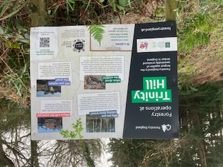
Photo: Trinity Hill information board (also the location of our 'welfare stop' for later finishers)







