Every part of England, Scotland and Wales is covered by 403 maps specially designed for walkers, off-road cyclists, horse riders and all involved in outdoor activities. The Active maps are an encapsulated map that is tough, durable and weatherproof. The maps are covered in a protective plastic coating that can be written on, so your favourite routes can be easily highlighted. They are more costly but more durable and may obviate the need for a map case, though they are bulkier and heavier. The Outdoor Leisure map series and the Pathfinder map series have been integrated with the OS Explorer Map series.

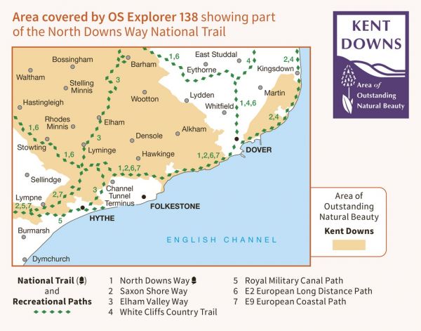
| Brighton to Whistable (England & Wales Coast Path Sector 17) | Various |
| ChalkUp21 | 27 km / 17 miles |
| Coast to Coast - Southern England | 444 km / 276 miles |
| Dover to Dorking Robust Ramble | 187 km / 116 miles |
| Dymchurch to Didcot Robust Ramble | 359 km / 223 miles |
| E-Path 2 UK Section - Middleton-in-Teesdale to Dover | 904 km / 562 miles |
| E-Path 9 UK Section Plymouth to Dover | 711 km / 442 miles |
| Elham Valley Way | 35 km / 22 miles |
| Four Pits Walk | 63 km / 39 miles |
| Kent Coastline Walk | 333 km / 207 miles |
| King Ethelbert's Ring | 129 km / 80 miles |
| Miner's Way Trail | 43 km / 27 miles |
| North Downs Way National Trail | 201 km / 125 miles |
| North Downs Way National Trail Canterbury Loop to Dover | 51 km / 32 miles |
| Old Way | 393 km / 244 miles |
| Royal Kentish Camino | 37 km / 23 miles |
| Royal Military Canal Path | 43 km / 27 miles |
| Royal Saxon Way | 56 km / 35 miles |
| Saxon Shore Way | 262 km / 163 miles |
| St Bernard's Way | 756 km / 470 miles |
| Timeball & Telegraph Trail | 156 km / 97 miles |
| Walking the Castles of Kent | 315 km / 196 miles |
| Way of St Martin | 34 km / 21 miles |
| White Cliffs Country Trails | 45 km / 28 miles |
