Latest News: Read more


Kett's Country Trail

Norfolk

27 km / 17 miles
A walk based on the 16th century activities of Robert Kett, who led Kett's rebellion in 1549, taking in a number of churches along a meandering route. By using the Norwich Riverside Walk a link can be achieved to Marriott's Way. The route starts in Wymondham where the story of Kett's Rebellion began in July 1549. It finishes in Eaton, Norwich, just past Cringleford's historic twin-arched bridge. This is where Robert Kett crossed with his followers on his journey to Norwich to seek a fairer society.

The trail weaves along the picturesque South Norfolk Claylands countryside, an important area for nature.


Details:

Path Type: Other Paths
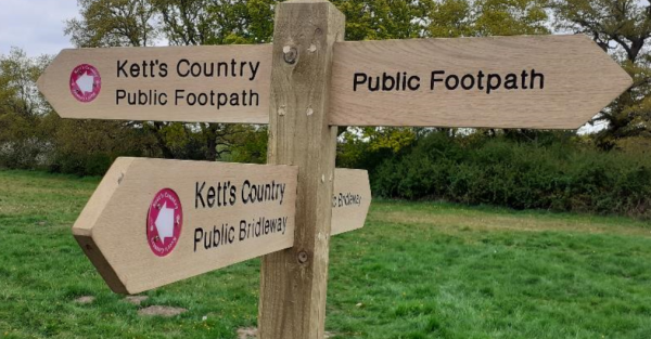
Waymark: Name in white on red disc
Attributes: Heritage
Start: TG105014 - Wymondham, Norfolk
Finish: TG201060 - Eaton, Norfolk
Open Date: 2022
Web Sites: Kett's Country Long Distance Trail

Publications, Badges and Certificates:

External download Kett's Country Long Distance Trail  (Norfolk County Council  - 2022 ) Download

Maps:

You can use the interactive controls to zoom in and out and to move around the map, or click on a path or a marker for more info.(interactive map help)

Show Connected Path Outlines
Paths Marked on OS mapping
Other Paths

Contains Ordnance Survey data © Crown copyright and database right 2016.
© OpenStreetMap contributors under Open Database Licence.
Rights of way data from selected Local Authorities.
Large scale digital mapping is provided by John Thorn.
At high zoom levels the route is indicative only.
Purchase Ordnance Survey Maps:
OS Landranger 134, 144
OS Landranger Active 134, 144
OS Explorer 237
OS Explorer Active 237

Connected Paths:


Downloads:

Reminder: Material downloaded from this website is for personal or LDWA use only. Commercial use, reproduction, modification of all content is strictly prohibited without prior approval by the LDWA. Please Contact Us if you have any requests.


GPX Route File
Kett's Country Walk GPX Exchange Format Route File
Last Updated 15/04/2025 10:07:29 - Replaces earlier version
Login to Download
(Members Only)

Route Profile:

27.6 km (17.1 miles)
169 m (554 ft) ascent
62 m (203 ft)  maximum height

This website uses cookies

To comply with EU Directives we are informing you that our website uses cookies for services such as memberships and Google Analytics.

Your data is completely safe and we do not record any personally identifiable information.

Please click the button to acknowledge and approve our use of cookies during your visit.

Learn more about the Cookie Law