Gtr London, Kent
A series of inter-linking circular walks in the rural southern fringes of the London Borough of Bromley in two sets based on (Pack One) Nash (5.2 miles), Leaves Green (6.5 miles), Farnborough (4.5 miles), Cudham (7.5 miles), Berrys Green (7.5 miles), Biggin Hill (7 miles), and Green Street Green (7.5 miles) and (Pack Two) Jubilee Park (1.4 miles), St Mary Cray (2.2 miles), Bromley Common (4 miles), Petts Wood (4 miles), St Pauls Cray (4 miles), Three Commons (5 miles), Chelsfield (5.5 miles) and Cray Riverway (Bromley) (6 miles).
Summaries of the routes are on the links and in more detail in the Definitive Walking Guide publication, that also includes a schematic of all these routes, and also online on the TfL website link. The Definitive Guide Cicerone book is a comprehensive guide to walking routes in Greater London dating from 2002.
The village of Downe visited on one of the routes (Cudham Circular Walk) was the home of Charles Darwin, where he wrote 'On the Origin of Species' and World Heritage Site status is being sought for this area, shown on the inset map. Full details, leaflets and mapping are available with free downloads on the 'Darwin's Landscape Laboratory' website, that also provides links to Audio Trails and Podscrolls.
The London LOOP passes through High Elms Country Park nearby.
Details:

| Path Type: |
Other Paths |
| Waymark: |
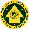
Name on green/yellow disc; oak leaf/acorn logo |
| Attributes: |
Easy
World Heritage Site
Heritage
|
| Start and Finish: |
Various, Gtr London
|
