


Beaconsfield - Thames - Marlow circuit
Sun 30th Nov 2014
Walk Details:
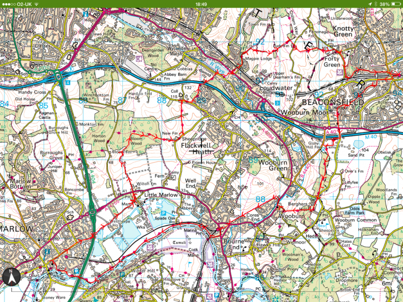
An enjoyable walk through beech woods to the Thames, following the Thames path to Marlow and then back through rolling Chiltern hills to Beaconsfield
Entry Details:
Walk Report
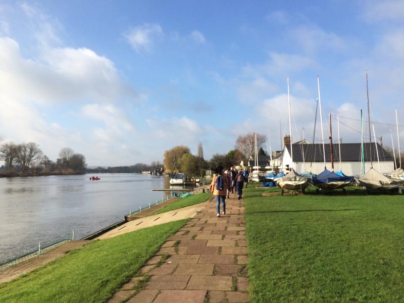
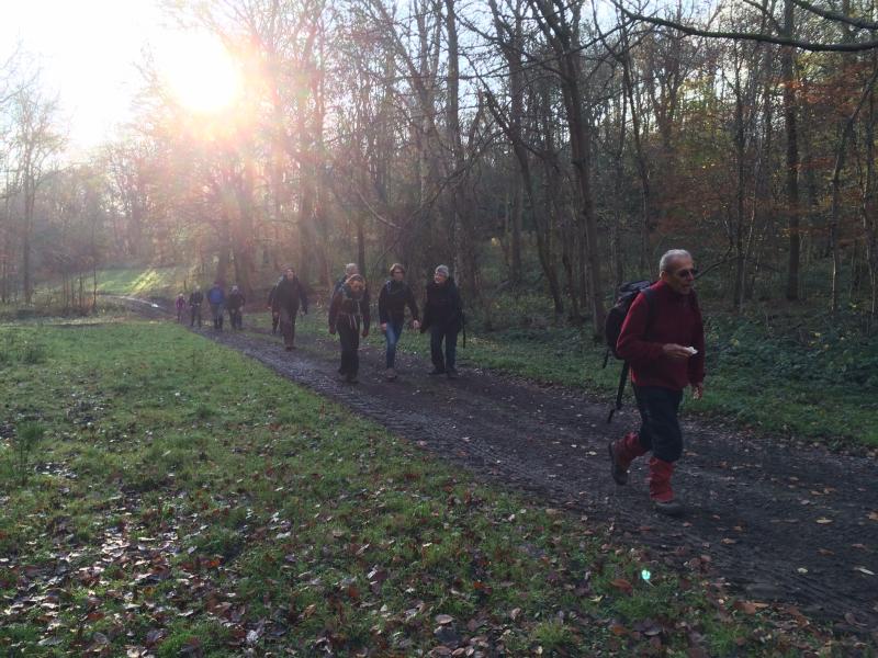
Beaconsfield Marlow Circuit, Sunday 30th November 201417 walkers, 18 miles - leader Adam Dawson
An unexpectedly dry and warm day for our 18-mile hike round the Chilterns today. Started at Beaconsfield station, headed down to the Thames and then back through the hills to Beaconsfield after lunch at the Queen's Head in Little Marlow.
17 walkers came to enjoy the fresh air and sunshine, and it was great to see some new members and visitors from other groups, too.
Other Files
Download Walk ReportGPX
A GPX file of the above route may be downloaded by clicking the link below.
Note: GPX files of Group Walks are created by LDWA Group members, and may be downloaded only by other LDWA members. They should not be made available outside the LDWA, and are used at members' own risk.
Login to Download (Members Only)You can use the interactive controls to zoom in and out and to move around the map, or click on a path or a marker for more info. (interactive map help)
You can use the interactive controls to zoom in and out and to move around the map, or click on a path or a marker for more info. (interactive map help)
© OpenStreetMap contributors under Open Database Licence
Rights of way data from selected Local Authorities
Large scale digital mapping is provided by John Thorn
At high zoom levels the route is indicative only.
Gallery
Maps:
You can use the interactive controls to zoom in and out and to move around the map, or click on a marker for more info. (interactive map help)
© OpenStreetMap contributors under Open Database Licence.
Rights of way data from selected Local Authorities.
Large scale digital mapping is provided by John Thorn.


