PENNINE WAY LOOP+ - 22.4.18


Our brave leader

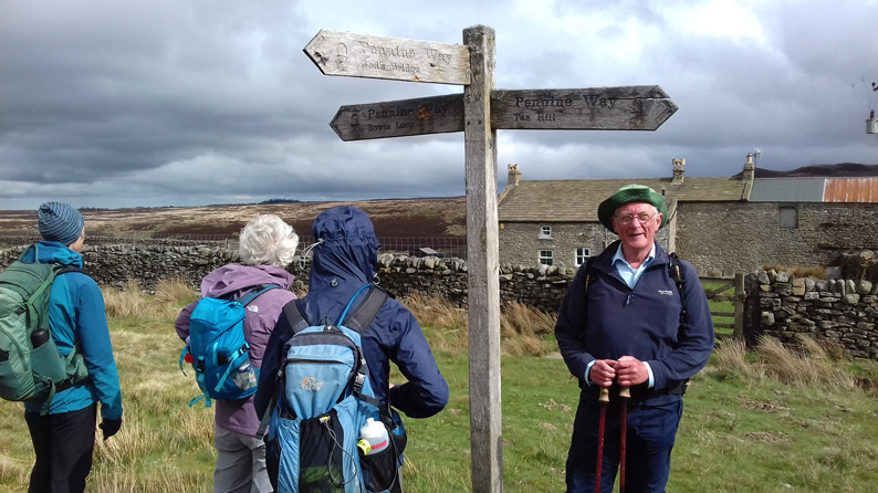
A walk in County Durham for a change, nine members met at Bowes village car park opposite the village hall. Six lady members Clare, Helen, Louise, Pat, Trish, (new member) and Wendy. The males were myself, Dave and Neil, once again we were outnumbered!

Departing promptly at 08-30 we proceeded through the village and on reaching the lane from the castle picked up the route of the Pennine Way Bowes Loop and Wainwright’s  Pennine Journey. After crossing the A66 the route ascended onto moorland, even though still on a minor road both sides of this road are out of bounds as the signs indicate that this is toxic ground, this is due to the burial of poisonous gases after WW1.

Levy Pool, next point of interest, from where in Roman Times an aqueduct supplied water to the bath-house at Bowes (Lavatris). One of the buildings at this location has a thatched roof, not the sort of roof you would expect to see in this area, it all looked moribund but some scaffolding was up so maybe some restoration work was underway, a long term project by the look of them!

After crossing Deepdale Beck up onto more moorland and after cresting the summit Goldsborough hill came into view. This hill 1,276 ft (389 metres) is thought to have

been the site of an Iron Age hill fort. Our route did not go over it but skirted the SW side of it which  enabled us to see the crags that are popular with climbers. Down into Baldersdale, where a break was taken shortly after passing the junction with the main route of the PW.

This same location was in about two hours time was to be our lunch stop! 

Leaving the PW accompanied by a light rain shower we headed West uphill past the old YHA, now used as an outdoor centre by Leeds Grammar school, and continued on a good track (not shown on OS map) almost to the summit of Shacklesborough 1,490 feet (454 metres) with a trig point and a tall cairn, but we did not linger as a strong cold wind with the remnants of the shower in it encouraged us to drop down. No route shown on map between here and the bridge over the head of Balderhead reservoir but a green plastic matting had been laid to enable access for the grouse shooters so we used this which extended almost to the bridge.

Once over the bridge we headed East along the North side of the reservoir, the track becoming a road before turning right towards Balderhead reservoir dam opened in 1961, but then dropping down the original access route to the YHA and our second visit to our al fresco dining location, this time for our lunch.

Now back on the PW we followed the main route South via Race Yate and Ravock Castle, just a pile of stones, and onto Pasture End  where the PW goes under the A66 via a subway this was followed by Gods Bridge, a natural limestone arch across the River Greta.

A short break was taken here while people had to decide if they would do the full route or take the short cut. Nobody admitted to wanting to do the latter so we all did the former.

On reaching Trough Heads we left the main PW route and resumed the Bowes Loop which we followed, passing lots of newly born lambs before once again crossing the River Greta and entering Bowes between the Castle and Church onto Front Street thereby completing the Bowes Loop of the PW. Turning right a short walk took us back to the car park.


Statistics S 08-30 F 16-26 Mileage 21.81 Ascent 3,312ft Average Speed 2.7mph (including stops)