
Historical information - Route section 3
![]() Back to Historical information overview
Back to Historical information overview
![]() Download as pdf file
Download as pdf file
Section 3: Rubery to Alvechurch
After leaving checkpoint 2, the route passes over the A38 and joins the North Worcestershire Path, a 35 mile LDP which crosses the county from Bewdley to Major’s Green on the edge of Birmingham.

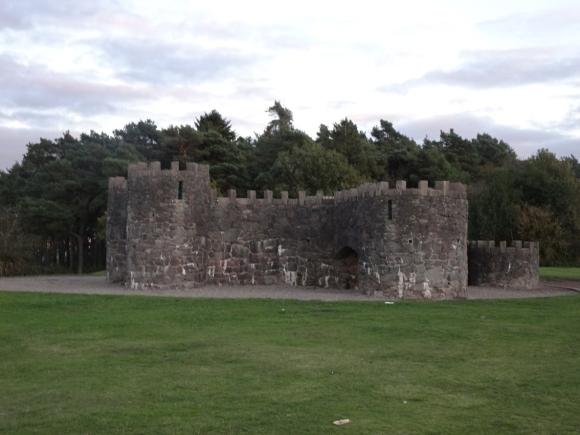
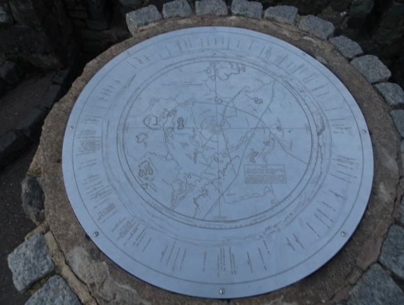
The path leads to the top of Beacon Hill, with another toposcope. Technically this is the diagram showing directions and distances of features visible from a viewpoint, but the term is loosely applied to the mock castle which houses it - built to commemorate the donation of the hill from Cadbury brothers in 1907, to be used by the people of Birmingham for recreation. It was restored in 1987-88.
The path descends to the road, where we cross to the rest of the Lickey Hills – like the Waseleys, part of the watershed. Evidence of human activity as far back as the Neolithic period (~10,000-2,000BC) has been found here; an arrowhead discovered on Rednal Hill is now in Birmingham Museum. There was a Roman road across the hills, linking the forts of Dodderhill (Droitwich) and Metchley (Edgbaston). In the Middle Ages the area was part of the manor of Bromsgrove, and used as a royal hunting ground; in this period the road’s use for the transport of salt from Droitwich gave it the name Saltway. The hills were sold to the Earl of Plymouth in 1682. Now combined as a single Country Park, the hills were acquired separately: on your left as you descend from Beacon Hill is Rednal Hill, bought by the Birmingham Society for the Preservation of Open Spaces in 1888 and given to the city in trust.

After crossing the road, next is Bilberry Hill which was leased for peppercorn rent at the same time. The earlier quarry on the hill was used as a proof range for testing field guns during World War One.

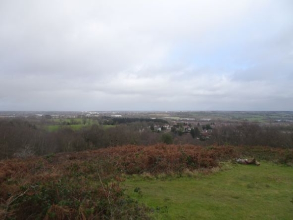
On a fine day, the hills give excellent views over Birmingham and the surrounding countryside.

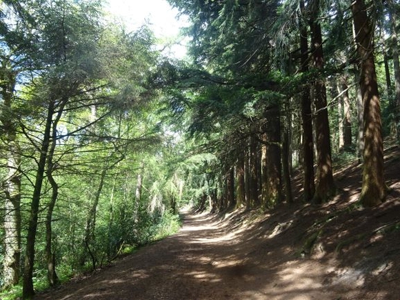
100m to the right as you cross the car park is the Visitor Centre, giving information on the geology and ecology of the area. Beyond it is Cofton Hill - bought by the city in 1920, and during World War Two the site of a test track for aircraft assembled by the Austin Works in Longbridge - along with the adjacent Lickey Warren and Pinfield Wood, through which the route descends.

In 1923 the Cadbury family added Rose Hill to their previous donation of Beacon Hill, preserving the complete range for free public access; it became a popular day out for the residents of the city, with trams running to Rednal. The hills were designated a Country Park in 1971.
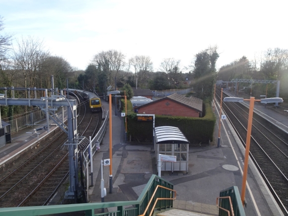
After the hills we reach Barnt Green station. The track was laid in 1841 as part of the Birmingham and Gloucester Railway; land for a station was donated by the local MP Robert Clive, grandson of Clive of India, and it was opened in 1844. Clive was a keen supporter of the development of railways in the area, serving as deputy chairman of both the Shrewsbury and Birmingham, and the Shrewsbury and Hereford Railways; it was at a meeting of the directors of the latter that he was taken ill, and died three weeks later.
The line to Redditch was added in 1859, and the footbridge dates from 1895. In 1940 Frank Wilson, the stationmaster, was fined 10s with 5s costs for allowing a light to show from his window during blackout. The station was listed for closure by Beeching in 1963, but spared following protests - although services were reduced. The Lickey Incline is south of the station.
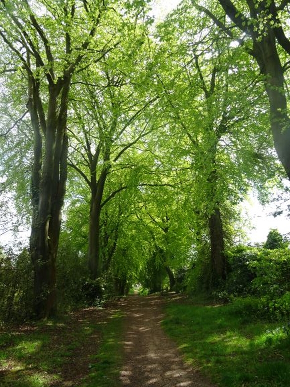
From Barnt Green, we cross the M42 footbridge and follow the path across fields from Foxhill Lane to arrive in Alvechurch, which was first recorded when King Offa of Mercia gave the land to the Bishop of Worcester in 780; it was mentioned in the Domesday Book, although the population at the time was under 20. In the thirteenth century the Bishops built a palace here, the site of which lay to the east of the village, near to where the A441 now runs; however, it was torn down in the seventeenth century and no trace of it remains.
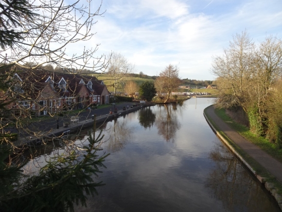
On your way into the village you cross a bridge over the Worcester and Birmingham Canal, which we last saw in Kings Norton; it runs 30 miles from the junction with the BCN Main Line at Gas Street Basin to meet the river Severn near Worcester Cathedral. By 1807 the section through Alvechurch was complete and the canal had reached Tardebigge, three miles to the south, but - in another parallel with the Stratford Canal - the company ran out of money and another Act was necessary to gain approval to sell more shares. Once sufficient funds had been raised, work continued with the construction of Tardebigge Locks – the longest flight in the UK, with 30 locks spanning two and a quarter miles.
The checkpoint venue at the Ark is adjacent to St Laurence’s Church. The first church on this site was founded by the Saxon woman Aelgiva, who in the process gave the village its name. Nothing remains of the original structure, with the earliest part of the current church – the surround of the south doorway - dating from the Norman period; the dedication to St Laurence was first recorded in 1239. The tower was built in the fifteenth century, although the upper part needed extensive repairs after being damaged in a storm in 1676. Most of the church was rebuilt 1858-61 - although earlier parts were incorporated into it – one of many designed by the Gothic Revival architect William Butterfield. Butterfield’s buildings were not universally loved: he was responsible for Keble College, Oxford, which was variously described as "[one of] the monstrosities of architecture… [which] give daily pain to posterity" and even “the ugliest building in the world”.
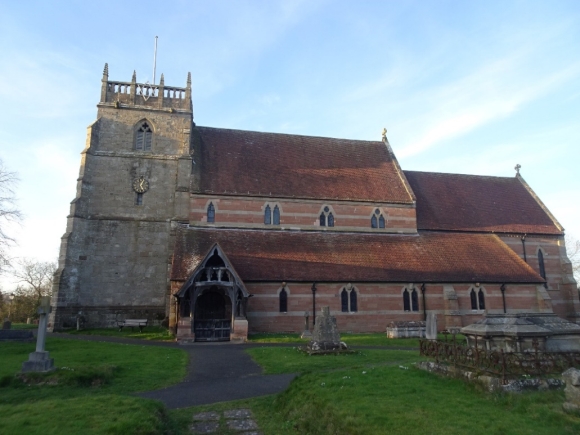
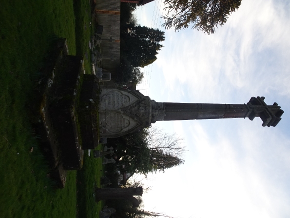
The large cross close to the south door of the church is a memorial to Robert Windsor-Clive (he gained the double-barrelled surname when his mother was made Baroness Windsor) – son of the Robert Clive who gave the land for Barnt Green station, who followed in his father’s footsteps both as MP for Ludlow and commander of the Worcestershire Yeomanry – although he is buried elsewhere.