
Historical information - Route section 2
![]() Back to Historical information overview
Back to Historical information overview
![]() Download as pdf file
Download as pdf file
Section 2: Northfield to Rubery
The Rea Valley Route as officially defined continues along the river to Longbridge, coming to an abrupt halt where the river flows through land not accessible to the public. National Cycle Network 5, which follows most of the length of the RVR, diverges from it at Longbridge and has a road section before returning to the river. The EBB route left both of them in order to reach the checkpoint, but from the fire station, we cross the A38 then via paths and back streets to rejoin the NCN at Tessall Lane.
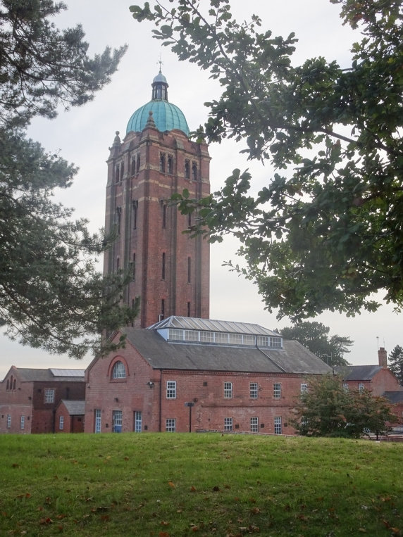
The dome-topped tower on your right as you reach Hollymoor Way is the water tower of Hollymoor Hospital, one of the few of its buildings remaining. The original Birmingham lunatic asylum was at Winson Green, close to where the prison is now; Rubery and subsequently Hollymoor were opened to accommodate patients away from the city. It was built on the site of a farm, part of which was retained to provide an occupation for the inmates. It was opened in 1905 by Alderman Beale, the Lord Mayor of Birmingham. The Corporation vacated both Rubery and Hollymoor during World War One, when they were used as the 1st and 2nd Birmingham War Hospitals respectively; from 1918-20 it functioned as an orthopaedic unit, but was returned to use for mental patients in 1921. By 1926 there was a general view that the term “lunatic asylum” was somewhat insensitive to their patients, and they were renamed “mental hospitals”. Hollymoor was requisitioned again in World War Two as Northfield Military Hospital, with civilian patients moved elsewhere. It was finally closed in 1994; most of the buildings were demolished two years later and replaced by housing. The water tower and a few other buildings still stand, and part of the site is still in use by the NHS as an ambulance hub.
The cycle path crosses a bridge, underneath which is the line of the former Halesowen and Northfield Railway – although authorisation to build it was granted to the Great Western Railway in 1860, construction was delayed due to GWR’s financial problems making contractors reluctant to deal with them; after the project was reduced in scope (a proposed extension to Bromsgrove being scrapped), it was finally commenced in 1876. The line was completed in 1881 – between Rubery and Longbridge it closely followed the route of the river - but opening was further delayed first due to it failing a safety check, then after the fault had been rectified and the line passed on reinspection, a further dispute between the companies regarding unfinished building work at Northfield station. The first train along the line finally ran on 10th September 1883. It later became known as the Halesowen Joint Railway, when Midland Railway joined the GWR in the venture. Passenger services on the line ceased in 1919, although freight trains continued to operate until 1960 – primarily serving the Austin Rover works at the old Longbridge station, which stood opposite the site of the current one. The track was taken up soon after the closure of the line.
We pass the Rubery Great Park Reservoir, then on the right shortly before reaching Rubery Lane is the cemetery where an estimated 2,000 patients of Hollymoor and Rubery Hospitals were buried. It has been claimed, although not verified, that there are also German prisoners of war here from their period as war hospitals.
After crossing the lane, the cycle route enters Balaam’s Wood, where it rejoins the Rea (Balaam was an Old Testament prophet whose donkey spoke to him; how the wood came to be named after him is unclear). First recorded in the thirteenth century, the wood was originally much larger; what remains today is the part which has survived centuries of harvesting for timber and clearance for housing. Frog Mill, the furthest upstream of a series of watermills on the Rea, was located near here; first mentioned in 1373, there is no record of how long the mill continued operating, and no trace of it remains now. A noticeboard at the entrance to the wood details the species to be found here.
To the left of the path as you reach Arden Road (on the opposite side to the row of shops) is the site of Rubery station, the location of the only passing loop on the aforementioned Halesowen to Northfield line, and of the connection to the Rubery and Frankley Railway – a mile-long branch line serving the water works at Frankley Reservoir. In World War One it served as the destination for ambulance trains bringing wounded soldiers back from France and Belgium, who were then transported the short distance to Rubery or Hollymoor Hospital (Rubery Hospital was located on the small hill around half a mile south of here). It officially closed to passengers in 1919, along with all the other stations on the line, but a daily workmen’s service continued to run from Old Hill to the Longbridge plant until 1958, making unadvertised stops at Rubery. The line was formally closed in 1964 and the station buildings demolished a few years later; the platforms were removed in the 1980s to clear the area for a housing estate, but a determined local railway enthusiast hunting for remnants of the station found one gatepost and part of a platform surviving as late as 2003.
Just before the path crosses Ormond Road, there is a medieval moat to the right; parts of a fourteenth century house have been excavated in the area inside it, and are now in Birmingham Museum.
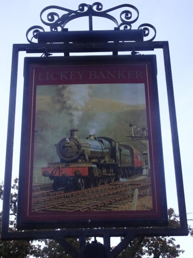
The name of the Lickey Banker pub has nothing to do with finance. A “banker” in this context was a banking engine – an extra locomotive attached to a train to help it up a slope. While the EBB100 route may not be noted for its hills, our area does boast the steepest sustained gradient of any main line railway in Britain – the Lickey Incline on the Bromsgrove branch south of Barnt Green station, which averages 1 in 37.7 for two miles. The Lickey Banker, nicknamed “Big Bertha” was built by the Midland Railway in 1919 and ran until 1956, when it was rendered obsolete by diesel locomotives able to tackle the incline without assistance.
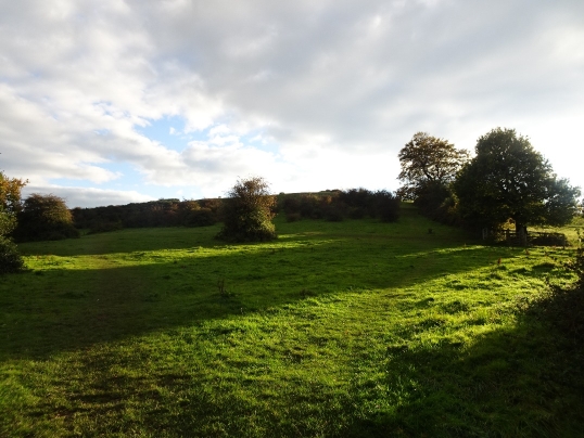
We cross Gannow Green Lane and follow the path alongside it to the Waseley Hills. The “ley” part of the name means “field”; the meaning of “Wase” is uncertain – it could be “sheep” or “watch place”. The source of the River Rea is signposted slightly off the route. The hills form part of watershed of England: rainwater falling on the north side of the hills flows first into the Rea, then from there to the Tame, Trent, Humber and eventually the North Sea; that on the south side into the River Arrow, then the Avon, Severn and the Bristol Channel. Until the sixteenth century the hills formed part of the Chadwick Manor estate; after the Dissolution they were given to Christchurch College, Oxford. In 1904 they were bought by the Cadbury family to stop city spreading into adjacent green areas, given to Bournville Village Trust after World War One then sold to Worcestershire County Council in 1971. The café (turn right at second kissing gate instead of going straight on up Windmill Hill) is in an old threshing barn relocated from Hindlip (near Worcester).
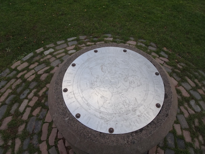
The steep (by West Midlands standards) ascent of Windmill Hill leads to the toposcope at the summit detailing the features which should (in theory) be visible. On a perfectly clear day these can include the Black Mountains, Shropshire Hills and Coventry’s Three Spires; even in less than ideal conditions you should still be able to pick out the nearby Rubery Hill (former location of the hospital) and Frankley Beeches – the latter another donation from the Cadbury family, now owned by the National Trust.
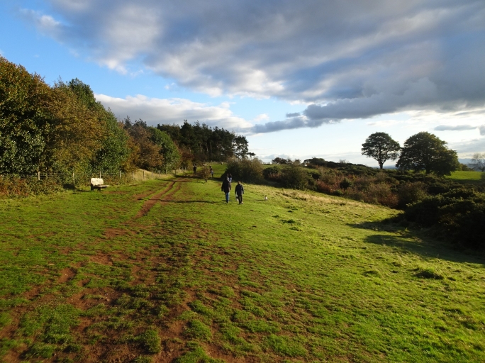
From Windmill Hill, the route undulates gently over the rest of the Waseleys before descending to the car park.
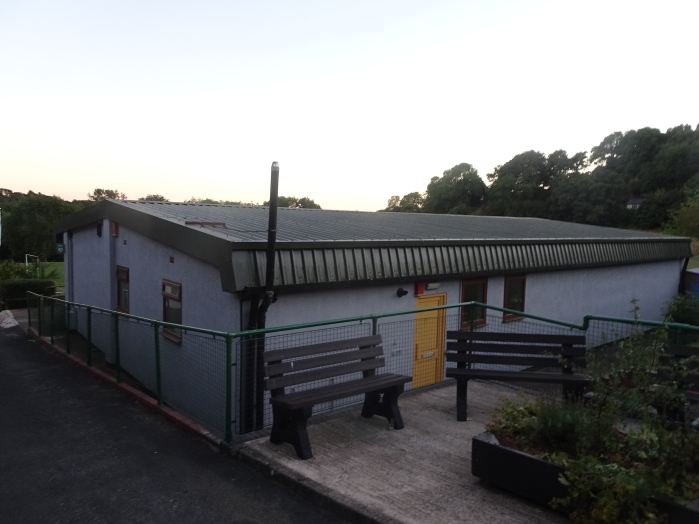
Opposite the car park is checkpoint 2 – now Rubery Community and Leisure Centre, it was originally known as St Oswald’s Camp. There is a well in Broadmoor Wood, the area of trees at the end of the football pitches, the name deriving from the legend that St Oswald pitched his tent by the well when his travels took him through Rubery.
he facility was yet another initiative of the Cadbury brothers, opened in 1906 as a holiday and nature study centre. It continued to provide holiday accommodation during World War One, was improved and extended in the 1920s and 30s – again funded by the Cadburys. During the Blitz it served as temporary accommodation for residents whose homes had been destroyed. Part of the site was destroyed by fire in 1947, but it was rebuilt and reopened by George Cadbury in 1951. Use of the facility declined in the 1960s, the buildings fell into disrepair and it was eventually abandoned. In the 1980s a group of locals seeking to provide a leisure centre for the village proposed to renovate the site, and it reopened in its current form in 1988.