

Historical information - Route section 1
![]() Back to Historical information overview
Back to Historical information overview
![]() Download as pdf file
Download as pdf file
Section 1: Moseley to Northfield
The EBB100 route starts in Birmingham. While artefacts in the city’s museum show evidence of human activity in the area as far back as the Stone Age, and there was a Roman fort at Edgbaston, the first permanent settlement grew up around the river Rea in the seventh century AD; a bridge over the river, around 3 miles north-northwest of HQ, bears the inscription “Near this river crossing an Anglian tribe led by Beorma founded Birmingham”, which gives rise to the name – Beorma ingas ham, “the home of the people of Beorma”. The Lunar Society of Birmingham (so called because they met at full moon to give more light for the journey home) - including such luminaries as James Watt, Matthew Boulton, Josiah Wedgwood and Erasmus Darwin – was at the centre of the Midlands Enlightenment, and the town was the driving force behind the Industrial Revolution (Manchester makes the same claim, but it started later there). Between 1760 and 1850 three times as many patents were registered in Birmingham as in any other British town or city: among the innovations pioneered here were mechanised cotton production, the steam engine, building society, plastic and postage stamp. It led political as well as industrial change, with meetings of the Birmingham Political Union attracting crowds of 200,000 and eventually precipitating the Great Reform Act of 1832.
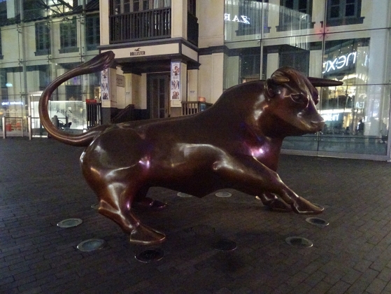
The area around St Martin’s, the parish church of Birmingham, has hosted a market since the mid-12th century. Bull baiting in the area was initially only a means of slaughtering the animal, but later turned into a public spectacle; it was banned in 1773 – because it tended to attract unruly crowds, rather than because it was considered cruel to the bull – but by then the name “Bull Ring” had come into use for the area originally known as Corn Cheaping. The first shopping centre on the site, built in the 1960s, took that name; when it was demolished and replaced in the 2000s the new one was styled “Bullring”, causing some controversy among locals who insisted that the name should be written as two words. The site’s history is commemorated by a bronze statue of a bull, and the animal has come to represent the city; it does not appear on the coat of arms, since that pre-dates the use of the bull as a symbol, but was included in the flag adopted in 2015, designed by local schoolchildren Thomas Keogh and David Smith. The zigzag on the hoist of the flag represents a stylised letter B – or rotated, M, the Roman numeral for 1,000 in a nod to the moniker “City of a Thousand Trades”. The blue is a reference to the city’s canal network, with which entrants on the EBB100 will become well acquainted.

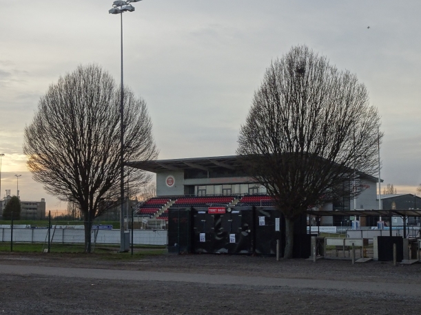
Event HQ is Birmingham Moseley RFC, which is celebrating its 150th anniversary this year – having been founded as an offshoot of a local cricket club whose players were looking for another sport to occupy the winter months. The club’s first ground was in Balsall Heath, around two miles to the north. In 1888 the New Zealand Natives became the first international rugby team to tour Britain, and Moseley were the first opponents to defeat them. It went through several changes of ground in its early years, before moving to The Reddings where it was based for over a century. The club had its heyday in the 1970s, when it was one of the leading sides in England and produced international players on a regular basis; it declined and went into administration in 1998, but was bought out by a group of members. After selling The Reddings, it found a temporary home at Birmingham University before gaining planning permission for the current ground, which hosted its first match in 2005 and was developed further in the early 2010s. Photos around the club room show old squads, while an honours board lists club captains and players who appeared at international level.
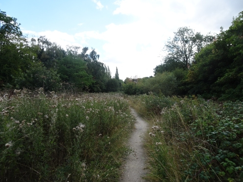
From the start, the route crosses Billesley Common. The name “Billesley” is of Anglo-Saxon origin, but there has been human activity in the area much longer than that: a mound of burnt stones excavated on the southern edge of the common was dated to c1200BC. The first mention of the area as common land was in 1774; the city council bought it in 1919 and developed much of it into one of the UK’s first council housing estates, but the remaining part was retained as open land for public use. During World War Two an anti-aircraft battery was located on the common, manned by the Warwickshire Home Guard.
Leaving the common at its southern corner, we cross Haunch Heath - so called because its shape resembled that part of an animal, and which gives the name to Haunch Brook which flows through it. There is a network of paths with signposted walks (of rather less than 100 miles!) and noticeboards detailing the history of the area, including the Fowler dairy farm in the nineteenth and early twentieth centuries.
After crossing Haunch Lane, the paths continue in the area around Chinn Brook, which we will revisit at the end of the route.
The brook paths take us to the Stratford-upon-Avon Canal, the construction of which was authorised by an Act of Parliament in 1793. It was commenced from the Birmingham end, got as far as Hockley Heath by 1796 but was suspended when the project ran out of money. After further funds were raised, it was joined to the Warwick and Birmingham Canal (now part of the Grand Union Canal) in 1802 and finally reached Stratford in 1816.
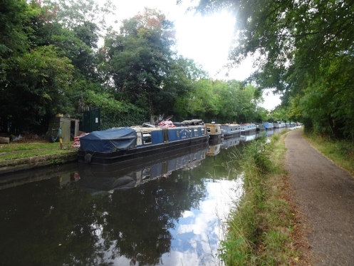 It's a commonly quoted fact that Birmingham has more miles of canals than Venice (and it’s true - the respective total lengths being 35 miles against 26); they were constructed during the Industrial Revolution as the primary means of freight transport, but in the mid-nineteenth century they were superseded by the railways, and many went into decline. More recently they have been restored for leisure use – barges chugging along them (possibly the only form of motorised transport slower than an average walker) are a common sight, and the network of towpaths is popular with runners and walkers. In most years the paths are showcased in the Birmingham Canal Canter, one of Heart of England group’s regular challenge events – it isn’t taking place this year because the usual organiser is heavily involved in the EBB100, but we hope it will be back in 2024!
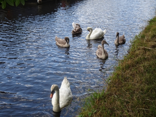
The most common wildlife on the canals are mallards, moorhens and swans – the Canada geese tend to congregate around Gas Street Basin in the city centre but can sometimes be seen elsewhere, while a heron may make the occasional appearance on some of the quieter stretches.
 Keep an eye on the gardens on the opposite side of the canal: there is one which often flies the bull flag.
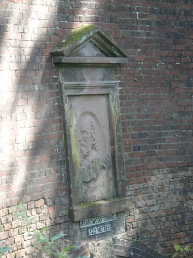
The path reaches the East Portal of Brandwood Tunnel, constructed from 1793-96. There is no towpath through the tunnel, which when it was in commercial use forced the horses to go over the road while the crew of the boat propelled it through the 322m length of the tunnel themselves; today it forces walkers to do likewise.
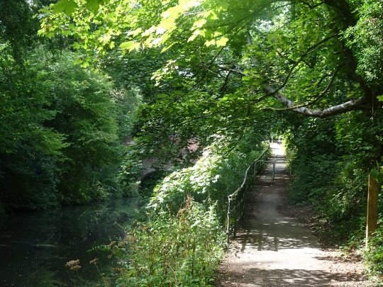 We rejoin the canal at the tunnel’s West Portal, which like the East is Grade II listed. The portrait above the tunnel entrance is not, as might be expected, its designer (Josiah Clowes) – but William Shakespeare, in a reminder of the canal’s destination.
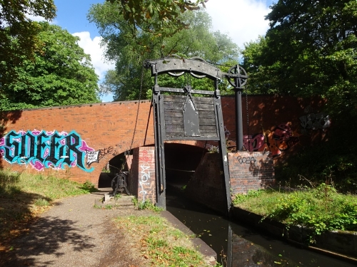
Shortly before the end of the canal we come to what is officially named Kings Norton Stop Lock, but more commonly known as Guillotine Lock – used to prevent water from one canal flowing into the other at a time when they were owned by different companies. The lock was initially installed at the time of the canal’s construction in the 1790s, but the gates were later replaced; the current ones date from the nineteenth century. The lock ceased operating in 1959 after both canals had passed into public ownership, removing the competition for water; the gates are now left permanently open. The lock-keeper’s cottage and stables which once stood nearby have been demolished.
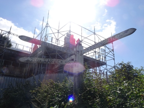
The western end of the Stratford Canal is at Kings Norton Junction, where it joins the Worcester and Birmingham Canal. The two are almost exact contemporaries: the Act of Parliament for the W&BC was passed in 1792, just a year before the Stratford; the funds for it were raised by selling shares. Construction began at the Birmingham end and reached Kings Norton four years later; it was opened in 1815, again one year earlier than Stratford.
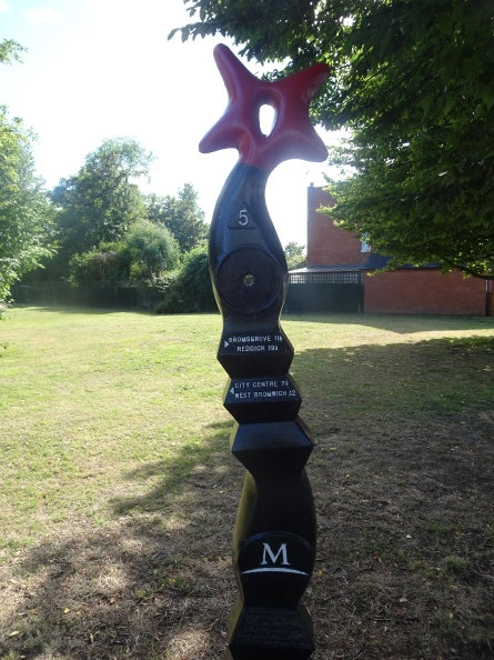
The signpost at the junction gives two numbers for each destination: the first is the distance, the second the number of locks along the way. The building covered in scaffolding is Junction House, built in 1796 – serving both as the office of the Worcester and Birmingham Canal Company, and a toll house for boats joining the canal at the junction. The house was awarded Grade II listed status in 1982, but damaged by fire in 2019 and is currently undergoing restoration; it is scheduled to be completed this year so the scaffolding may have gone by the time you read this!
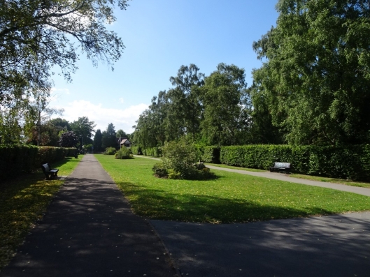
 We leave the canal on the path which crosses Kings Norton Playing Fields and then into Kings Norton Park. The land for the park was given to the city by Birmingham Civic Society in 1924; George Cadbury, of the chocolate family, donated £850 towards landscaping. The Cadbury family were Quakers, whose faith guided them not only in the treatment of their employees – they built Bournville village to provide decent living conditions for them, at a time when workers in most English factories lived in slums – but also in wider philanthropy: it’s a rule of thumb that most nice things available to the people of Birmingham owe their public access at least in part to the Cadburys.
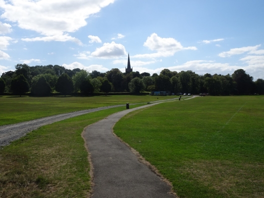
The spire visible above the treetops belongs to the parish church of St Nicolas (no “h”), Kings Norton. There has been a church here since at least the Norman period, although the earliest parts of the current building date from the early 1200s, the spire was constructed from 1446-1475, and the church underwent restoration in the nineteenth. The Rev W.V. Awdry served as curate here from 1940-46, during which time he wrote the first of the Thomas the Tank Engine series of books; a plaque unveiled in 2021 commemorates his role at the church. Rev Awdry, well familiar with both the Church of England and British Railways, commented that there were certain similarities between the two: “Both had their heyday in the mid-nineteenth century; both own a great deal of Gothic architecture, which is expensive to maintain; both are assailed by critics; and both remain convinced that they are the best way of getting man to his ultimate destination.”
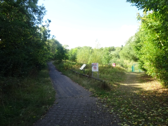
 From Westhill Road, the route turns into Kings Norton Local Nature Reserve. Previously the farmland of Wychall (pronounced “Witchell”) Meadows, it was donated to the city council in the 1960s. We pass Wychall Reservoir - there had been water mills along the river Rea since at least 1638, but when the canal was under construction in the first few years of the nineteenth century, the mill owners protested that it was taking water from the Rea, so the canal company built a reservoir to ensure a continuing supply. The last of the mills closed in the mid-twentieth century, so the reservoir is no longer needed for industrial purposes and is given over to conservation; notice boards detail the wildlife which can (sometimes) be found here.
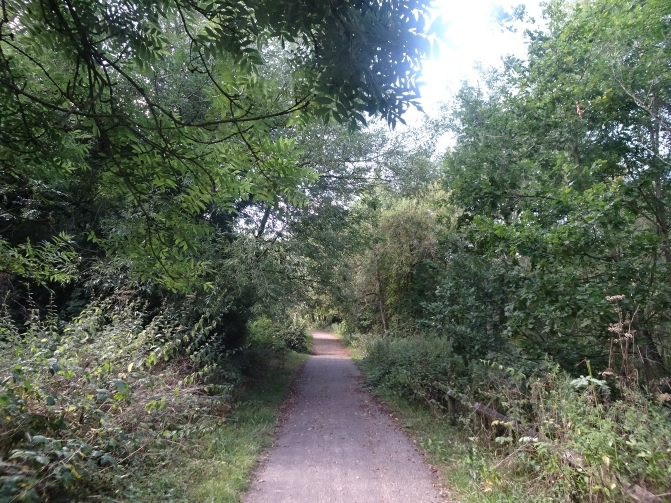 We continue along the Rea Valley Route. Like many settlements, Birmingham originally grew up around a river – in its case the Rea (pronounced “Ray”; the name derives from an Old English word for “flow”), which follows a roughly northward course for 14 miles from its source in the Waseley Hills to its confluence with the Tame near Spaghetti Junction. The RVR is a designated cycle/footpath which follows the river for just under half its length – usually followed southwards (upstream) from the city centre through a chain of parks.
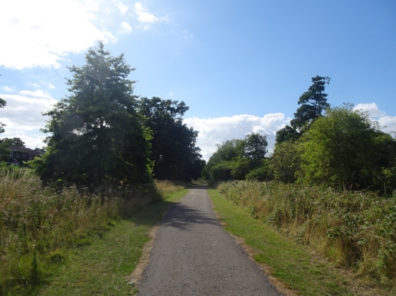
After passing Northfield station, we turn off the RVR to reach the first checkpoint.


