Route Summary
1. HEXHAM TO NEWBROUGH – 9.1 Km, 5.7 miles. 155 m, 500 ft.
A pleasantly easy start leaving Hexham in the company of the River Tyne then following quiet fields and roads to an early checkpoint.
2. NEWBROUGH TO SEWING SHIELDS – 9.4 Km, 5.8 miles. 260m, 860 ft.
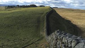
A climb on moorland to reach the Hadrian’s Wall Path at Brocolitia. Then a short warm up on the national Trail before the next stop at quaintly named Sewing Shields. This probably refers to seasonally occupied shelters used by Anglo-Saxon herdsmen.
3. SEWING SHIELDS TO HALTWHISTLE – 15.2 Km, 9.5 miles. 435m, 1420 ft.
A long section along the some of the best bits of the Wall before leaving it to drop down into Haltwhistle via the attractive Burn Path for a well-deserved rest and refreshments in the Centre of Britain!
4. HALTWHISTLE TO KNARSDALE – 13 Km, 8.1 miles. 300m, 980ft.
After leaving Haltwhistle alongside the River South Tyne we join the track bed of the former Haltwhistle to Alston branch railway. This is the South Tyne Trail, whose highlight is the magnificently restored Lambley viaduct, and is followed all the way to the next stop – easy miles for now!
5. KNARSDALE TO GARRIGILL – 16.4 Km, 10.3 miles. 320m. 1060ft.
Another long but easy section follows the course of the South Tynedale Railway into Alston, England’s highest market town. This narrow gauge railway is the highest in England and operates a passenger service in the summer months. The eventual plan is to extend it as far as Haltwhistle.
Now in Cumbria the Pennine Way is joined at Alston and is followed for some 30 of its 250 plus miles. This was Britain’s first National Trail and is now more than 50 years old.
6. GARRIGILL to GREG’S HUT – 10.1 Km, 6.3 miles, 430m. 1400 ft.
No navigation problems on this section but the walk now starts to become serious as it climbs on a well graded land rover track to gain the bothy at an altitude of 2300 ft.
7. GREG’S HUT to DUFTON – 16 Km, 10 miles, 380m. 1250 ft.
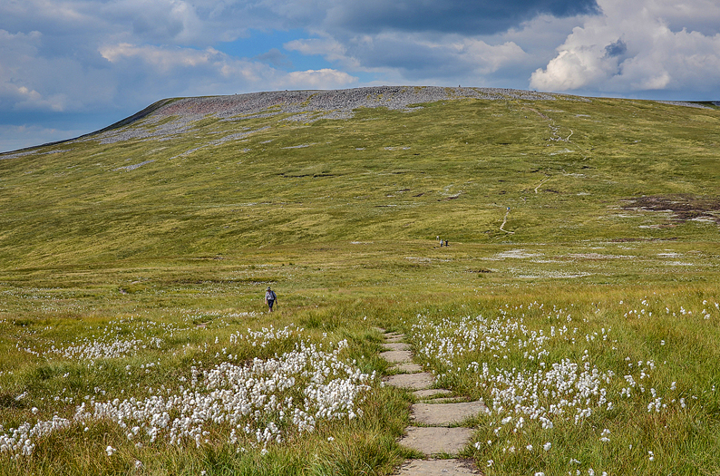
At 893m/2930 ft. Cross Fell is the highest point on the walk and probably the highest point reached in any LDWA 100 Event! It is also the highest point on the Pennine Way and subject occasionally to the local Helm Wind, the only ‘named’ wind in Britain (fortunately rare!).
8. DUFTON to BIRKDALE - 12.8 Km, 8 miles, 520m. 1700 ft.
Another serious section as the Pennines are re-crossed on the way to Teesdale. The undoubted highlight is High Cup Nick, one of Northern England’s geological wonders. This classic U-shaped glaciated valley, part of the Whin Sill, with its dolerite crags has to be seen to be believed.
Desolate moorland follows enlivened by the proximity of Maize Beck and the Army firing range at Warcop before reaching the next stop at Birkdale, at over 1500 ft. it is the highest inhabited farm in England.

9. BIRKDALE to WATERSMEETING - 9.2 Km, 5.8 miles, 150m. 500 ft.
A short and easy section on quiet tracks and roads as we change Counties again. Cumbria is left and Durham entered as the route passes under the Cow Green reservoir dam built across the River Tees in the late 60’s to supply water to the industries of Teeside. Objections were raised as the habitat of the rare Teesdale violet habitat was threatened, happily largely saved by designating the nearby Moorhouse area as a National Nature Reserve.
Just downstream and not visited on the walk is the rocky stairway of Cauldron Snout, highest waterfall in England and majestic in spate despite the damming of the river.
10. WATERSMEETING to COWSHILL – 10 Km, 6.3 miles. 320m, 1050 ft
This section involves the crossing from Teesdale into Weardale. Upper Teesdale (SSSI and AONB) despite all the letters is a place of rare beauty! From its botanical richness to the leck of the Black Grouse and the haunting warble of the Curlew it is an area that deserves respect and care during your passage.
Weardale is reached by a high moorland crossing over Coldberry End passing Burnhope reservoir, built in the 1930’s, before arriving at Cowshill (recent population 156).
11. COWSHILL to ALLENHEADS – 12 Km, 7.5 miles. 420m, 1380 ft
The Weardale Way stretches from Cowshill to the coast at Sunderland with an extension to Killhope which our route follows. There is a lead mining museum at Killhope with many attractions including a working waterwheel.
A short climb over grouse moors reaches the County boundary where Northumberland is re-entered before descending into Allendale and the former lead mining community of Allenheads.
12. ALLENHEADS to ALLENDALE TOWN – 14 Km, 8.7 miles. 290 m, 950 ft
Many of the footpaths in Allendale are rarely walked and in poor condition with lots of unfriendly stiles so quiet roads and tracks are used to follow the River East Allen down to Allendale Town making for undemanding navigation.
Isaac Holden was an itinerant tea seller and local philanthropist in the 19th century and a section of Isaac’s Tea Trail route is followed on the walk.

13. ALLENDALE TOWN to GREENRIDGE FARM – 7.2 Km, 4.5 miles, 140m, 460 ft
A short moorland crossing awaits after leaving the bustling and lively community of Allendale Town. Greenridge Farm offers the last opportunity to top up before the final lap. The end is in sight.
14. GREENRIDGE FARM to HEXHAM – 8 Km, 5 miles. 100m, 330 ft
The wooded path above West Dipton Burn provides a quick and elegant route towards the Racecourse which is perched high above Hexham. It only remains then to enjoy/endure the final swoop down Causey Hill to the Finish.


