
The Route
The event route runs from Wadebridge on the north Cornish coast to Teignmouth on the south Devon coast.
The route description will be made available from this site in January 2013. The description available will include alternative routes for those paths crossing private land for which permission has only been granted for the weekend of the event itself. In the meantime the map below together with the brief outline of the route will hopefully provide enough information to enable members to decide whether they wish to enter the event.
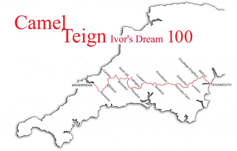
After leaving Wadebridge the route runs along the Camel Trail to Checkpoint 1 at Dunmere. Shortly after this it leaves the trail and heads off across pasture and woodland to Bodmin Moor, passing Brown Willy on the way to Jamaica Inn and the A30. From here the walk winds its way through pastureland again to Pensilva and Callington to arrive at Tavistock for breakfast stop. From here is a steady climb to Dartmoor by way of Sampford Spiney and the dismantled railway to reach Princetown (of Dartmoor Prison fame) and the highest point of the walk. A gentle descent follows to Hexworthy and Dartmeet before leaving the moor at Newbridge. Back through woodlands and riverside walking to Ashburton at 80 miles, followed by pasture and heath passing through Liverton, Chudleigh Knighton and Ideford before a final ascent over the Haldon Ridge, to cross the golf course and the descent into the finish at Teignmouth.
Link to Checkpoints
The route is covered by 4 Explorer or Landranger maps, however we have negotioated the provision of a custom map for the event as follows:
A double sided map size 1189mm x 841mm. Each side will carry 2 printed map sections at 1:25 000 scale with the route printed onto each section. Provided we have sufficient demand, these will be available at a cost of approximately £10 and entrants will be asked to indicate whether they would like to purchase a map on the entry form.


