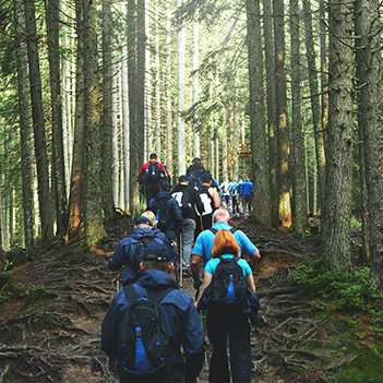


Joint Walking Weekend: Sunday walk
Sun 28th Sep 2025
Walk Details:
This is a 13 mile circular walk going north from Grantown through Grant Castle parkland, along a section of the Dava Way & back via moorland. There is a 10 mile more sheltered route in case of bad weather.

Entry Details:
Walk Report
This was a circular route mostly on good gravel tracks with a couple of short road sections. We started outside the Grant Arms Hotel on the road heading north from Grantown-on-Spey, then entered Castle Grant parkland at one of the Castle's gatehouses. We then joined the Dava Way until the locked gate close to the A939 which we climbed over, walked north on the road for about 50 metres, then crossed to join good tracks through the moorland heading north-west, then swung round to the south and back to Grantown. There was an easy river crossing on stepping stones. The weather was dry and bright for most of the day.Other Files
GPX
A GPX file of the above route may be downloaded by clicking the link below.
Note: GPX files of Group Walks are created by LDWA Group members, and may be downloaded only by other LDWA members. They should not be made available outside the LDWA, and are used at members' own risk.
Login to Download (Members Only)You can use the interactive controls to zoom in and out and to move around the map, or click on a path or a marker for more info. (interactive map help)
You can use the interactive controls to zoom in and out and to move around the map, or click on a path or a marker for more info. (interactive map help)
© OpenStreetMap contributors under Open Database Licence
Rights of way data from selected Local Authorities
Large scale digital mapping is provided by John Thorn
At high zoom levels the route is indicative only.
Maps:
You can use the interactive controls to zoom in and out and to move around the map, or click on a marker for more info. (interactive map help)
© OpenStreetMap contributors under Open Database Licence.
Rights of way data from selected Local Authorities.
Large scale digital mapping is provided by John Thorn.