
Ambleside Weekend - Day 2 - Hangover Hike
Sun 17th Sep 2023
Walk Details:
Loughrigg Fell and Rydal Caves
Entry Details:
Walk Report
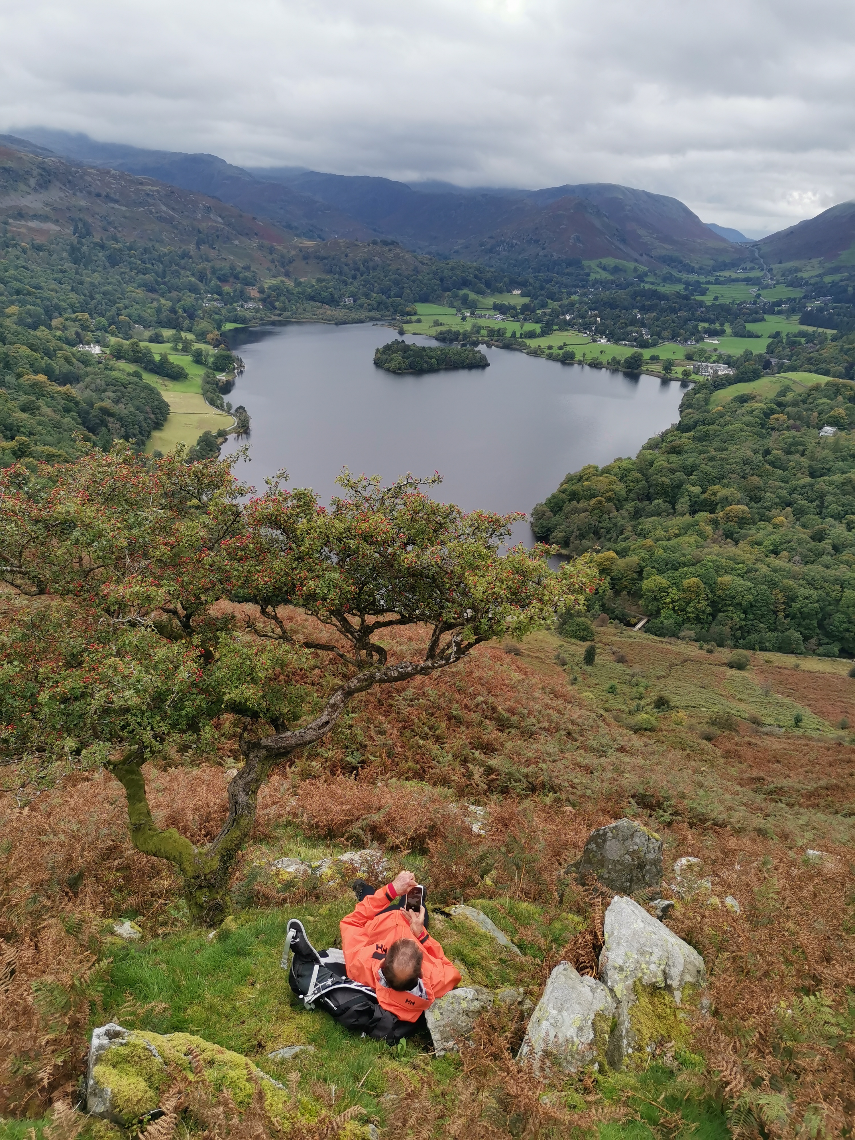
Sunday's walk, with a 9.30 start time, headed out west to Loughrigg Fell over Ivy Crag where Herdwicks nestled along its jutting rocks. The majority of this route was a fairly easy walk through the countryside; however, the uphill portion to reach the summit of Loughrigg 335 metres/1099.08 ft was more rugged along a series of steps. Relatively speaking it is a modest hill but affords spectacular 360 degree views round and down to Grasmere. The descent was also along a series of rugged steps which needed careful negotiation particularly when passing others - it is a popular Sunday walk. We paused at a bench for our break soaking up the views over Grasmere and watching more cold water swimmers. Moving on we headed east to Rydal Water and the astonishing Rydal Cave. This is a large man made quarry which in its heyday of the 19th century produced high quality roofing slates. Access to the interior of the cave is over stepping stones. I've learnt since that occasionally blocks do fall from the ceiling! Further along our route where other caves, Paul (Ashman) trialling his climbing skills to access one but deciding the descent would be a tad tricky - age can bring an aversion to too much risk!! It was a gentle stroll back into Ambleside, crossing and re-crossing the stepping stones over the River Rothay, watching at one point a fat black pig snuffling in a field and at another a Heron. So on to the Royal Oak in Ambleside for our usual refreshment and banter. It had been such a brilliant weekend which I/we thoroughly enjoyed. Many thanks to Paul (his walk on Saturday originally planned 10 years ago but thwarted by bad weather at the time finally accomplished!!), and John for leading the walks and to everyone for the great company. I had a final browse around Hayes Garden Centre before heading home c. 3pm. (Beryl Massey)Other Files
GPX
A GPX file of the above route may be downloaded by clicking the link below.
Note: GPX files of Group Walks are created by LDWA Group members, and may be downloaded only by other LDWA members. They should not be made available outside the LDWA, and are used at members' own risk.
Login to Download (Members Only)You can use the interactive controls to zoom in and out and to move around the map, or click on a path or a marker for more info. (interactive map help)
You can use the interactive controls to zoom in and out and to move around the map, or click on a path or a marker for more info. (interactive map help)
© OpenStreetMap contributors under Open Database Licence
Rights of way data from selected Local Authorities
Large scale digital mapping is provided by John Thorn
At high zoom levels the route is indicative only.
Gallery


Maps:
You can use the interactive controls to zoom in and out and to move around the map, or click on a marker for more info. (interactive map help)
© OpenStreetMap contributors under Open Database Licence.
Rights of way data from selected Local Authorities.
Large scale digital mapping is provided by John Thorn.


