
We're in no Hury
Sat 28th Jan 2023
Walk Details:
Along the Teesdale Way, past Pecknell Wood/Farm, heading NW to Hury Reserviour for the first stop. Head East to join the Tees Railway Path, then north to Romaldkirk for a second break. Then SE along the river to back to Barnard Castle
Entry Details:
Walk Report
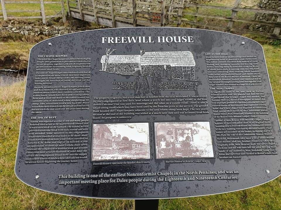
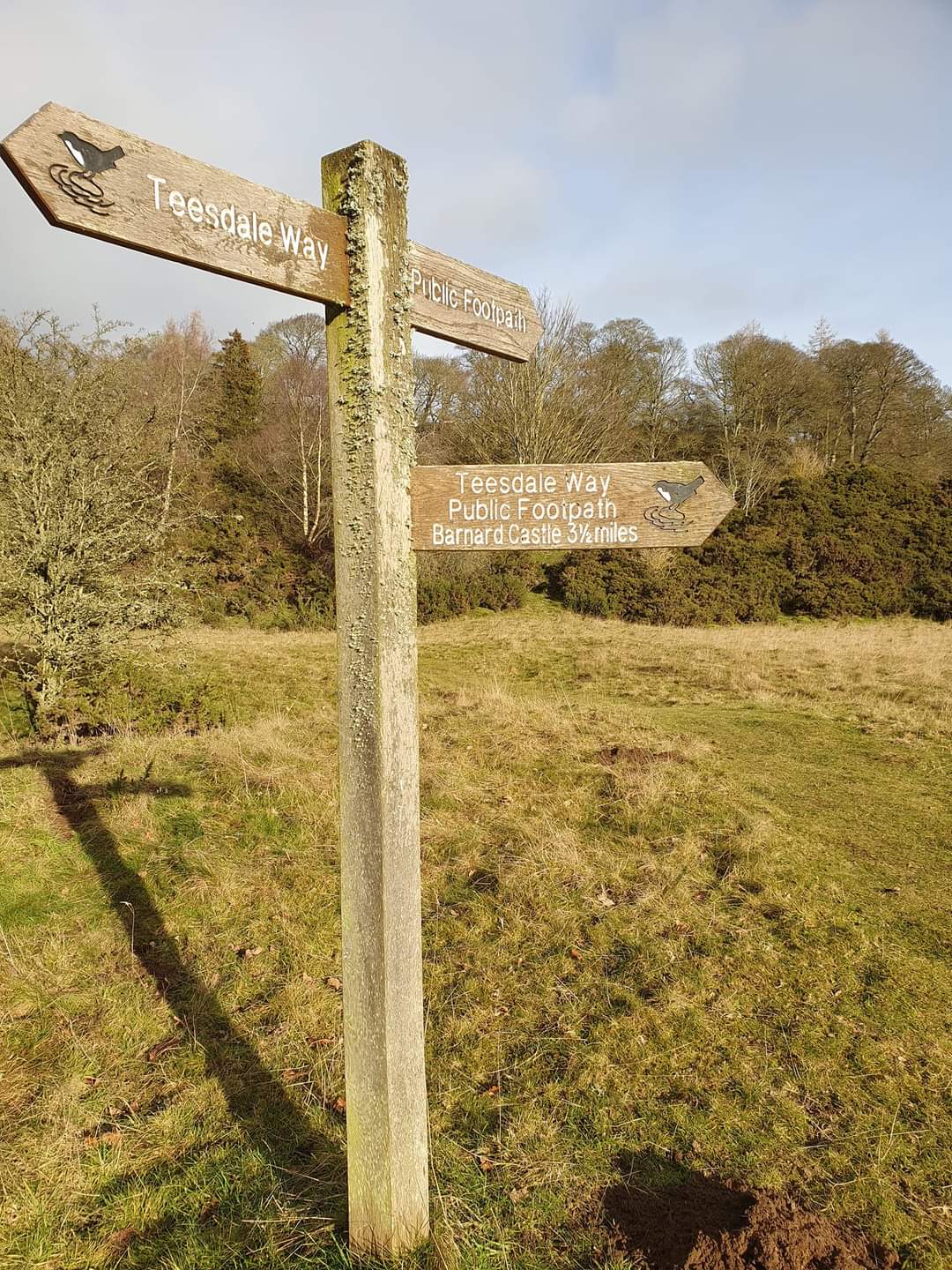
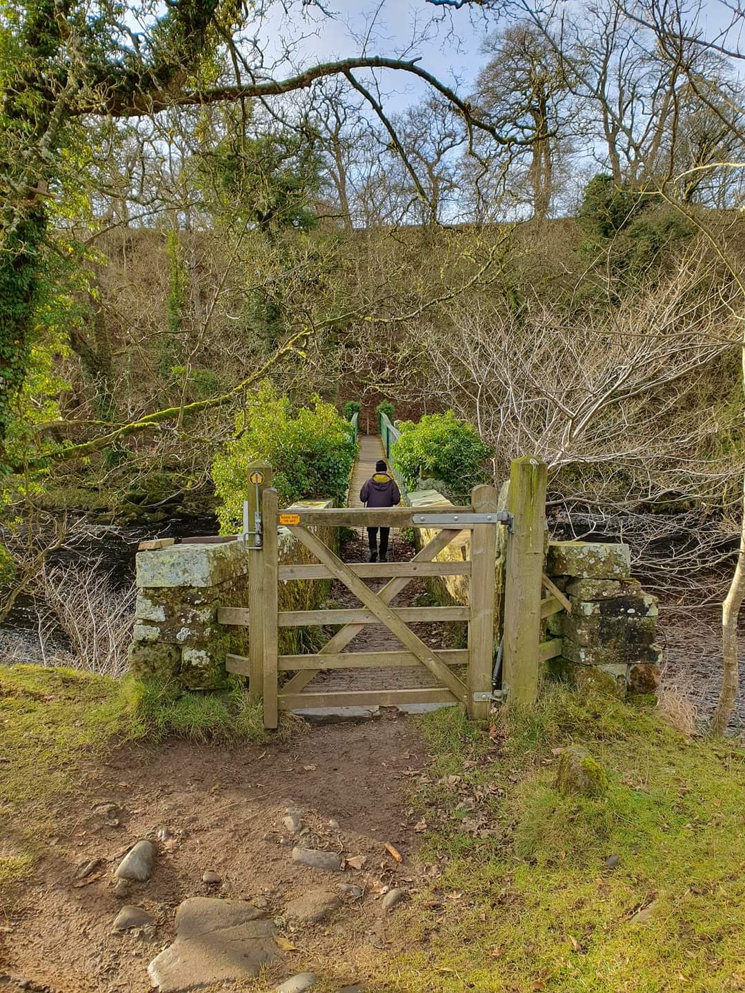
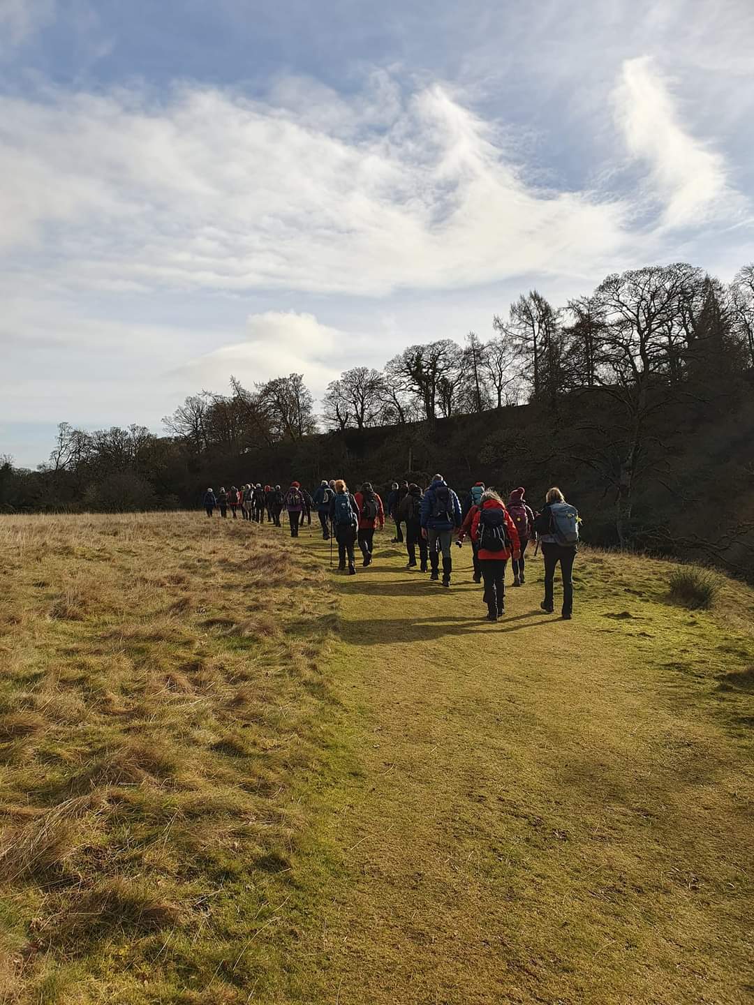
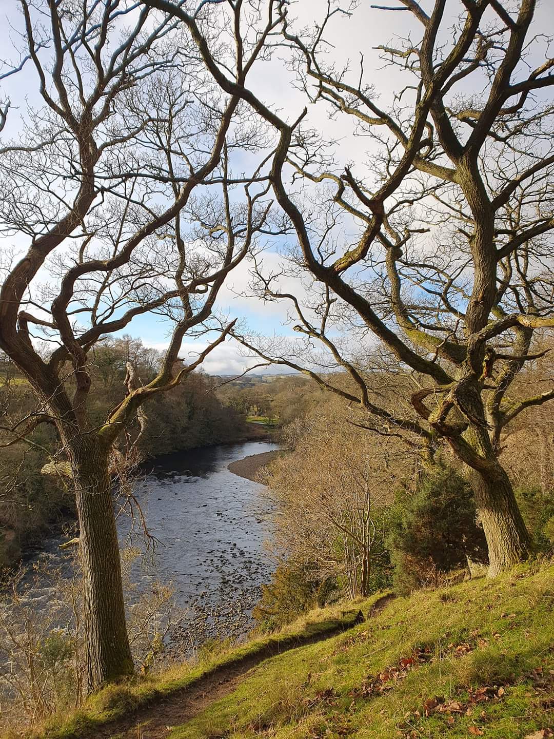
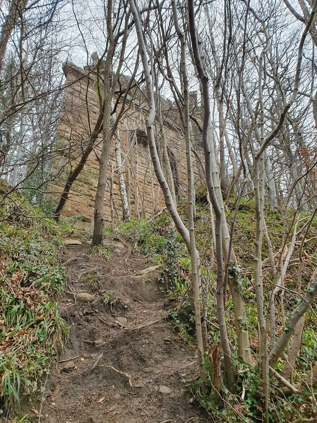
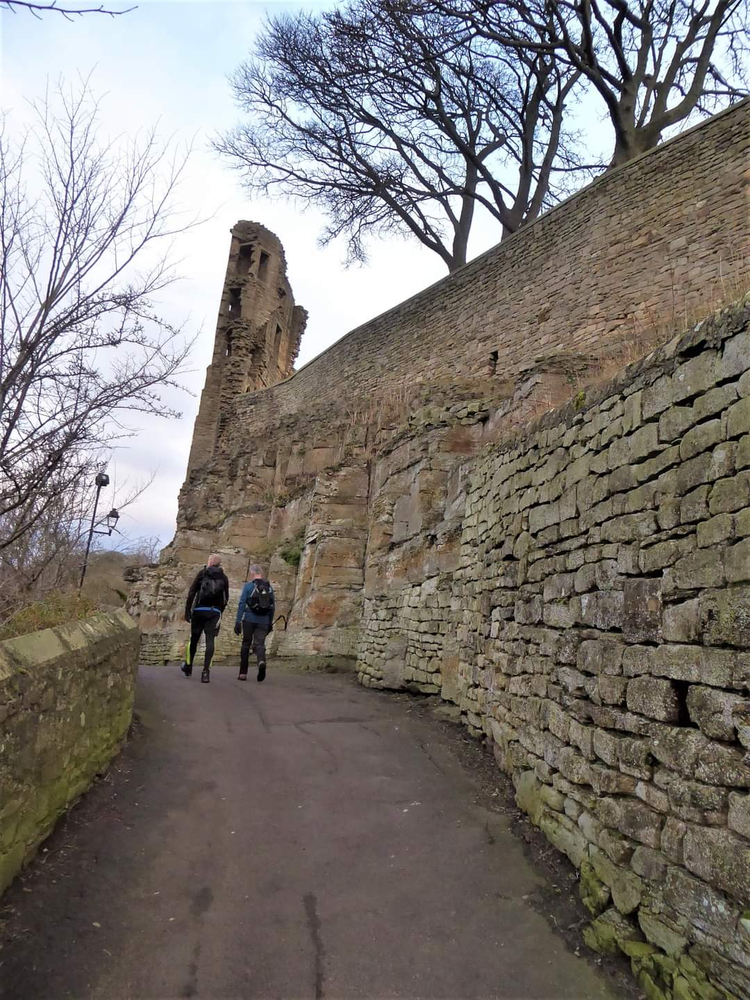
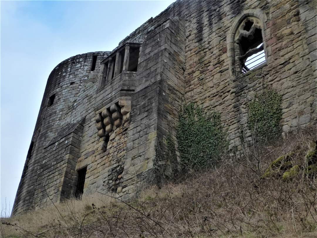
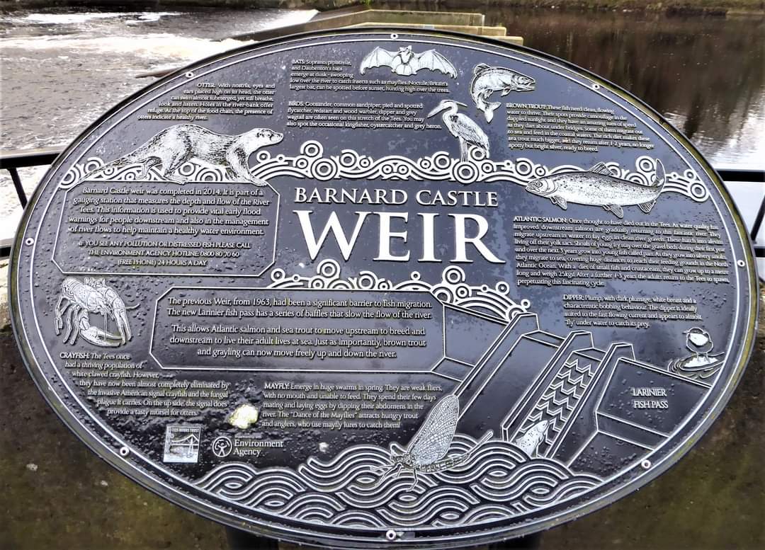
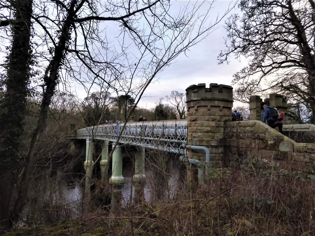
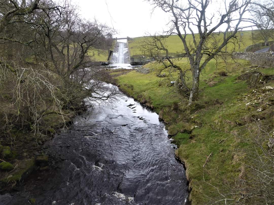
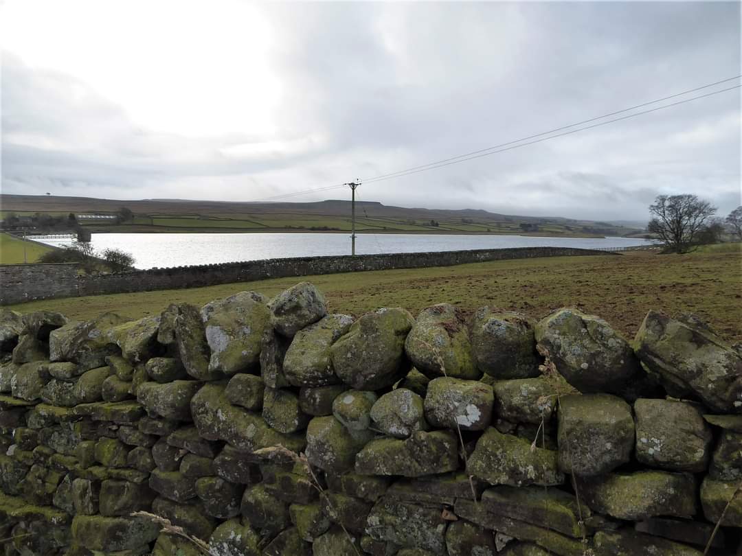
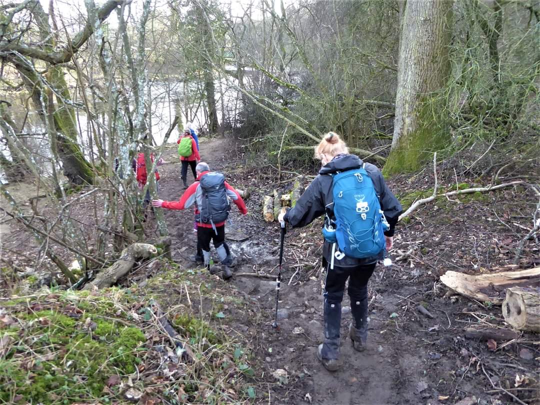
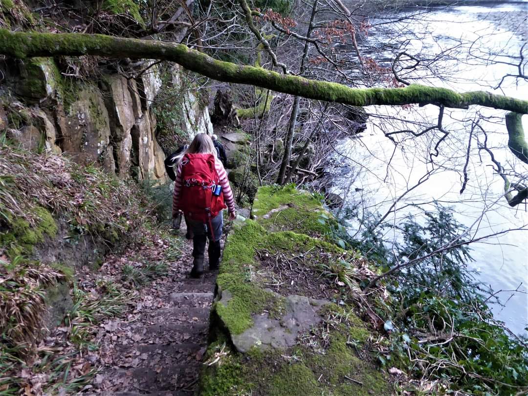
As we walked West from the Lartington area to Hury Reservoir there was an obvious table top shaped hill to our left. We had some discussion as to what it was. It was in fact Goldsborough. It is about 2km SW of the dam end of Hury Reservoir. The Bowes loop of the Pennine Way passes just to the south of the summit. ( Paul Nellist) So to Saturday and a magnificent 16 mile walk with the Northumbria LDWA group from Barnard Castle. It was a great mix of scenery, variety of terrain and undulation - along riverside paths, through woodland, over pasture, across moorland and following an old railway track - nothing too taxing. After some initial mizzle in the morning we were again blessed with glorious sunshine. The route took us past the 12th century castle built by the Balliol family, though this site has been strategically important for millennia. In 1307 the castle was bequeathed to the Earl of Warwick and remained with his descendants for the next 164 years, including Duke of Gloucester who married into the family and became King Richard 111. Richard took particular interest in the castle making alterations and repairs, one remaining obvious feature being the magnificent projecting oriel window overlooking the River Tees. The underside of the lintel has a carving of a boar, Richard's heraldic symbol. (I can't make it out myself - too weathered!) After this time it had links with the Bowes family who were appointed keepers. The castle's demise began when in the 17th century the then owner, Sir Henry Vane, began to plunder the castle to provide building materials for his seat at Raby! Thereafter we passed the recently constructed weir equipped with an automatic water level recorder which gives an essential early flood warning to communities downstream. Now it is also equipped with a fish ladder allowing salmon and sea trout to once again access the upper reaches of the Tees. We crossed Deepdale footbridge, a Victorian structure built in 1893 originally to carry water pipes over the river from the reservoirs in the upper reaches of the Durham Dales to the industrial coastal towns of Stockton and Middlesbrough. And so into Deepdale Wood. We continued north along the Teesdale Way on the southern bank and then headed out westward through Pecknell Woods and farm towards Hury Reservoir, over rough pasture before dropping down in to Briscoe. We had views across to the distinct table top hill of Goldsborough. A stretch of tarmac led us up and across the dam wall. Along the road, we turned east over a style and across pasture above the River Balder making our way to a crossing point of a tributary of the Balder where we paused and perched on the bank side for our first break. The early mizzle had stopped and the sun was soon to break through. Further along we left the River Balder and turned north towards Romaldkirk, over more styles, some undulating pasture and then linking into the Tees Railway Walk. Our lunch stop had to be on the green at Romaldkirk - a race to the seat beneath the tree canopy! Paul was there first and myself a close second - at a good walking pace!! Tempted to have a half at the pub nearby but resisted!! From here we took a SE direction along the south bank of the Tees crossing over to the north side by the Cotherstone Bridge just above the meeting of the Balder with the Tees and just north of Cotherstone Cragg. Thereon we made our way over more pleasantly undulating pasture, across a small tributary and negotiated the sometimes tricky path following the Teesdale Way back to Barnard Castle and ultimately the Blue Bell - an early finish at c.3.15. A wonderful day was followed by a magnificent pint, Clare's delicious cake and biscuits, much banter and laughter - brilliant. Many thanks Julie for organising and leading the walk, to Clare for her great culinary skills and to the great company of everyone (Beryl Massey)Other Files
Download Walk ReportGPX
A GPX file of the above route may be downloaded by clicking the link below.
Note: GPX files of Group Walks are created by LDWA Group members, and may be downloaded only by other LDWA members. They should not be made available outside the LDWA, and are used at members' own risk.
Login to Download (Members Only)You can use the interactive controls to zoom in and out and to move around the map, or click on a path or a marker for more info. (interactive map help)
You can use the interactive controls to zoom in and out and to move around the map, or click on a path or a marker for more info. (interactive map help)
© OpenStreetMap contributors under Open Database Licence
Rights of way data from selected Local Authorities
Large scale digital mapping is provided by John Thorn
At high zoom levels the route is indicative only.
Gallery
Maps:
You can use the interactive controls to zoom in and out and to move around the map, or click on a marker for more info. (interactive map help)
© OpenStreetMap contributors under Open Database Licence.
Rights of way data from selected Local Authorities.
Large scale digital mapping is provided by John Thorn.


