


Faccombe Foray
Sat 28th May 2011
Walk Details:
Event Type
Group Walk
Region
Southern England
Local Group
London
Distance
21ml.
Start Time
9.31
Route
Kintbury stn
Depart London Paddington 8.18. Free parking available on the Canal Side c.p., not signposted or marked on the map, between railway and canal opposite stn. Pub or picnic lunch at the Jack Russell, Faccombe. Ldr Steve Singleton
Web Site
Start and Finish
Entry Details:
Cost
Walk Report
Faccombe Foray, Saturday 28th May 201113 walkers, 21 miles - leader Steve Singleton
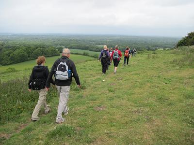
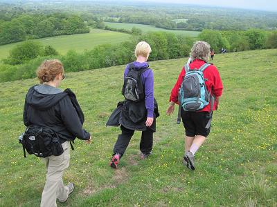
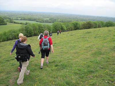
The forecast was for a mainly cloudy day with a possibility of showers and a fresh breeze. Thirteen of us, including several people new to the group, met at Kintbury Station, near Newbury, for a walk over the Berkshire Downs to Faccombe and back. Our start was delayed by latecomers, but by 9:45 we were on our way through Kintbury. Our route took us south past Titcomb Manor and across Inkpen Great Common, then south to climb over the eastern shoulder of Walbury Hill, which at 297m is the highest point in the Home Counties. It was cool and breezy on the ridge. We descended to Combe for elevenses, before re-ascending to the conspicuous radio mast on Combe Hill. A long descent to Combe Bottom followed, after which we walked west down the valley before climbing steeply again to Linkenholt. A walk across field paths took us to Netherton, from where there was three quarters of a mile on a minor road, uphill, to the Jack Russell at Faccombe for lunch. Those who did not want to eat in the pub were able to use some rather worse-for-wear picnic tables by the village pond. Service at the pub was slow, and it was nearly an hour before we were able to set off again; the weather was grey, cloudy and breezy; those people eating outside got rather cold. After lunch a descent north-eastward was followed by the last major climb of the day, over the shoulder of Pilot Hill. Our descent took us along the edge of a quarry, with a sheer drop to our left, then north to East Woodhay and onwards to Ball Hill. We carried on north through sunshine and showers to Hamstead Park, where the three people who had come by train sped on ahead to catch the 17:46 train, for which time was tight. Our route took us through the park to Hamstead Lock on the Kennet and Avon Canal for the last two and a half miles along the towpath. One of our party, who was suffering from severe blisters, decided to stay at the lock and wait for her friend to pick her up in her car; the rest of us made our way back to Kintbury, having covered approximately 21 miles with 2,500 feet of ascent; we were pleased to find when we got there that our train travellers had caught their train.
Other Files
Download Walk ReportGallery


Maps:
You can use the interactive controls to zoom in and out and to move around the map, or click on a marker for more info. (interactive map help)
Contains Ordnance Survey data © Crown copyright and database right 2016.
© OpenStreetMap contributors under Open Database Licence.
Rights of way data from selected Local Authorities.
Large scale digital mapping is provided by John Thorn.
© OpenStreetMap contributors under Open Database Licence.
Rights of way data from selected Local Authorities.
Large scale digital mapping is provided by John Thorn.


