


A Jolly Circular Walk Round the East London Parks & Marshes
Sun 13th Dec 2020
Walk Details:
Victoria and Olympic parks, Hackney and Walthamstow marshes
Entry Details:
Walk Report
A Jolly Circular Walk Round the East London Parks and Marshes, Sunday 13th December 20204 walkers, 16.3 miles - leader Lonica Vanclay
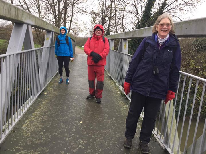
Just look at the smiles on those faces! It was last Sunday, 13th December. 4 of us set out - the waiting list from the following week. Little did we know that the actual walk would have to be cancelled so we were to be practically the last London LDWA walk out probably for some months. Lonica led a delightful walk of 16.3 miles from Mile End up into the Lockwood reservoir, Walthamstow. There were some intriguing and beautiful corners explored on the way and we didn't mind at all about the rain. Pictured here, Lonica Vanclay, Ken Main and Marie Heracleous. The actual walk will be offered again once it is possible!.
Report and photograph by Minna Graeber
Other Files
Download Walk ReportGPX
A GPX file of the above route may be downloaded by clicking the link below.
Note: GPX files of Group Walks are created by LDWA Group members, and may be downloaded only by other LDWA members. They should not be made available outside the LDWA, and are used at members' own risk.
Login to Download (Members Only)You can use the interactive controls to zoom in and out and to move around the map, or click on a path or a marker for more info. (interactive map help)
You can use the interactive controls to zoom in and out and to move around the map, or click on a path or a marker for more info. (interactive map help)
© OpenStreetMap contributors under Open Database Licence
Rights of way data from selected Local Authorities
Large scale digital mapping is provided by John Thorn
At high zoom levels the route is indicative only.
Gallery
Maps:
You can use the interactive controls to zoom in and out and to move around the map, or click on a marker for more info. (interactive map help)
© OpenStreetMap contributors under Open Database Licence.
Rights of way data from selected Local Authorities.
Large scale digital mapping is provided by John Thorn.


