


Escape from Romford
Fri 28th Sep 2018
Walk Details:
Event Type
Group Walk
Region / Area
Southern England / London
Local Group
London
Distance
15ml.
Start Time
10.15
Route
Romford Station
General Notes
A repeat of last year's walk but with an additional 5 mile loop to be explored on the day so come prepared for the unexpected. Light refreshments on route, Wetherspoons at finish
Web Site
Start
Finish
Entry Details:
Cost
Walk Report
Escape from Romford, Friday 28th September 201810 walkers, 15 miles - leader Ron Williamson
Another visit to Romford, where each year we seem more desperate to escape further from its busy cosmopolitan centre. Our voyage into the unknown initially led us northwards through various familiar splendid town parks across the busy A12 into Bedfords Country Park and the heights of Havering Atte Bower.
Then followed this year's additional 5-mile loop into uncharted territory required careful navigating along paths that showed little signs of previous walkers especially when crossing the many recently ploughed fields encountered on route.
A bonus at an impromptu lunch stop at Stapleford Abbot's somewhat isolated parish church of St Mary the Virgin, was picnic chairs for all and a portaloo but even these attractions could not prevent a desperate trio seeking refreshment at a nearby hostelry.
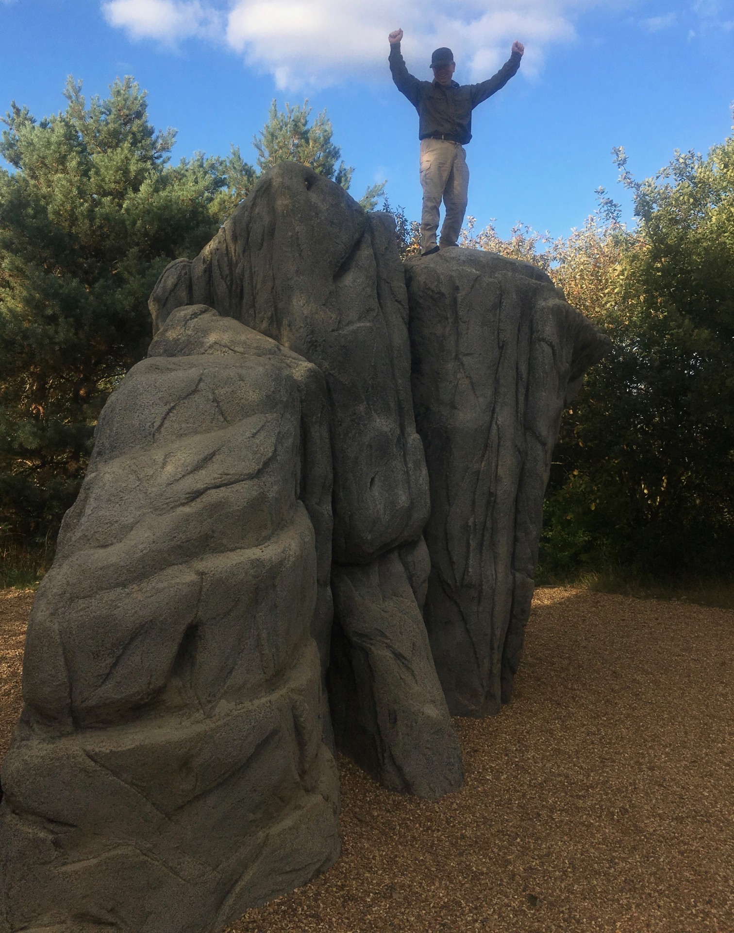
Across Stapleford aerodrome to briefly follow the Three Forests Way through Lambourne Woods and back to well-known territory as we traversed the resplendent Hainault Forest. Then came the highlight of the day as we witnessed Gavin's successful solo ascent, without oxygen, of the 29.029ft Mount Fairlop; only the second LDWA member to claim this summit (see November 2017 photos of the first climb). An achievement which was celebrated at a convenient meeting house in the centre of Fairlop
All in all a good walk in dry sunny conditions but would have been a mud bath if the ground had been wet.
Photograph by Keith Lane; Photographs by Gavin Fuller are on the group Facebook Page
Other Files
Download Walk ReportGPX
A GPX file of the above route may be downloaded by clicking the link below.
Note: GPX files of Group Walks are created by LDWA Group members, and may be downloaded only by other LDWA members. They should not be made available outside the LDWA, and are used at members' own risk.
Login to Download (Members Only)You can use the interactive controls to zoom in and out and to move around the map, or click on a path or a marker for more info. (interactive map help)
You can use the interactive controls to zoom in and out and to move around the map, or click on a path or a marker for more info. (interactive map help)
Contains Ordnance Survey data © Crown copyright and database right 2016.
© OpenStreetMap contributors under Open Database Licence
Rights of way data from selected Local Authorities
Large scale digital mapping is provided by John Thorn
At high zoom levels the route is indicative only.
© OpenStreetMap contributors under Open Database Licence
Rights of way data from selected Local Authorities
Large scale digital mapping is provided by John Thorn
At high zoom levels the route is indicative only.
Gallery
Maps:
You can use the interactive controls to zoom in and out and to move around the map, or click on a marker for more info. (interactive map help)
Contains Ordnance Survey data © Crown copyright and database right 2016.
© OpenStreetMap contributors under Open Database Licence.
Rights of way data from selected Local Authorities.
Large scale digital mapping is provided by John Thorn.
© OpenStreetMap contributors under Open Database Licence.
Rights of way data from selected Local Authorities.
Large scale digital mapping is provided by John Thorn.


