
A Walk Through History
Wed 18th Sep 2019
Walk Details:
Event Type
Group Walk
Region
Southern England
Local Group
Thames Valley
Distance
c15ml.
Start Time
09.30
Route
St Helen's Avenue, Benson
General Notes
Assistance dogs only
Web Site
Start and Finish
Entry Details:
Cost
Walk Report
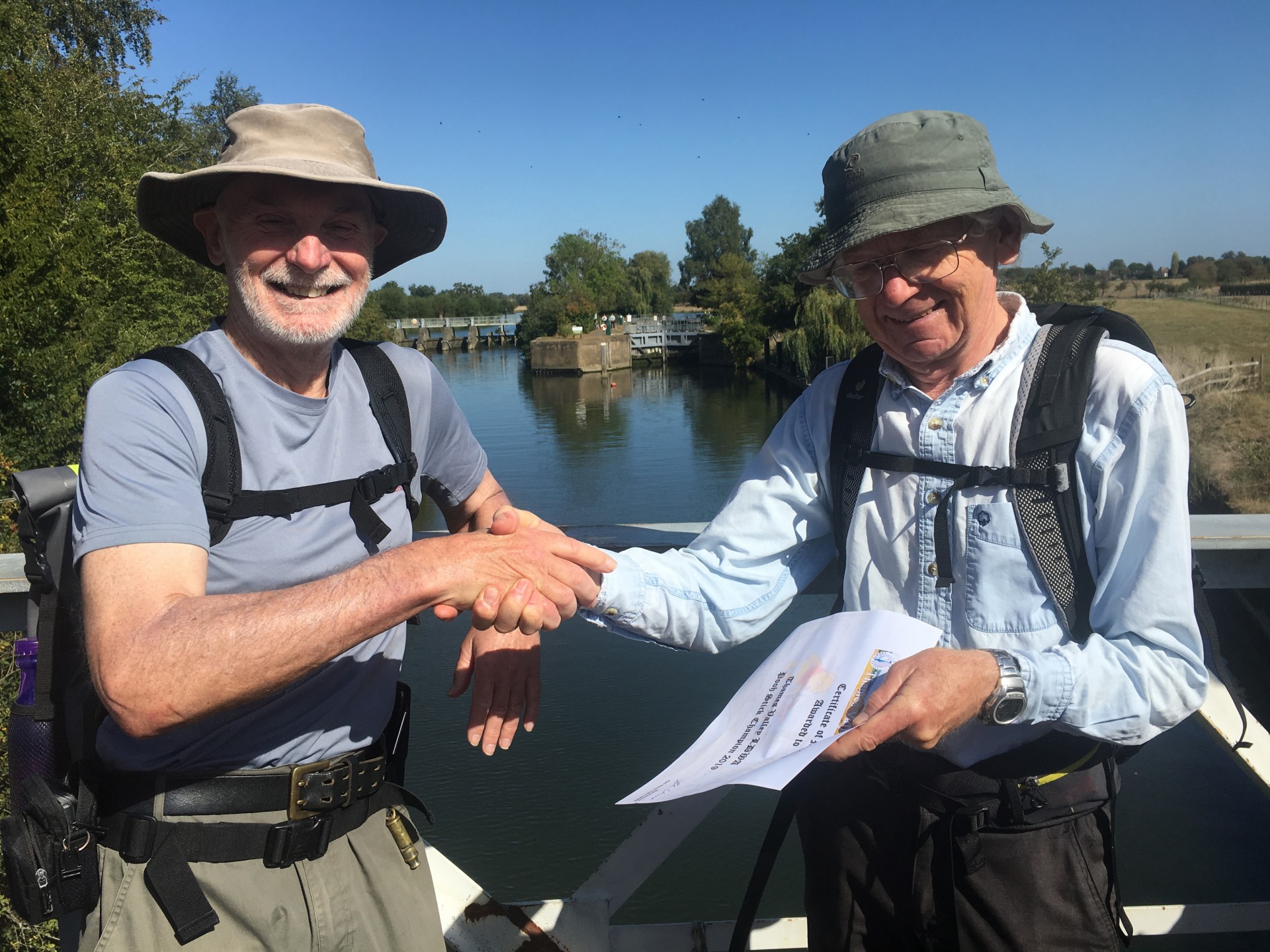
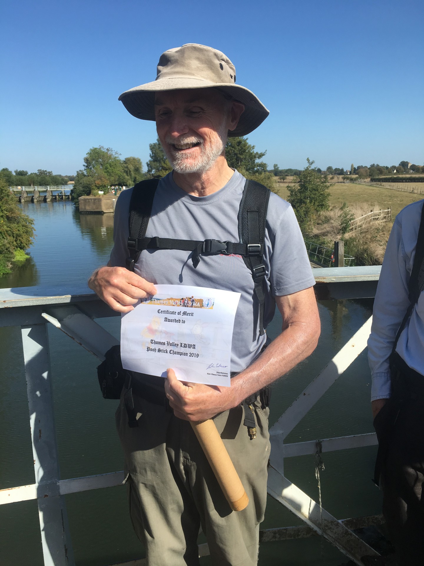
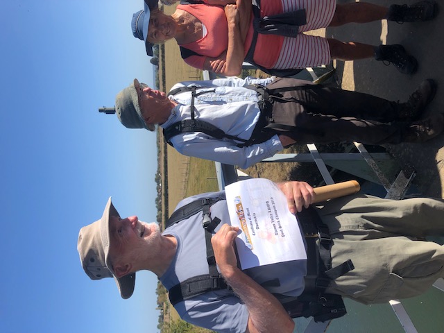
On a lovely late-summer day Chris Lloyd led 20 of us to Dorchester (with a stop at the abbey), Little Wittenham and Day's Lock.Here we held our own Poohsticks championship (see photos). This is a game first mentioned in The House at Pooh Corner, a Winnie-the-Pooh book by A. A. Milne. It's a simple game which may be played on any bridge over running water; each player drops a stick on the upstream side of a bridge and the one whose stick first appears on the downstream side is the winner. The annual World Poohsticks Championships have been held at Day's Lock on the River Thames since 1984.
After this excitement, we continued to Wittenham Clumps for lunch, and then back to the start via Brightwell-cum-Sotwell and Shillingford.
Photos by Mary Jones.
Other Files
GPX
A GPX file of the above route may be downloaded by clicking the link below.
Note: GPX files of Group Walks are created by LDWA Group members, and may be downloaded only by other LDWA members. They should not be made available outside the LDWA, and are used at members' own risk.
Login to Download (Members Only)You can use the interactive controls to zoom in and out and to move around the map, or click on a path or a marker for more info. (interactive map help)
You can use the interactive controls to zoom in and out and to move around the map, or click on a path or a marker for more info. (interactive map help)
Contains Ordnance Survey data © Crown copyright and database right 2016.
© OpenStreetMap contributors under Open Database Licence
Rights of way data from selected Local Authorities
Large scale digital mapping is provided by John Thorn
At high zoom levels the route is indicative only.
© OpenStreetMap contributors under Open Database Licence
Rights of way data from selected Local Authorities
Large scale digital mapping is provided by John Thorn
At high zoom levels the route is indicative only.
Gallery
Maps:
You can use the interactive controls to zoom in and out and to move around the map, or click on a marker for more info. (interactive map help)
Contains Ordnance Survey data © Crown copyright and database right 2016.
© OpenStreetMap contributors under Open Database Licence.
Rights of way data from selected Local Authorities.
Large scale digital mapping is provided by John Thorn.
© OpenStreetMap contributors under Open Database Licence.
Rights of way data from selected Local Authorities.
Large scale digital mapping is provided by John Thorn.


