


Timeball & Telegraph Trail Pt 4 Teynham to Chilham LINEAR
Sun 24th Mar 2019
Walk Details:
Event Type
Group Walk
Region
Southern England
Local Group
London
Distance
19ml.
Start Time
09.35
Route
Meet Teynham rail station. Finish Chilham rail station
This is the fourth of five walks which, in total, cover a 97ml route between the Timeballs at Greenwich & Deal, going over 9 hills on which the relay stations of the predecessor mechanical telegraph stood. JOINT WITH KENT
General Notes
Pub lunch
Web Site
Start
Finish
Entry Details:
Cost
Walk Report
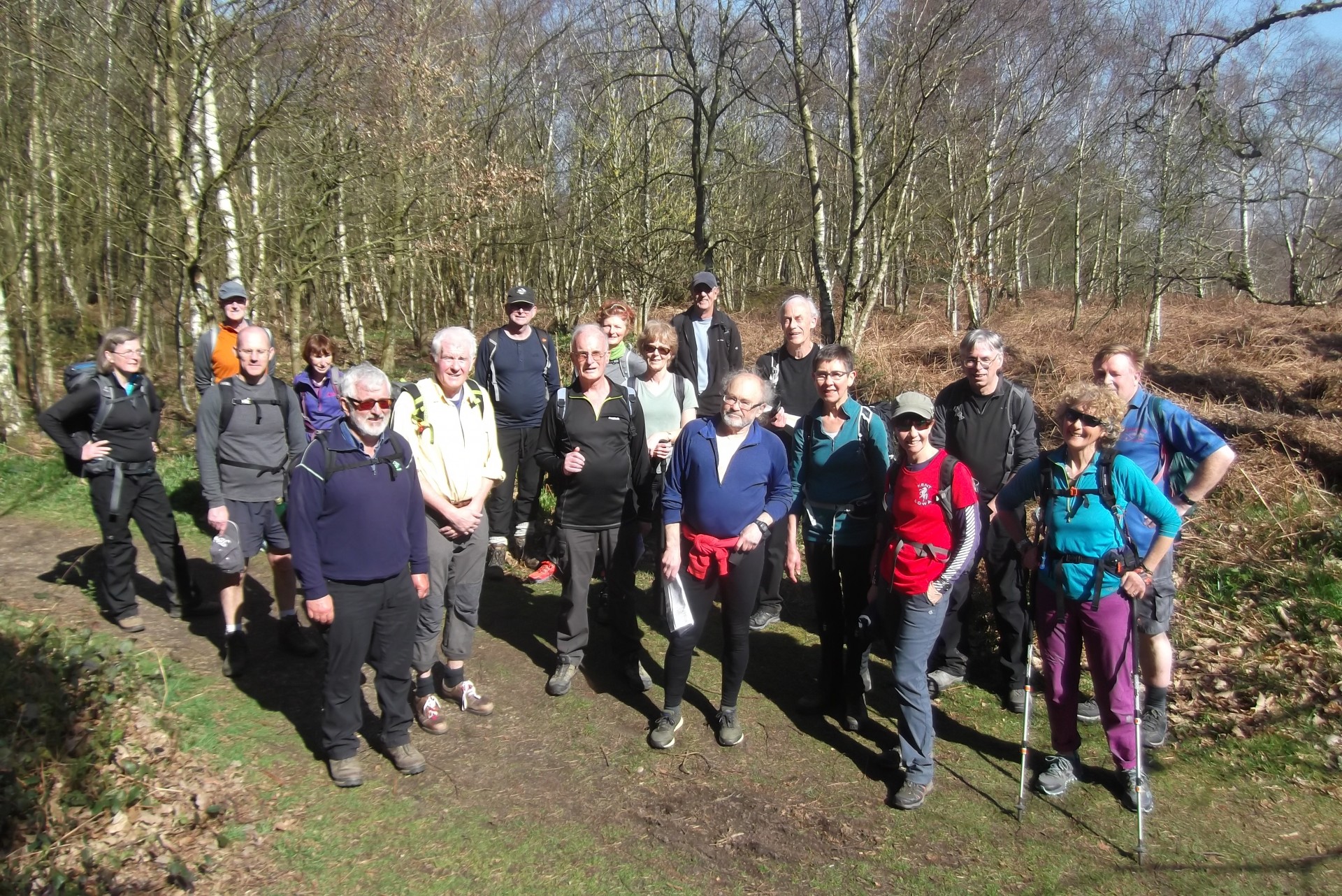
Timeball and Telegraph Trail Part 4 - Teynham to Chilham, Sunday 24th March 201919 walkers, 19 miles - leader Peter Jull
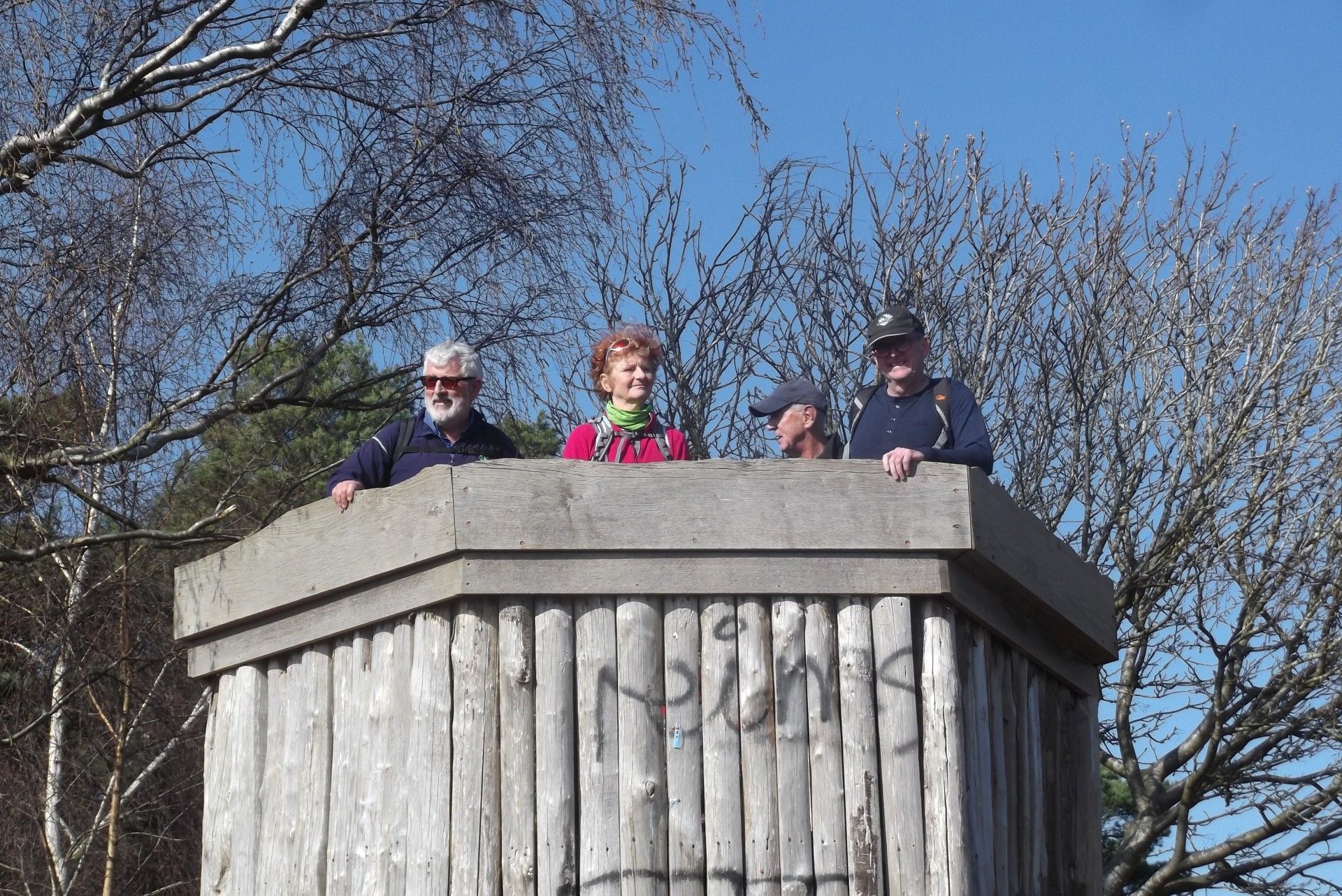
Signals from The Admiralty strengthened slightly with 19 walkers rapidly reaching rural out of Teynham. South of the A2 3x horse electric across the right of way were a right irritation to get past. Picnic perfect logs atop Ospringe's Telegraph Bank were reached too soon, so just a tree free pause to view the views the telegraph operators would have had. Down & up & down to Ospringe's churchyard which was reached more timely for elevenses. South of the M2 it was fairly flat barring one valley crossing before a suddenly steep ascent of Windmill Hill. At the top Roman era earthworks within which the shutter station was contemporaneously described as standing are hardly identifiable, now overgrown with trees & ferns. Picnic lunchers left at benches the only slippery mud of the day sloped down to the Rose & Crown. Their kitchen was caught unprepared so longer than intended was spent in their garden basking in post equinox sunshine. Up the adjacent hill to a country park installed viewing point (nicknamed the pulpit) to see what would have been seeable in pre-tree days. Embarrassed away by Rex, Ian Paisleying loudly from the top with innocent picnickers nearby, it was back into orchard country but blossoms not yet blooming. Up to cross the North Downs Way then down with grand views of grand Godmersham Park to cross the Stour at a picturesque spot. Up the valley's other side it was time to leave the Trail for Chilham station 2 miles off. Nearly there and the level crossing gates dropped against us. But the train was Canterbury bound and there was 5 minutes spare to get round the corner to the London bound platform.
Photographs by Peter Jull, more by Stephen Lannon on the group Facebook site
Other Files
Download Walk ReportGallery

Maps:
You can use the interactive controls to zoom in and out and to move around the map, or click on a marker for more info. (interactive map help)
Contains Ordnance Survey data © Crown copyright and database right 2016.
© OpenStreetMap contributors under Open Database Licence.
Rights of way data from selected Local Authorities.
Large scale digital mapping is provided by John Thorn.
© OpenStreetMap contributors under Open Database Licence.
Rights of way data from selected Local Authorities.
Large scale digital mapping is provided by John Thorn.


