


Five Hills, Four Parks, Two Spoons
Wed 25th Apr 2018
Walk Details:
Event Details Updated
Mileage updated to 7 miles
Event Type
Group Walk
Region
Southern England
Local Group
London
Distance
7ml.
Start Time
18.15
Route
Meet Forest Hill Railway Station, platform 1 exit (regular services from London Bridge). Finish Denmark Hill Railway Station (regular services to Victoria, Blackfriars, Kings Cross St Pancras; bus to Waterloo)
A linear walk from one Hill (Forest) to another (Denmark)
General Notes
Meet 17.45 The Capitol pub (nr station) for pre-walk drink
Web Site
Start
Finish
Entry Details:
Cost
Walk Report
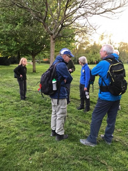
Five Hills, Four Parks, Two Spoons, Wednesday 25th April 201812 walkers, 7 miles - leader Pete Colley
Undeterred by the premature loss of a hill and the gain of a mile, 12 of us set off to explore the heights, sights and delights of South London. My first walk as leader went more or less according to plan, with only a small number of hesitations, repetitions and deviations.
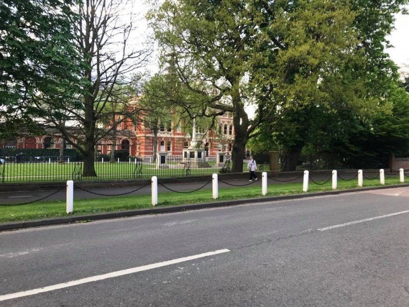
The route: Forest Hill ('The Capitol' Spoons), Havelock Walk, Horniman Museum & Gardens, Dulwich and Sydenham Woods, Sydenham Hill, Dulwich College, Belair Park, Dulwich Picture Gallery, Dulwich Park, Herne Hill Velodrome, Knight's Hill, Brockwell Park, Herne Hill, Ruskin Park and Denmark Hill ('Fox on the Hill' Spoons)
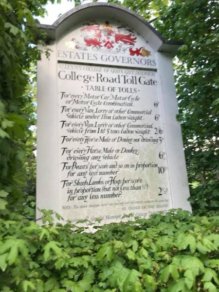
Seen off by a double rainbow, past a building housing an overstuffed walrus, we navigated our way through the woods. Next, a tollbooth where sheep were charged at 2 1/2 d (per sheep or in total? Who counted them through? How did they stay awake?). Skirting Dulwich, the highlight (for most) was the track meeting at Herne Hill Velodrome, where Sir Bradley (and many others) discovered his legs.
On through Brockwell and Ruskin Parks, with views over the city, we arrived at Denmark Hill intact and, on the whole, cheerful. Might do this again sometime...
Photographs by Julie Welch; more by Julie on the group Facebook page
Other Files
Download Walk ReportGallery


Maps:
You can use the interactive controls to zoom in and out and to move around the map, or click on a marker for more info. (interactive map help)
Contains Ordnance Survey data © Crown copyright and database right 2016.
© OpenStreetMap contributors under Open Database Licence.
Rights of way data from selected Local Authorities.
Large scale digital mapping is provided by John Thorn.
© OpenStreetMap contributors under Open Database Licence.
Rights of way data from selected Local Authorities.
Large scale digital mapping is provided by John Thorn.


