


Edenbridge to Tonbridge
Sat 31st Mar 2018
Walk Details:
Event Type
Group Walk
Region
Southern England
Local Group
London
Distance
18ml.
Start Time
09.46
Route
Meet Edenbridge Station 09:46 (London Bridge 09:08, East Croydon 09:23). Return from Tonbridge station
Ascending from the Eden Valley and passing through lovely Kent countryside with aspiring views we undulate our way up Crockenhill, Mariner's Hill Chartwell Toy Hill and Ide Hill (lunch 9 miles). After lunch we descend to the Medway Valley past Bough Beech Reservoir and Leigh (refreshment stop 15 miles)
General Notes
There is a good Community cafe/shop and picnic areas at Ide Hill. The Fleur de Lys PH is the refreshment stop in Leigh
Web Site
Start
Finish
Entry Details:
Cost
Walk Report
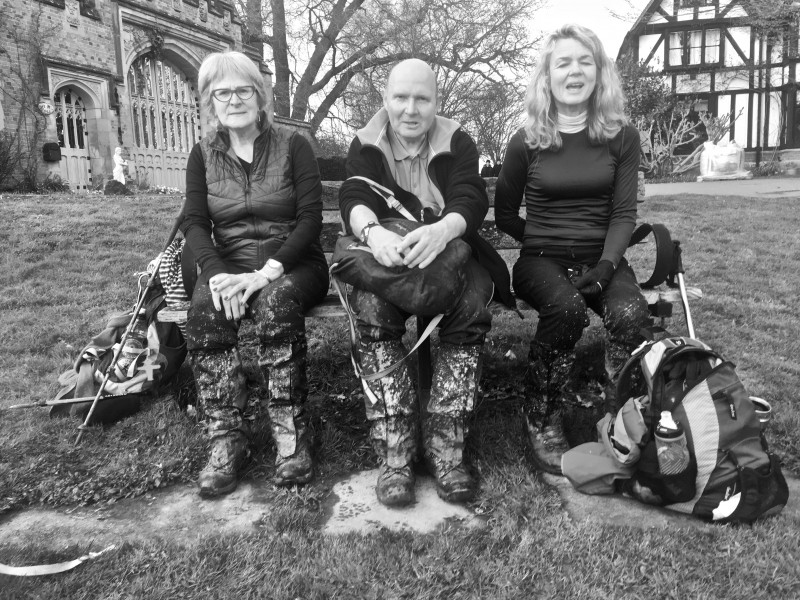
Edenbridge to Tonbridge, Saturday 31st March 20186 walkers, 18 miles - leader Keith Lane
4 mudlarks triumphed over the confusion and travel disruption to start at Edenbridge Town Station. 2 potential mudlarks didn't manage to overcome the difficulties. The 4 mudlarks waded through mud and standing water to climb Up Crockenham Hill and followed the mud to Mariners Hill, Chartwell and undulated their way to French Street and on to Toys Hill At Ide Hill (the lunch stop in the middle of the planned walk) there were 2 more mudlarks awaiting them. Now there were 6 mudlarks but not for long as one decided to cut short the walk and follow the Greensand Way to Sevenoaks. Now there were 5 mudlarks descending through the mud to the Medway Valley. 4 of the mudlarks reached Tonbridge Station just in time to miss the 17:19 to Victoria. Two mudlarks decided to head for the Wetherspoons to meet up with the sole mudlark who had gone there directly. Now there were 3 mudlarks. 1 mudlark stayed in the Wetherspoons and the 2 remaining mudlarks caught the 18:19 train to Victoria to get home and start the cleaning up operation. Surprisingly, the 4 then 6 then 5 then 3 then 2 mudlarks endured the mud, water-logging, confusion, travel disturbance and, some heavy rain with remarkable good humour and forbearance and even seemed to be enjoying themselves.
Photograph by Keith Lane
Other Files
Download Walk ReportGallery
Maps:
You can use the interactive controls to zoom in and out and to move around the map, or click on a marker for more info. (interactive map help)
Contains Ordnance Survey data © Crown copyright and database right 2016.
© OpenStreetMap contributors under Open Database Licence.
Rights of way data from selected Local Authorities.
Large scale digital mapping is provided by John Thorn.
© OpenStreetMap contributors under Open Database Licence.
Rights of way data from selected Local Authorities.
Large scale digital mapping is provided by John Thorn.


